Will La Niña arrive in time for winter?
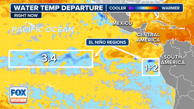
Water temperatures in the central Pacific Ocean have been holding steady near long-term average levels during the past few months instead of exhibiting much of any cooling trend that would be expected in a budding La Niña
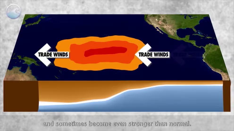
The meaning of El Nino and La Nina
The status of whether the world is being impacted by an El Nino or a La Nina is determined by water temperatures in the central and eastern Pacific. (NOAA)
COLLEGE PARK, Md. -- La Niña is still running late, and when it finally gets here, doesn’t look like it’s now going to stick around very long, and that could adjust some of the winter seasonal outlooks.
Water temperatures in the central Pacific Ocean have been holding steady near long-term average levels during the past few months instead of exhibiting much of any cooling trend that would be expected in a budding La Niña, which is considered when water temperatures drop at least 0.5 degrees C (0.9 degrees F) below long-term averages. The latest measurements posted for the October update are about the same as September’s update.
WHAT ARE THE EL NINO AND LA NINA PATTERNS?
El Niño-La Niña weather-related patterns are also indicative of those tropical Pacific water temperatures near average — known as the "neutral" phase of the "El Niño Southern Oscillation Cycle" - or ENSO.

As such, the odds for La Niña coming this winter have waned a little, but it is still the favored outcome, according to NOAA’s Climate Prediction Center. Forecasters give a 60% chance of La Niña arriving in the coming month. Only now the favored outcome is a weak La Niña that may only last through the mid-winter.
"A weaker La Niña implies that it would be less likely to result in conventional winter impacts," NOAA wrote in its October forecast update. "Though predictable signals could still influence the forecast guidance."
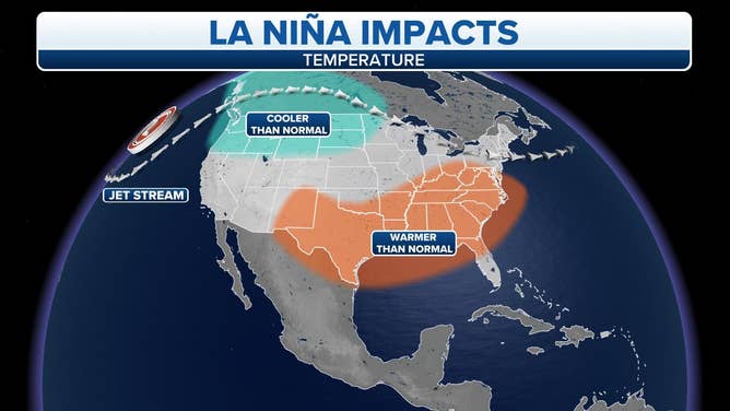
If La Niña conditions do arrive in time for winter, that would usually bring an overall wetter, cooler winter to the northern US and a drier, milder winter to the South.

La Nina Weather Impacts
(FOX Weather)
But with now a weak La Niña expected, the pattern may not have as much of a significant influence. In that case, if neutral phase conditions hold, there are fewer kinks in the jet stream, meaning more regional patterns dominate local weather. A weak La Niña may just occasionally nudge the pattern toward La Niña favored conditions.
What about the waning hurricane season?
La Niña never did make it officially in time for the bulk of the hurricane season, but it turns out we may have been "close enough."
Dr. Phil Klotzbach, a hurricane expert with Colorado State University, was prophetic when he said during an update on the state of the tropics in mid-September that even a late-arriving La Nina or a "La Niña" that comes up just short could still combine with above-average water temperatures and other factors to produce an active late hurricane season in some waters.
"Broadly speaking, even if we don't officially get to La Niña, the likely cool neutral ENSO combined with the extremely warm Caribbean could lead to a busy late season in the Caribbean," he told FOX Weather on Sept. 13.
Days later, Hurricane Helene formed in the western Caribbean and eventually caused devastation across the Southeast, only to be followed this week by another Caribbean and Gulf-borne Hurricane Milton that just tore across Florida.
The tropics have thankfully quieted down aside from Milton’s remnants, but hurricane season does linger until Nov. 30.
