Labor Day Weekend kicks off with severe weather threat across Northeast, mid-Atlantic
Scattered thunderstorms — some reaching severe levels — will develop along a line through western New York, Pennsylvania and into West Virginia in the early afternoon, moving through the region from west to east as the afternoon progresses into the evening.
Severe weather threat kicks off Labor Day weekend in Northeast, mid-Atlantic
The start of the Labor Day weekend will be a stormy one across parts of the Northeast down into the Ohio and Tennessee Valleys as an ill-timed cold front sweeps through, bringing a severe weather threat.
The start of the Labor Day weekend was a stormy one across parts of the Northeast down into the Ohio and Tennessee Valleys as an ill-timed cold front crawled through, bringing a severe weather threat.
Saturday began warm and muggy ahead of the cold front’s arrival, which added fuel to the developing storms as the front tracked across the region.
Scattered thunderstorms — some reaching severe levels — developed along a line through western Pennsylvania and into West Virginia in the early afternoon, moving through the region from west to east as the afternoon progresses into the evening.
A Severe Thunderstorm Watch was posted across much of West Virginia and parts of Pennsylvania and western Maryland through the evening.
LABOR DAY TRAVEL: WILL EXTREME WEATHER IMPACT HOLIDAY TRAVEL IN THE US THIS WEEKEND?
The weather caused significant impacts to outdoor activities, including the football game where #8 PSU was expected to take on WVU in Morgantown, West Virginia.
The game was temporarily suspended as officials waited for lightning to progress through the region.
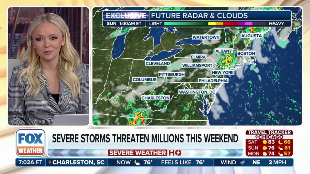
Overall, NOAA’s Storm Prediction Center says the greatest threat of severe weather is the region stretching from about Binghamton, New York south through Pittsburgh and Harrisburg, Pennsylvania into Charleston, West Virginia. That area has been placed in a Level 2 out of 5 severe weather risk Saturday with primary damage threats coming from wind gusts over 60 mph and large hail.
A lower Level 1 risk covers much of the Ohio and Tennessee Valleys up into the interior Northeast, including Nashville, Louisville, Cincinnati, Philadelphia, Baltimore and Washington, DC.
But while the risk of severe weather may be lower, thunderstorms of any intensity contain dangerous lightning and with millions heading outdoors to take advantage of the holiday weekend, keeping tabs on the skies and the forecast is paramount.
Unfortunately, the forecast only shows minimal improvement for Sunday. While the severe weather threat wanes, the slow-moving cold front and unstable atmosphere will keep scattered showers and thunderstorms in the forecast across the mid-Atlantic and Northeast, including the entire Interstate 95 corridor from North Carolina to Maine.

(FOX Weather)