Tornado damage seen in Ohio Valley as derecho knocks out power to nearly half a million
A Tornado Watch was issued for millions of people across Missouri, Illinois and Indiana through Wednesday evening.

Plains slammed by strong storms Wednesday
States from Missouri to Ohio are on alert for severe weather this evening, as a line of strong storms makes its way across the central U.S. These storms are capable of producing strong, damaging winds gusts and even a few tornadoes are possible.
INDIANAPOLIS – A serial derecho ripped across the Ohio Valley on Wednesday and produced damaging wind gusts across hundreds of communities, causing nearly 500,000 power outages at the height of the storm.
According to the FOX Forecast Center, the derecho – a cluster of thunderstorms that produces multiple wind gusts of at least 75 mph – swept across a 580-mile stretch from Illinois to western Pennsylvania.
The states of Indiana, Illinois and Ohio appeared to be the hardest hit, with even a few tornadoes spotted during the late-morning and early afternoon.

(FOX Weather)
Damage consistent with an EF-1 tornado was reported in Pike County, Missouri, according to the National Weather Service. A survey of the damage is ongoing.
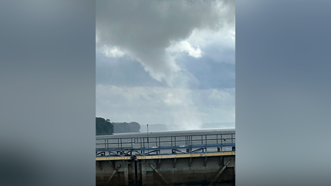
This photo shows a likely waterspout spinning across the Mississippi River in Clarksville, Missouri, on June 18, 2025.
(@subzerodjtype/X / FOX Weather)
Video from Jacksonville, Illinois, showed a large tornado whirling on Wednesday, with debris blowing up in its wake.

Watch: Tornado looms over fairgrounds in central Illinois
Video from Jacksonville, Illinois, shows a tornado on Wednesday afternoon.
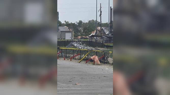
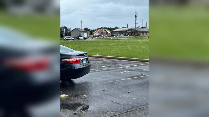
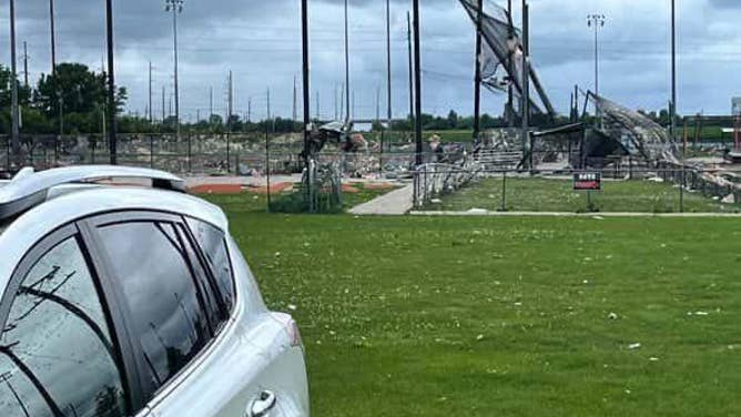
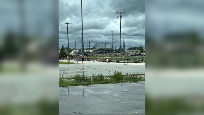
Photos from Jacksonville showed damage to a sports complex.
![Damage reported in Jacksonville, Illinois to the Future Champions Sports Complex.]() Image 1 of 4
Image 1 of 4Damage reported in Jacksonville, Illinois to the Future Champions Sports Complex. (Laura Wamble via Facebook)
![Damage reported in Jacksonville, Illinois to the Future Champions Sports Complex.]() Image 2 of 4
Image 2 of 4Damage reported in Jacksonville, Illinois to the Future Champions Sports Complex. (Laura Wamble via Facebook)
![Damage reported in Jacksonville, Illinois to the Future Champions Sports Complex.]() Image 3 of 4
Image 3 of 4Damage reported in Jacksonville, Illinois to the Future Champions Sports Complex. (Laura Wamble via Facebook)
![Damage reported in Jacksonville, Illinois to the Future Champions Sports Complex.]() Image 4 of 4
Image 4 of 4Damage reported in Jacksonville, Illinois to the Future Champions Sports Complex. (Laura Wamble via Facebook)
Video from Menard County, Illinois, roughly 40 miles northeast of Jacksonville, showed a funnel cloud spinning up over a field.

Watch: Funnel cloud forms over field in Illinois
Video from Wednesday afternoon shows a large funnel cloud forming over a field in rural Illinois. Severe storms are charging through the heartlands, putting millions of people on alert for damaging winds and possible tornadoes.
Strong storms reached Indiana on Wednesday afternoon, bringing gusty winds and rain. Wind gusts of 67 mph were reported in Warren Park, a town east of Indianapolis.

Watch: Doorbell camera video captures storms blasting central Indiana
Video from Westfield shows different angles of storms moving in. Most of Indiana was put under tornado watch through Wednesday evening.
This renewed risk comes after extreme weather tore across the Plains and Midwest over the past few days, producing tornadoes in Minnesota and Nebraska, while a record-breaking 101-mph wind gust was reported in Wichita, Kansas.
WATCH VS. WARNING: HERE ARE THE DIFFERENCES BETWEEN THESE WEATHER TERMS THAT COULD SAVE YOUR LIFE

WATCH: Powerful storm produces heavy rain, low visibility in Oklahoma
A dramatic video shared from Pawhuska, Oklahoma, shows a powerful thunderstorm dumping heavy rain leading to low visibility on Tuesday, June 17, 2025.
The severe weather threat is expected to continue for the rest of the week, putting the mid-Atlantic, Northeast and New England on alert by Thursday.