Large hail, brief tornadoes reported again Thursday as severe storms push east from Plains
Nearly 200 Severe Thunderstorm Warnings were issued Thursday afternoon across more than a dozen states that included reports of large hail and damaging winds as storms erupted.
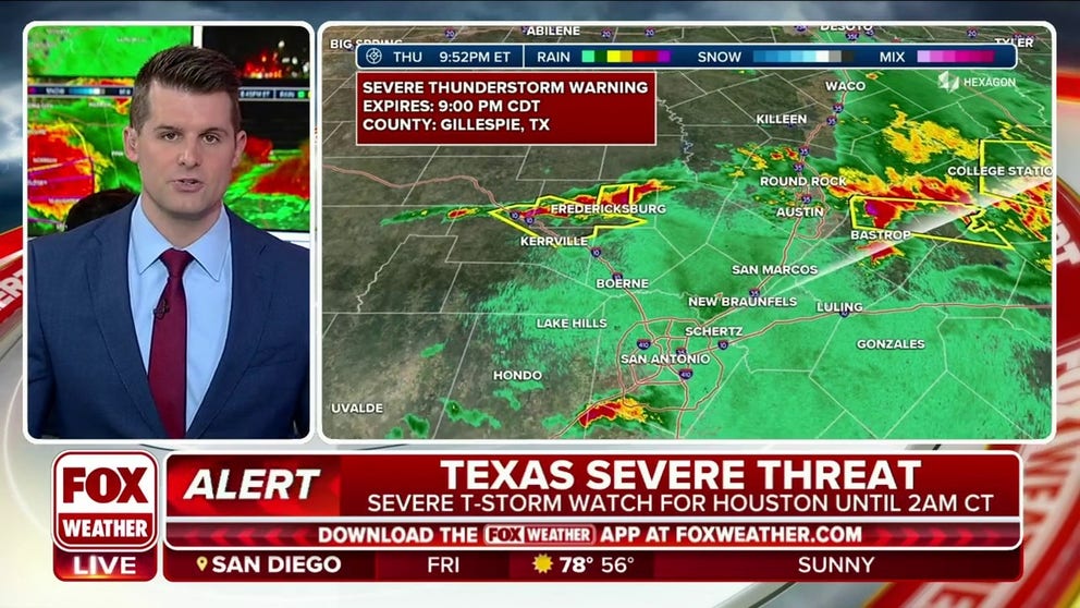
Severe thunderstorms move through Texas, damaging wind and hail possible
Severe thunderstorms linger in Texas on Thursday evening. A Severe Thunderstorm Watch has been issued for Houston until 2am CT Friday. Damaging winds and hail are possible.
Following several reports of tornadoes from Oklahoma to Iowa on Wednesday, including one that killed three people in Cole, Oklahoma, severe storms spread over 1,000 miles on Thursday, pummeling communities with large hail and damaging wind.
Nearly 200 Severe Thunderstorm Warnings were issued Thursday afternoon across more than a dozen states that included reports of large hail and damaging winds as storms erupted.
Doppler radar in the eastern part of the Sooner State detected a rotating supercell with a possible tornado in Pushmataha County, Oklahoma. Rural areas of the eastern part of the state were put under a Tornado Warning as the storms worked eastward.
The possible tornadic storm was about 150 miles southeast from where a deadly EF-3 struck central Oklahoma on Tuesday.
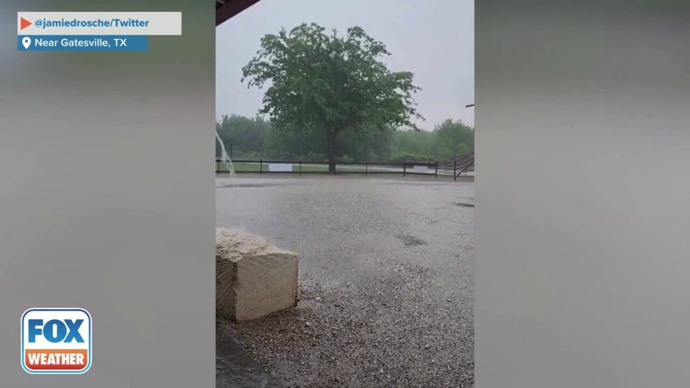
Hail ricochets off building near Gatesville, TX
Hail ricochets off a building north of Gatesville, Texas on Thursday. (Credit: @jamiedrosche/Twitter)
Due to the proximity of the storms to the Dallas metroplex, a ground stop was issued for departing flights from both the Dallas-Fort Worth International Airport and Dallas Love Field.
Radar indicated at least golf ball-sized hail was possible in storm in North Texas and the Red River Valley.
During the early evening, an Illinois weather spotter reported seeing a tornado impacting Bureau County, west of Chicago.
Storms also triggered a Tornado Warning for Peoria, Illinois, after radar detected strong rotation. Cameras around the city captured video of downpours causing poor visibilities along the Illinois River.
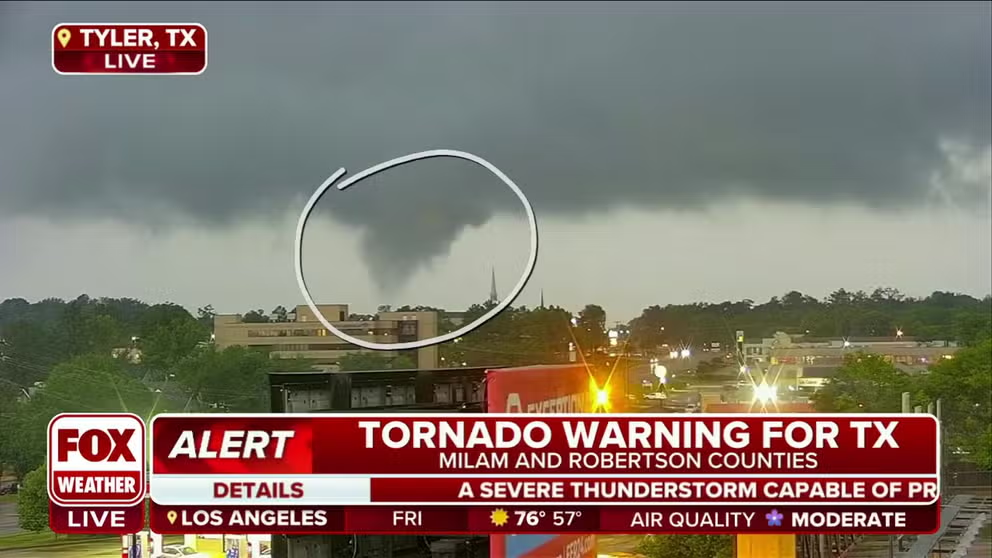
Texas tornado formation caught on cam
About an hour before sunset over Tyler, Texas, a tornado formed during live FOX Weather severe storm coverage.
Tornado forms in Tyler, Texas
Tornado forms live during FOX Weather's severe weather coverage in Tyler, Texas.
During the brief time the tornado was on the ground, damage was reported at a local junior college in Smith County.
The local NWS office warned residents to seek shelter and that mobile homes could be damaged or destroyed by high winds.
PowerOutage.us reported several hundred outages in the area where the tornado moved through.
The decision on how strong the tornado was will come from a storm survey conducted by NWS meteorologists in future days.
In addition to the tornado threat, the storm was also capable of leading to flash flooding with several inches of rain possible in just a few hours.
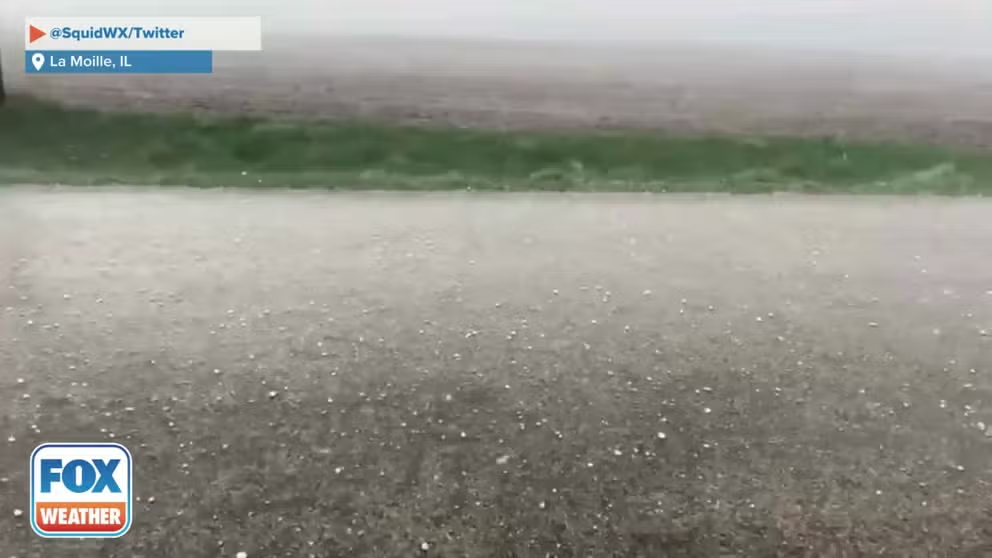
Hail pelts car in northern Illinois
Hail pelts a vehicle in La Moille, Illinois on Thursday. (Credit: @SquidWX/Twitter)
Chicago area sees heavy rains, reports of hail
Suburbs on the northern side of Chicago were put under a Severe Thunderstorm during the rush hour. Radar indicated hail possibly as large as hen eggs was falling west of Interstate 94 in northern Illinois.
The threat of rain and lightning in the Windy City caused the Chicago Cubs to issue a weather delay in the game against the L.A. Dodgers. The game was able to resume a little more than an hour after its original starting time.
The largest report of hail from the Prairie State came from Henry County, where a witness spotted 3" diameter stones. Three-inch hailstones are about the size of an apple and slightly larger than a baseball.
Severe threat moves east into the weekend
Thunderstorms are expected to continue to rumble eastward on Friday with the main threats being from heavy rain, hail and gusty winds.
The Storm Prediction Center has highlighted two areas to watch for the chance of increased storm activity - the Ohio Valley and the Gulf Coast.
Severe thunderstorms will be possible on Saturday in the Carolinas and far southeastern Georgia with a risk of hail and 60-plus-mph wind gusts during the afternoon hours.

(FOX Weather)
