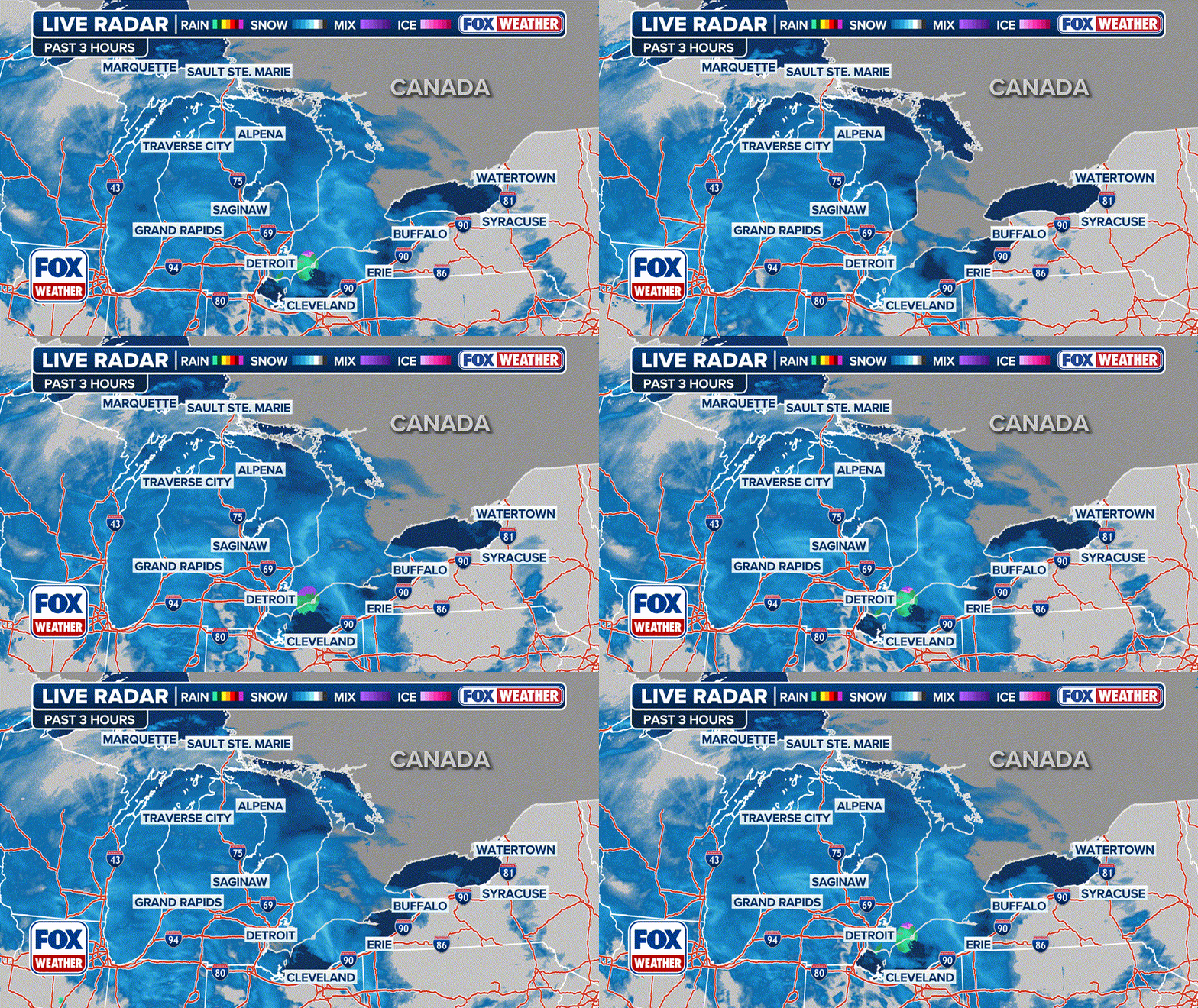
Great Lakes, Northeast dig out as lake-effect snow winds down ahead of another storm this weekend
Lake-Effect Snow Warnings continue for parts of the Great Lakes through Friday, but another clipper system is expected to bring more snow this weekend.
Digging out from feet of snow in the Great Lakes and Northeast
Piles of snow are everywhere in lake-effect snow prone areas along Lake Erie and Lake Ontario as yet another storm heads that way for the weekend, but the script flips next week when temperatuers significantly warm.
ERIE, Pa. – Snow is winding down across the Northeast on Friday after a powerful winter storm finishes its race across the U.S., bringing life-threatening snow squalls and blizzard conditions to regions slammed by the first significant lake-effect snowstorm of the season.
The FOX Forecast Center said a gradual warm-up is expected to limit snow chances over the weekend. However, a fast-moving clipper will swing across New England late Saturday into Sunday, causing some disruptions to travel along with a quick burst of snow.
Due to the fast-moving nature of the snow, totals are likely to only amount to around 3-5 inches of additional snow. This clipper is expected to move out by late Sunday into the Atlantic.
SEE IT: POWERFUL WINTER STORM LASHES NORTHEAST AS MILLIONS ENDURE SNOW SQUALLS, BITING WINDS

(FOX Weather)
This week's latest snowfall caused treacherous travel and led to several crashes which closed lanes on Interstate 80 in Pennsylvania. Frozen precipitation amounts were rather modest along the heavily traveled Interstate 95 corridor on Thursday.
And in Michigan, FOX Weather Exclusive Storm Tracker Brandon Copic said Interstate 94 was snow-covered in the southwestern part of the state.
"We had 10-15 trucks that we’ve seen so far in the last two hours stuck on these secondary roads," Copic said. "Because they try and go on these roads that aren’t plowed, because they’re trying to get away from the road closures and they get stuck on hills… and it even leads to more chaos."
DON'T LEAVE ANY OF THESE ITEMS IN YOUR CAR THIS WINTER
Watch: Video shows multi-vehicle crashes on Michigan highway during winter storm
Treacherous travel conditions were reported in Michigan as a winter storm swept across the area dumping heavy snow and producing strong winds. This video shows a multi-vehicle crash on Highway 40 near Holland, Michigan.
The Massachusetts Department of Transportation said winter weather conditions had forced officials to lower the speed limit on Interstate 90 from the New York state line to Westfield, Massachusetts, but those restrictions had been lifted as of Thursday afternoon.
In addition, MassDOT said more than 1,000 pieces of equipment were out plowing and treating roads statewide.
Winter storm causing issues in Ohio as snow, wind continue
A powerful winter storm that has been sweeping across the Great Lakes region and Northeast is continuing to blast millions of people with heavy snow and strong winds. FOX Weather Correspondent Brandy Campbell was in Mentor, Ohio, where crews have been busy trying to keep road and highways clear.
Power outages have also started to creep up during the height of the storm, with PowerOutage.US reporting outages in Pennsylvania, Ohio and Connecticut in New England.
Multiple reports of rare thundersnow
The National Weather Service office in Pittsburgh said there were numerous reports of lightning flashes and rare thundersnow as the line of rain, snow and sleet slid across the region late Wednesday night and into Thursday morning.
A video shared from Holland, Michigan, showed a bright flash of lightning and thundersnow as the storm pushed through the region.
TRAVELING THIS WINTER? HERE'S WHAT TO KEEP IN YOUR CAR IN CASE YOU GET STUCK
Watch: Lightning, thundersnow reported in Michigan
Flashing of lightning and thundersnow was reported near Holland, Michigan, as a powerful winter storm moved through the region on Wednesday and Thursday.
Thundersnow is a rare weather phenomenon where thunder and lightning are observed despite precipitation falling in the frozen variety.
Similar to thunderstorms, thundersnow requires a significant amount of atmospheric instability, and in areas where the phenomenon occurs, snowfall rates can be exceptionally heavy.
NOW IS THE TIME TO PREPARE YOUR VEHICLE FOR COLD WEATHER
Winter weather alerts Thursday stretched from Michigan to Maine, including Blizzard Warnings in portions of West Virginia and Maryland in the mid-Atlantic, as well as a new Blizzard Warning that has Erie, Pennsylvania, on alert for whiteout conditions amid 10-18 inches of new snow and gusts to 60 mph.
Erie, Pennsylvania, buried in snow as new Blizzard Warning issued
FOX Weather Correspondent Robert Ray reports live from a snowy Erie, Pennsylvania, where another round of heavy snows and strong winds are coming Thursday.
Dangerous winds blew across the eastern half of the U.S. with gusts of 40-50 mph. Winds toppled the Christmas tree at the West Virginia State Capitol when a securing cable snapped overnight Wednesday.
In total, more than 17 million people were included in some sort of winter weather alert Thursday but had dropped to just 3.5 million Friday evening.
"Nearly 3 feet of snow has fallen already since last Friday here in Erie, and surrounding areas on the interior up to 6 feet in some pockets," FOX Weather Correspondent Robert Ray said Thursday. "We know how dangerous I-90 has been over the course of the past almost a week, and we expect those conditions to be as dangerous or even more as these blizzard conditions continue throughout the morning."
Watch: Heavy snow falls during Blizzard Warning in Erie, Pennsylvania
A video shared by FOX Weather Correspondent Robert Ray shows heavy snow and strong winds during a Blizzard Warning in Erie, Pennsylvania, on Thursday, Dec. 5, 2024.
Storm left whiteout conditions across Upper Midwest
The storm first spent Wednesday revving up over the Upper Midwest as it dropped out of Canada, bringing multiple snow squalls to North Dakota, Wisconsin and Minnesota.
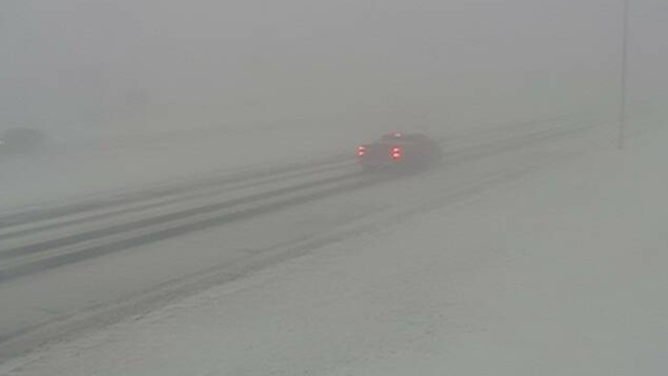
NOAA’s Weather Prediction Center (WPC) shared a dramatic photo just west of Grand Forks, North Dakota that showed the whiteout conditions blinding portions of far eastern North Dakota and northwestern Minnesota.
DOWNLOAD THE FREE FOX WEATHER APP

This image shows a life-threatening snow squall just west of Grand Forks, North Dakota, on Wednesday, Dec. 4, 2024.
(@NWSWPC/X / FOX Weather)
A time-lapse video that was shared from Fargo, North Dakota, shows a snow squall racing through the city on Wednesday.
DRIVING ON THE ICE AND DRIVING IN THE SNOW: WEATHER DRIVING TIPS FOR DRIVING IN INCLEMENT WEATHER
Watch: Time-lapse video shows snow squall blasting Fargo, North Dakota
A time-lapse video shows a snow squall blasting Fargo, North Dakota, on Wednesday.


