Winter Storm Watches issued from Washington, D.C. to Boston, I-95 prepares for biggest snowstorm in years
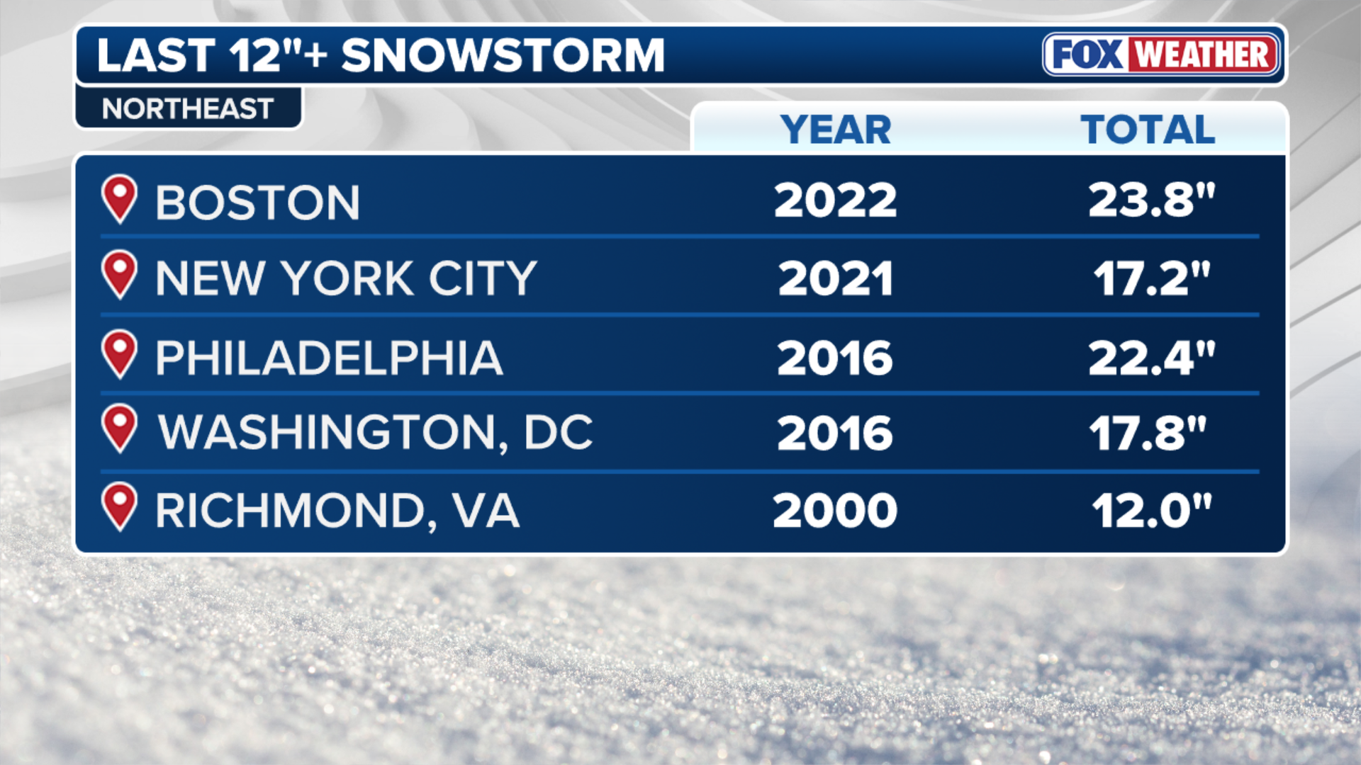
It has been 10 years since the last winter storm dumped more than a foot of snow on cities including Philadelphia, Baltimore and Washington D.C., and the prolonged streak may come to an end.

Chances increasing that major winter storm slams the Northeast this weekend
FOX Weather Meteorologist Jane Minar analyzes the 2,000-mile long major winter storm forecast to affect 200 million Americans across 40 states in the US. Recent forecast show an increasing chance that major snow will fall in the Northeast and Mid-Atlantic as more than 10 states in the region could see over a foot of snow.
NEW YORK – Parts of the Mid-Atlantic and the New York tri-state area are bracing for what computer forecast models are increasingly projecting to be the most significant snowstorm in recent years, with more than a foot of snow possible through Monday.
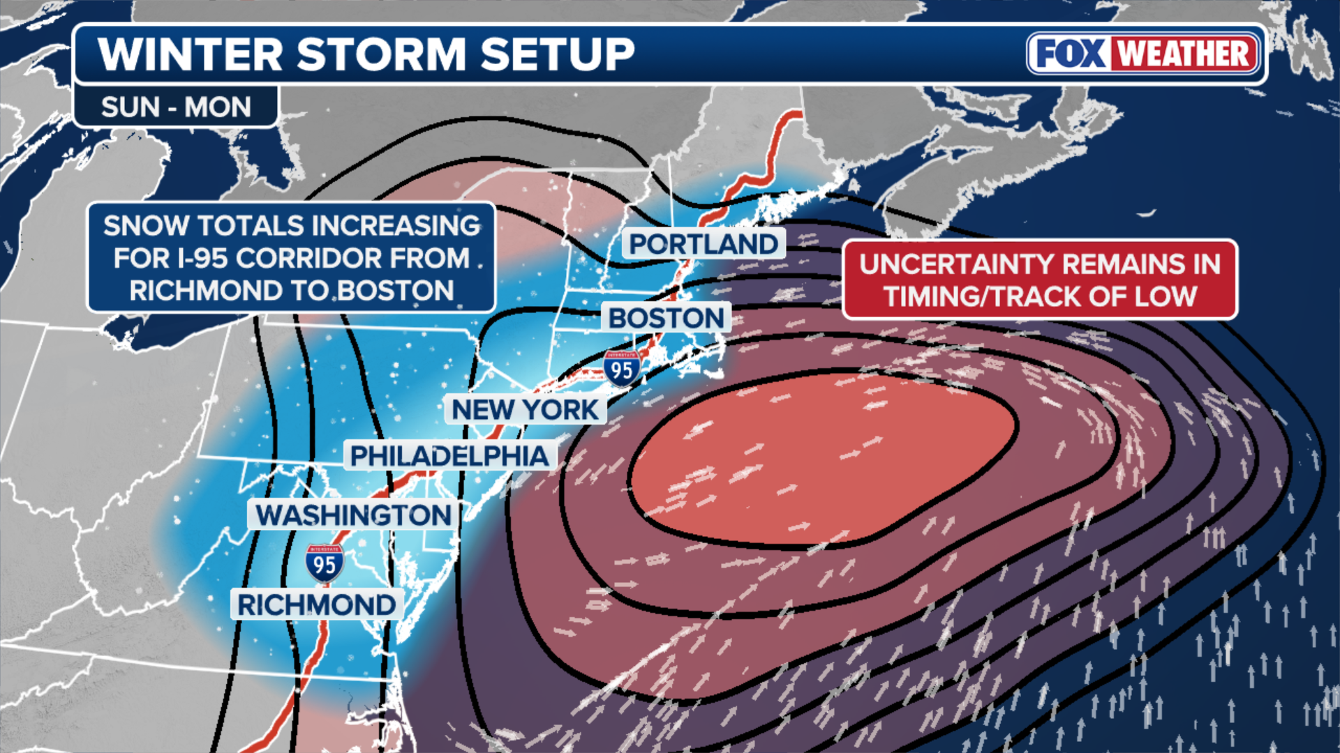
The region will be the last stop of the potentially historic system that is expected to carve a dangerous 2,000-mile-long path east from Arizona to Maine, packing heavy snow and ice.
Winter Storm Warnings have been issued from Washington, D.C., through Philadelphia and New York City, to Boston.

(FOX Weather)
The storm will reach the region by Saturday night and peak through the day Sunday before finally relenting Monday.
The first impacts will arrive in Virginia on Saturday afternoon from the west. As the sun rises Sunday morning, snow will be falling from northern Virginia to potentially as far north as Massachusetts, with the storm peaking in intensity through the day Sunday, when snow rates may be as high as 1 inch per hour before winding down.
That comes as computer forecast models show an increasing likelihood that the massive winter storm will merge with a disturbance out of the Northern Plains and create an even more powerful system off the East Coast.
(FOX Weather)
If this scenario plays out, Philadelphia, New Jersey and New York City could see more than a foot of snow by Monday morning.
The precise interaction between these two systems will determine whether snow totals land closer to 8 inches or 16 inches.
Major delays are expected across northeastern airport hubs while dangerous driving conditions are forecast along the Interstate 95, 81 and 80 corridors.
(FOX Weather)
It has been 10 years since the last winter storm dumped more than a foot of snow on cities including Philadelphia, Baltimore and Washington D.C., and the prolonged streak may come to an end.
According to the FOX Forecast Center, the biggest snow totals in the Mid-Atlantic and Northeast include areas from the Potomac Highlands of West Virginia, through northern Virginia and Washington D.C., Maryland and Virginia (DMV) area, and up toward the New York tri-state area.
Although more precipitation will fall across central Virginia, questions remain about whether the snow will change over to sleet and freezing rain.
![One of the last big snow storms happened last year on January 29, 2022, when a Nor'easter storm blanketed the city with snow.]() Image 1 of 4
Image 1 of 4FILE: One of the last big snow storms happened on January 29, 2022, when a Nor'easter storm blanketed the city with snow. (John Lamparski)
![Snow falls in Washington, D.C., on Monday as a winter storm snarls travel across the nation.]() Image 2 of 4
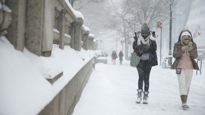
Image 2 of 4FILE: Snow falls in Washington, D.C., on Monday as a winter storm snarls travel across the nation. (White House)
![Snow in Philadelphia]() Image 3 of 4
Image 3 of 4FILE: Snow falls in Philadelphia on Jan. 19, 2024 ( )
![FILE - A snow plow clears a pathway from snow on February 9, 2025 in Boston, Massachusetts. (Photo by Scott Eisen/Getty Images)]() Image 4 of 4
Image 4 of 4FILE: A snow plow clears a pathway from snow on February 9, 2025 in Boston, Massachusetts. (Photo by Scott Eisen/Getty Images) ( )


The farther north the storm is able to track, the greater the likelihood of significant snow further north along the I-95 corridor in New England.
The FOX Forecast Center will continue to monitor the evolving threat and provide updates as forecast guidance comes into better agreement.
Check back for updates on this developing story.