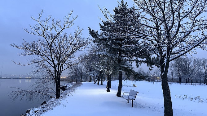
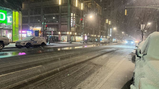
Snow squalls pummel Northeast in wake of winter storm that dumped foot of snow in Pennsylvania, New Jersey
Over a dozen Snow Squall Warnings were issued on Saturday in counties in New York, Pennsylvania and Massachusetts. The warnings were issued as cold air flowed over the Great Lakes, causing sporadic yet intense snow showers in the downwind areas.
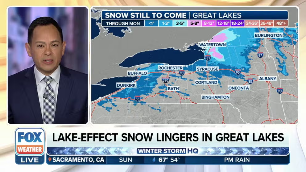
Lake-effect snow lingers in eastern Great Lakes on Sunday
Lake-effect snow continues to fall on Sunday in parts of western and northern New York following a snowstorm that swept across the mid-Atlantic states Friday night and early Saturday that dumped about a foot of snow from parts of eastern Pennsylvania into northern New Jersey.
LYONS, Pa. – A fast-moving winter storm that was due to bring a few inches of snow to the mid-Atlantic and Northeast Friday night instead packed quite a punch for some in New Jersey and Pennsylvania, who awoke Saturday morning to find more than a foot of snow had fallen overnight.
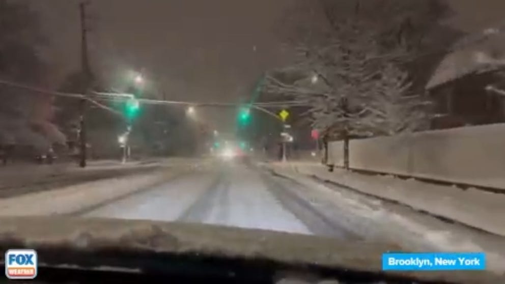
While the steady snow has since moved out into the Atlantic, the impacts are not finished. Over a dozen Snow Squall Warnings were issued on Saturday in counties in New York, Pennsylvania and Massachusetts. The warnings were issued as cold air flowed over the Great Lakes, causing sporadic yet intense snow showers in the downwind areas.

(FOX Weather)
Snow squalls are like a miniature blizzard with gusty winds that typically last less than an hour. Very high snowfall rates, on the order of 2 inches in 30 minutes, are not uncommon. They are extremely dangerous for travelers as the visibility can drop to near zero, leaving drivers disoriented and unable to see other traffic. Some of the largest multi-vehicle pileups during winter weather have come from sudden snow squalls.
WHAT ARE SNOW SQUALLS AND WHY ARE THEY SO DANGEROUS?
Lake-effect snow is expected to continue through at least Monday, primarily in the eastern Great Lakes region. Drivers are urged to use caution and be prepared for sudden dips in visibility.

(FOX Weather)
The National Weather Service has issued Lake-Effect Snow Warnings downwind of Lake Ontario in northern New York, including cities like Watertown and Potsdam.
Winter Weather Advisories are also in effect for portions of central and western New York, including Buffalo and Niagara Falls.

(FOX Weather)
Storm system drops several inches across a dozen states
Outside the snow squalls, the fast-moving clipper system left a blanket of snow across parts of at least a dozen states from Ohio to Massachusetts Friday night and early Saturday.
Snow blankets New York City area after quick-hitting storm races through Friday night
New York City residents awoke to what these days counts as a rare snowfall that left anywhere from 2-6 inches across the boroughs.
The highest accumulations were observed when a narrow band of intense snowfall dumped around a foot of snow on eastern Pennsylvania and New Jersey.
The FOX Forecast Center said that heavy snow bands caused snow rates to exceed 1 inch per hour in the region, but some places saw snowfall rates that were mind-boggling.
One spotter in Hellertown, Pennsylvania, measured over 5 inches of snow in an hour, and over 11 inches in total Saturday morning. Lyons, Pennsylvania, reported exactly 12 inches.
In New Brunswick, New Jersey, an observer reported that 9.3 inches of snow had fallen as of early Saturday morning.

(FOX Weather)
Outside the heavy snow band, spotters reported 4-6 inches in the area surrounding Pittsburgh, while 5-8 inches of snow piled up in eastern Pennsylvania, extending into other parts of New Jersey.
New York City, which has struggled to see much snow over the past two winters, awoke to a few inches that had fallen across some boroughs.
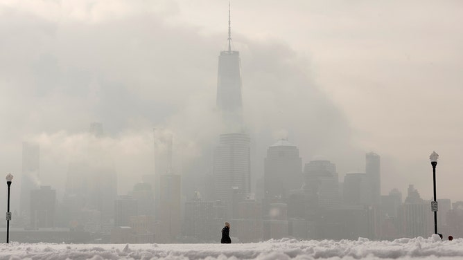
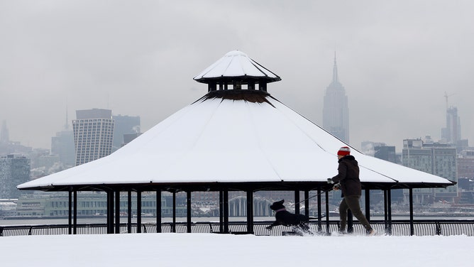
A woman walks through a snow-covered park in front of the skyline of lower Manhattan and One World Trade Center in New York City on February 17, 2024, in Hoboken, New Jersey.
(Gary Hershorn / Getty Images)
Snowfall in Central Park totaled 2 inches, while John F. Kennedy International Airport recorded 6.1 inches.
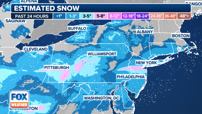
Estimated snowfall between Feb. 16-17, 2024.
(FOX Weather)
Coney Island was the New York City area snow winner, coming in at just under 10 inches of new snow.
The storm stayed a bit farther north of the Washington-Baltimore corridor, with just 1-2 inches measured around that region Saturday morning, though there were a few isolated spots of 3-4 inches. Another 3-6 inches fell across the mountains of Virginia and West Virginia.
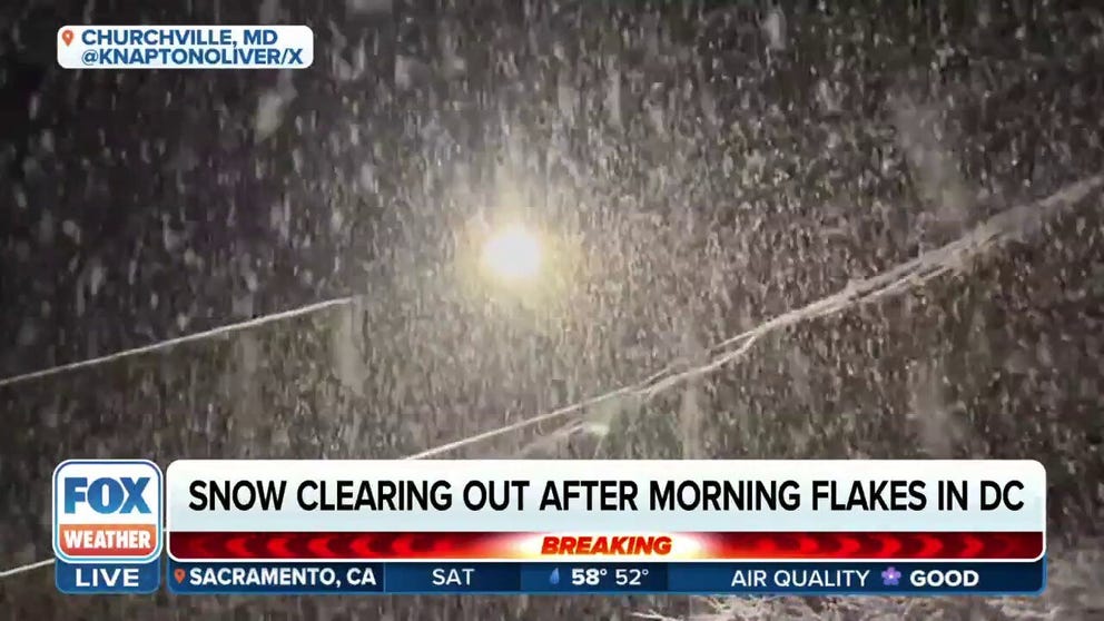
Snow clearing out in DC Saturday after morning flakes
People across more than 10 states are waking up to fresh snow after a clipper system dumped a few inches of snow Ohio to Connecticut overnight. Localized bands of heavy snow brought snow rates over I" per hour across the region.
Snow wanes but winter chill remains
The snowfall is decreasing as the low-pressure system moves away from the region. However, the wintry impacts will not stop there.
Winter weather is expected to stay this weekend, bringing high temperatures in the 20s and 30s. The wind chill is expected to drop into the single digits to near zero at night.
Starting Monday, the region will be on a gradual warming trend through the week before the next chance of wintry weather next weekend.
Snowfall causes problems throughout the Midwest, including deadly crash
The fast-moving storm system dropped a quick 2-5 inches of snowfall along the Interstate 74 corridor in the Midwest on Friday morning.
The frozen precipitation was the first flakes cities such as St. Louis and Indianapolis have seen within the past month, according to the FOX Forecast Center.
A pileup crash on Interstate 70 outside of St. Louis shut down parts of the interstate for several hours, and photos from the scene showed at least one jackknifed semi truck and several stranded vehicles. Troopers have not said how many people are believed to have been injured or how many cars were involved in the crash near Warrenton, Missouri, but the crash certainly made for a rough commute.
HOW MANY CALORIES DOES SHOVELING SNOW BURN?
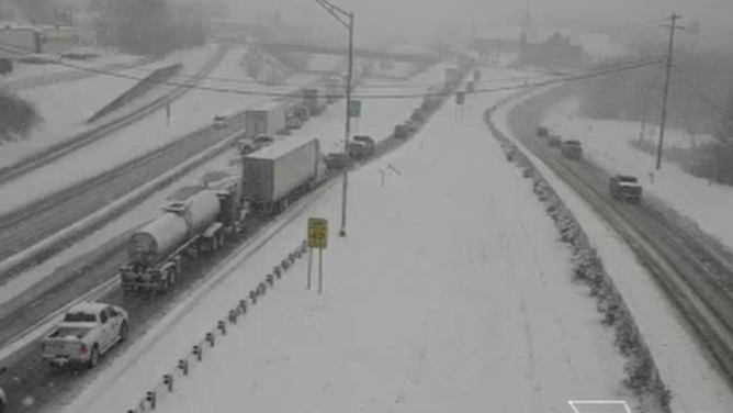
Snow snarled traffic on Interstate 70 in Missouri on Feb. 16, 2024.
(FOX Weather)
Outside of Lake Ozark, Missouri, a deadly crash was reported by troopers in Morgan County. The Missouri State Highway Patrol said a driver lost control during slick conditions on Friday morning.
Outside of the Plains, the highest accumulations were in central Illinois and Ohio, where snowfall topped more than a half-foot in several communities.
As of Friday evening, Springfield, Illinois, reported a snowfall total of 6.5 inches, while Marysville, Ohio, had reached 6 inches.
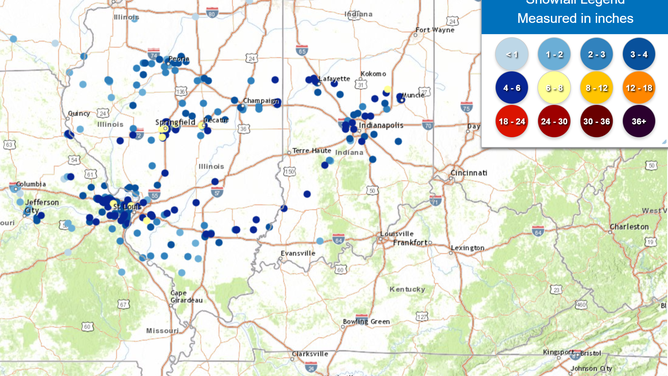
Snowfall accumulations in Midwest as of Friday evening
(NOAA)
