Philadelphia, New York City slammed by severe storms Wednesday
Wednesday's threat came one day after severe weather slammed portions of the Northeast on Tuesday and two days after a powerful and deadly derecho swept across the Midwest on Monday, spawning several tornadoes in the Chicago area and killing at least one person in Indiana.

Dangerous storms to hit Northeast again
Over 48 million Americans are under a 2 out of 5 severe storm threat Wednesday night. July 17, 2024.
NEW YORK – Wednesday was another stormy day for tens of millions of people living along the Interstate 95 corridor from the mid-Atlantic to the Northeast. Cities like Washington, D.C., Philadelphia and New York City were at risk of damaging thunderstorms capable of producing hurricane-force wind gusts and deadly lightning.
The threat came a day after severe weather slammed portions of the Northeast on Tuesday and two days after a powerful and deadly derecho swept across the Midwest on Monday, spawning several tornadoes in the Chicago area and killing at least one person in Indiana.

(FOX Weather)
Thunderstorms began to develop along and ahead of a cold front across the interior Northeast and Central Appalachians during the midday hours on Wednesday and started to charge off to the east.
Those storms approached the highly-populated Northeast Corridor during the late afternoon and early evening hours.
Because of the growing severe weather threat, the National Weather Service issued a Severe Thunderstorm Watch that covered about 40 million people across the Northeast and New England.
New York State police said they responded to reports that three people had been struck by lightning at High Tor State Park in Rockland County.
They said when emergency crews arrived at the scene, the three victims said they felt the effects of the strike when lightning hit trees nearby. All three people were brought to a local hospital for treatment as a precaution.
Washington, New York City, Boston all saw heightened severe weather risk Wednesday

(FOX Weather)
NOAA’s Storm Prediction Center (SPC) highlighted an expansive area of the eastern U.S. that was at risk of severe weather on Wednesday.

(FOX Weather)
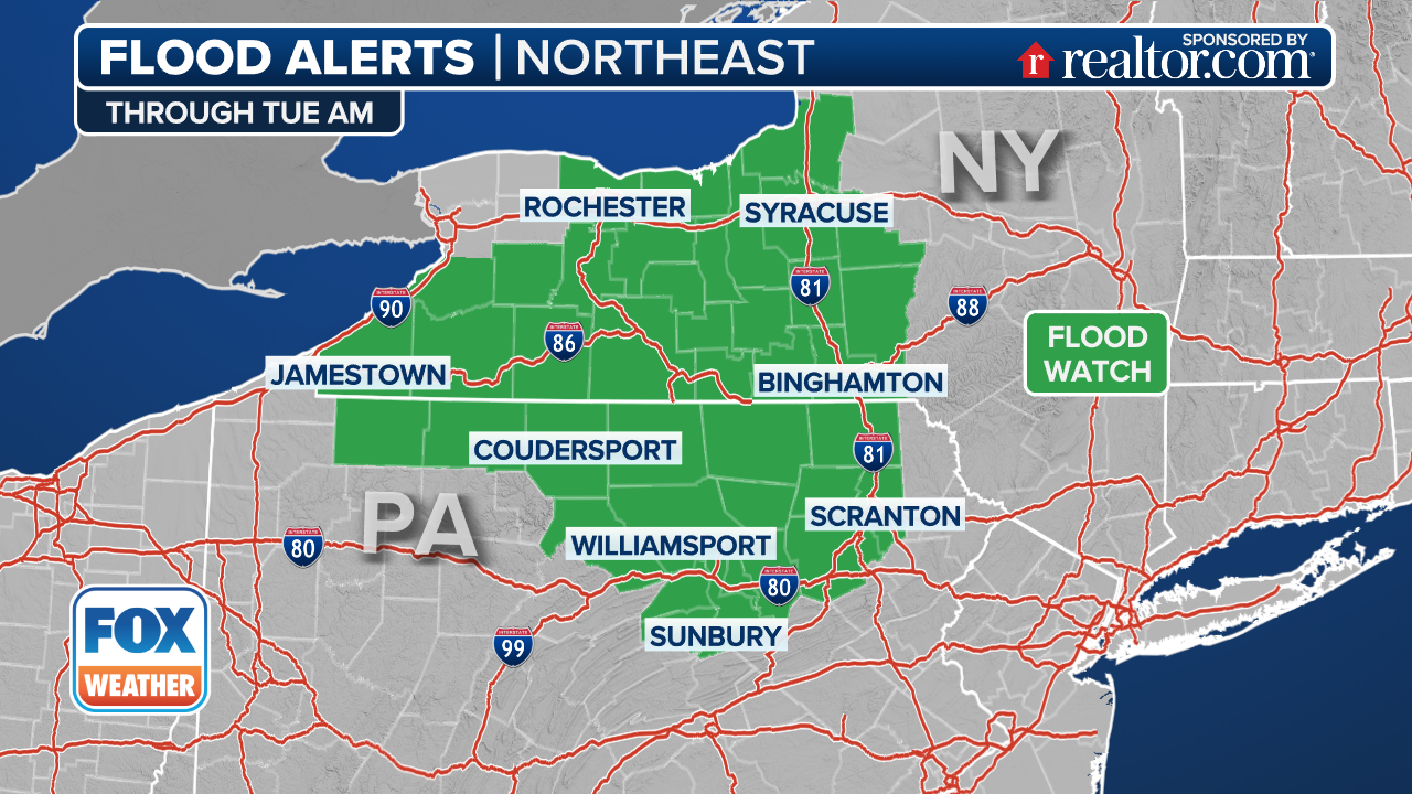
In addition, torrential rain could lead to major problems – especially in the Washington, D.C. and Baltimore areas, where the National Weather Service issued a Flood Watch.
"Excessive runoff may result in flooding of rivers, creeks, streams and other low-lying and flood-prone locations," the NWS said. "Flooding may occur in poor drainage and urban areas."
(FOX Weather)
Forecasters said rainfall rates could approach 2 inches per hour, and if locally repetitive or prolonged thunderstorms develop, flash flooding could occur across the area.
Be sure to download the free FOX Weather app and enable notifications to receive potentially life-saving weather alerts and keep up with the latest forecast in your area.