

Texas in the bull's-eye of relentless flood threat as 50M from Southern Plains to East Coast face downpours
All told, this event impacted more than 150 million people across the Southwest, the Plains and Midwest.
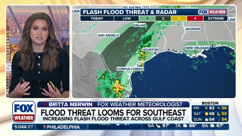
Texas in bull’s-eye of flood threat as 50M from Southern Plains to East Coast face Friday soaker
The major Texas cities of Dallas, Austin and San Antonio face another round of potential flash flooding as thunderstorms fire along an 1,800-mile front draped border-to-border from South Texas to Upstate New York. More than 50 million people are under a flash flood threat, with another round of heavy rain fueled by tropical moisture expected to move into the Southeast this weekend.
THE TAKEAWAY
- The major Texas metros of Dallas, Austin and San Antonio are again in the bull's-eye of the greatest flash flood risk on Friday.
- Parts of the Midwest, Ohio Valley and Northeast could see a shot of rain on Friday as a massive 1,800-mile front slowly pushes eastward through the day.
- This follows a weeklong flood threat across the Central U.S, that was fueled by tropical moisture from the remnants of Polo and Hurricane Rachel.
The major Texas cities of Dallas, Austin and San Antonio are in the bull's-eye of another round of flash flooding as thunderstorms fire along an 1,800-mile front stretching from South Texas to Upstate New York.
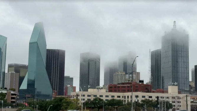
Dallas soaked by tropically enhanced rain on Oct. 1, 2026.
(FOX Weather Senior Correspondent Robert Ray / FOX Weather)
More than 50 million people are under a flash flood threat Friday, with another round of heavy rain fueled by tropical moisture expected to move into the Southeast this weekend.
Parts of the Midwest, Ohio Valley and Northeast could see a shot of rain on Friday from the massive front slowly pushes eastward through the day.
A Level 2 out of 4 risk of flash flooding covers a corridor from South Texas to southeastern Oklahoma, including Laredo, San Antonio, Austin, Waco and Dallas on Friday.
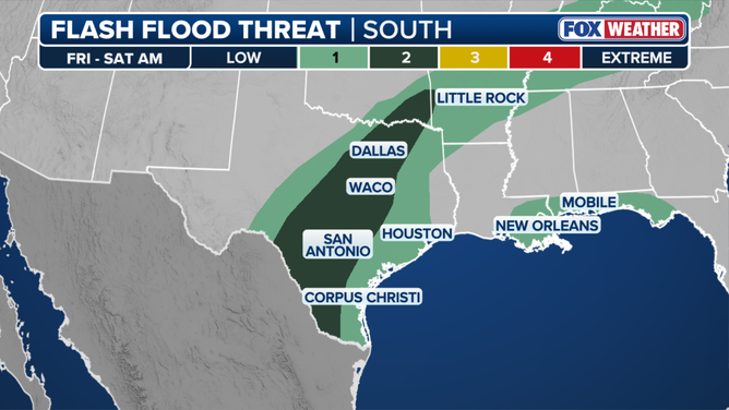
Friday flash flood threat.
(FOX Weather)
Repeated rounds of storms could increase the flood threat over Central Texas, including Austin and San Antonio, as well as Texas Hill Country, the site of deadly flooding on July 4, 2025.
This follows a weeklong flood threat across the Central U.S, that was fueled by tropical moisture from the remnants of Polo and Hurricane Rachel that was pulled into the Lower 48 by a large dip in the jet stream.
All told, this event impacted more than 150 million people across the Southwest, the Plains and Midwest.
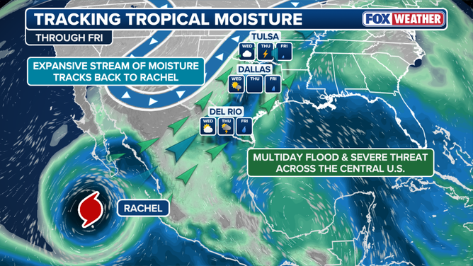
Moisture from Hurricane Rachel fueled flood threat across the Central U.S.
(FOX Weather / FOX Weather)
The weather pattern triggered heavy rain across parts of Central Texas, as well as Kansas, Iowa and Nebraska late Wednesday through the day on Thursday.
Officials from Texas Parks and Wildlife said the South Llano River State Park in Junction received 7.82 inches of rain Wednesday night. The Texas Interstate 35 corridor saw its first round of intense downpours on Thursday.
A Flash Flood Emergency was issued just south of Dodge City, Kansas, on Thursday afternoon. The National Weather Service (NWS) received a report of 6 inches of rain falling in just a two hour span.
Kansas Governor Laura Kelly issued a verbal state of disaster emergency on Wednesday due to the heavy rain.

Timelapse: Heavy rain moves over Trinity River in Dallas
Timelapse video shows heavy rain moving over the Trinity River in Dallas on Thursday morning, Oct. 1, 2026. Some parts of the river rose about 4 feet in 4 hours as a strong line of thunderstorms moved over the area.
The Lincoln-Lancaster County Emergency Management Agency, Nebraska, said many roads were flooded across the county early Thursday and emergency crews were being spread thin.
Many state and local roads were closed due to flooding early Thursday, according to the state's department of transportation.
WATCH: RESCUES UNFOLD IN NEW MEXICO AS HURRICANE POLO MOISTURE FUELS STATEWIDE FLOOD THREAT

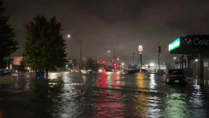
Watch: Intense thunderstorms swamp Lincoln, Nebraska, with flash flooding
Intense thunderstorms swamped Lincoln, Nebraska, on Sep. 30, 2026, triggering flash flooding.
Omaha recorded 4.74 inches of rain Wednesday, a new daily record. Lincoln, Nebraska, recorded 6.15 inches of rain, shattering a daily record that had stood since 1910.
The Cedar Falls, Iowa, Public Safety Department said there was significant flooding across the city, with reports of manhole covers lifted out of position by rising floodwaters.
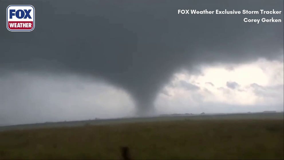
A tornado rips across Kansas as severe weather targets the Central Plains
A large tornado forms in Kansas as the region braces for a night of severe weather. The Central Plains could see more tornadoes, along with heavy rain, thunderstorms and hail.
At least two confirmed tornadoes touched down in Kansas on Wednesday evening as severe thunderstorms swept across the region.
FOX Weather Storm Tracker Corey Gerken captured video of a twister ripping across Pawnee County.
![Flash flooding in Lincoln, Nebraska, on Oct. 1, 2206.]() Image 1 of 7
Flash flooding in Lincoln, Nebraska, on Oct. 1, 2206. (@James_LNK/X)
![Nebraska driver narrowly avoids jackknifing semitruck on I-80 in Omaha amid pouring rain on Sep. 30, 2026.]() Image 2 of 7
Nebraska driver narrowly avoids jackknifing semitruck on I-80 in Omaha amid pouring rain on Sep. 30, 2026. (Tyler Kraus via Storyful)
![Flash floods damage property in Lincoln, New Mexico, on Sep. 29, 2026.]() Image 3 of 7
Flash floods damage property in Lincoln, New Mexico, on Sep. 29, 2026. (FOX Weather Exclusive Storm Tracker Mark Sudduth)
![Flash floods damage property in Lincoln, New Mexico, on Sep. 29, 2026.]() Image 4 of 7
Flash floods damage property in Lincoln, New Mexico, on Sep. 29, 2026. (FOX Weather Exclusive Storm Tracker Mark Sudduth)
![Heavy rain along Rio Ruidoso, New Mexico, on Sep. 29, 2026.]() Image 5 of 7
Heavy rain along Rio Ruidoso, New Mexico, on Sep. 29, 2026. (FOX Weather Exclusive Storm Tracker Mark Sudduth)
![Flooding in Crownpoint, New Mexico, on Sep. 28, 2026.]() Image 6 of 7
Flooding in Crownpoint, New Mexico, on Sep. 28, 2026. (Navajo Police Department/Facebook)
![Flooding in Laughlin, Nevada, on Sep. 28, 2026.]() Image 7 of 7
Flooding in Laughlin, Nevada, on Sep. 28, 2026. (Rock Doctor Adventures via Storyful)

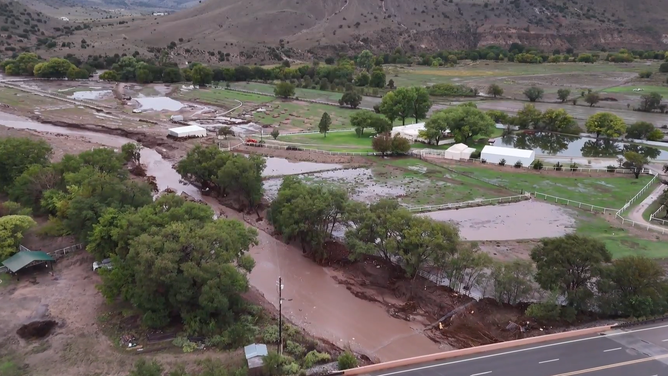
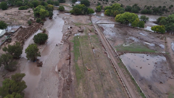
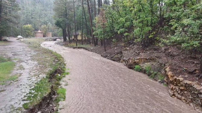
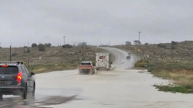
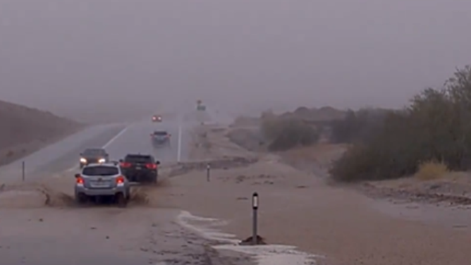
There was widespread flooding across New Mexico Tuesday, including a Flash Flood Emergency in the Hatch Valley in the southern part of the state as the remnants of Polo first crossed into the U.S.