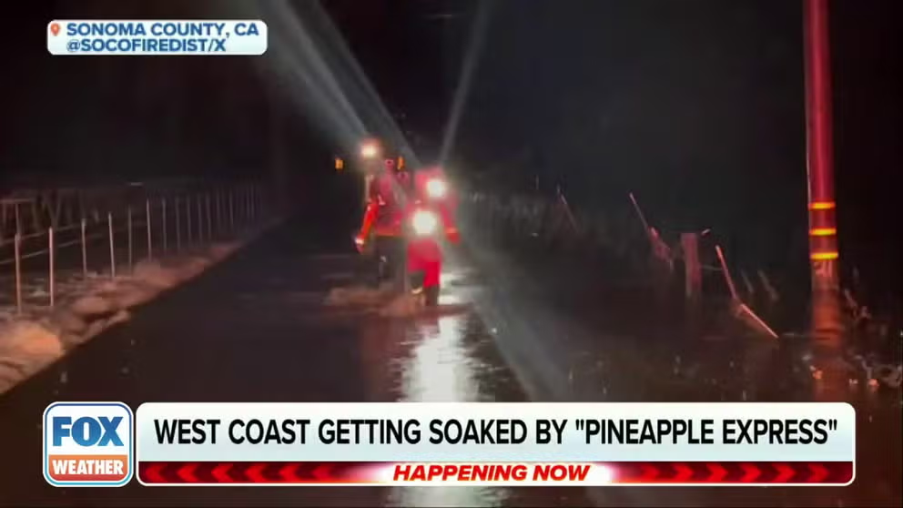
Pineapple Express temporarily winds down along West Coast with renewed threat by end of weekend
The areas affected by last Monday's damaging floods, particularly those in the San Diego metropolitan area, are especially vulnerable from additional rainfall.
Atmospheric river event sends heavy rainfall into California
California is bracing for more flooding from an uptick in precipitation chances over the upcoming weekend.
LOS ANGELES – A slug of heavy rainfall from a potent atmospheric river event that plagued California this week brought a variety of impacts, including flash flooding, damaging winds, power outages and landslides.
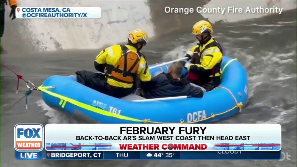
Man rescued from swollen waterway in Southern California
Rescue crews saved a man from a waterway that was swollen from heavy rain in Costa Mesa, California.
The storm system was known as a "Pineapple Express" due to it bringing moisture from the tropical Pacific near Hawaii. This weather pattern can carry up to 27 times more water than the Mississippi River, and usually features several inches of rain.

(FOX Weather)
After drenching Northern California with as much as 8 inches of rain, setting multiple daily rainfall records, the storm focused its energy on Southern California and the Los Angeles areas Thursday, leading to traffic issues from flooded roads.
Various points of the Pacific Coast Highway were closed in Southern California due to flooding, including stretches in Huntington Beach, Santa Monica and part of US 101 was covered in floodwaters in Ventura.
In Orange County's Costa Mesa, swift water rescue teams were called to save a man who became trapped in a storm channel filled with raging water. Teams used an inflatable boat to reach the man and pull him to safety. He was taken to a local hospital to be checked out.
The lowlands around Los Angeles and San Diego neared 3 inches of rainfall while the mountains and surrounding hills may see 2-5 inches. Los Angeles' LAX Airport crossed the 2-inch mark in rainfall in just 5 hours Thursday morning, eventually reaching a daily record of 2.49 inches. Flash Flood Warnings were posted for Long Beach Thursday morning where 2.45 inches fell at the airport.
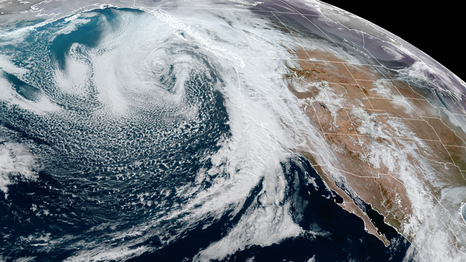
GOES-18 satellite image of the massive storm heading into the West Coast taken the afternoon of Jan. 31, 2024
(CIRA / RAAM-B / NOAA)
Especially vulnerable were those across the San Diego metro area, which was recently impacted by the damaging flooding last Monday.
The City of San Diego issued evacuation notices for the same neighborhoods that saw flash flooding last week.
LANDSLIDE THREAT HALTS TRAIN SERVICE BETWEEN LOS ANGELES AND SAN DIEGO
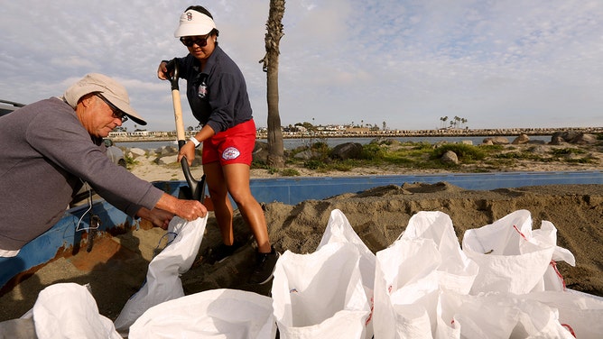
Lee Meister, 66, left, helps Long Beach lifeguard Molica Anderson, 37, fill up sandbags available for residents to prep for any possible flooding from the upcoming storm at 72nd Place Lifeguard Station in Long Beach on January 31, 2024.
(Genaro Molina/Los Angeles Times / Getty Images)
Strong winds were also a factor with peak gusts around 40-45 mph in the Los Angeles area, and gusts of 55 mph or higher in the mountains. A few of the higher mountain peaks reported gusts in the 60-70 mph range.
Under the influence of the upper low, the atmosphere will become marginally unstable on Friday, and the widespread rain will be replaced with scattered showers and even a few thunderstorms, the FOX Forecast Center said.
Heavy rains, wind spread across California
Meanwhile, Northern California will shift from steady rains to scattered showers as the storm moves south. Rain totals reached 4-8 inches along the Northern California Mountains.
The National Weather Service (NWS) also issued Flood Advisories for much of the San Francisco area due to urban and small-stream flooding.

(FOX Weather)
Since Wednesday, 40 storm reports of flooding around the San Francisco Bay Area have occurred. Downtown San Francisco set a daily rainfall record with 1.67 inches on Wednesday, while Santa Rosa shattered their daily record with 2.42 inches of rain, besting the old mark of 0.87 inches set in 2008.
As a result of heavy rains, the city temporarily suspended all cable car services late Wednesday, but service has since resumed. Several roads in the city were blocked due to flooding on Wednesday night. In Santa Rosa, firefighters responded to several weather-related traffic collisions.
Gusts reached nearly 100 mph along some elevated locations across Northern California. In Point Reyes on the coast, a 66 mph wind gust was reported.

Here's a look at the top wind reports along the West Coast the past 24 hours.
A pilot of a Boeing 757 flying just east of San Francisco at 35,000 feet Wednesday night reported a very bumpy ride with constant turbulence. "In a boxing match and losing," the pilot noted on a weather report to air traffic controllers.
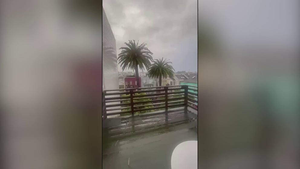
Atmospheric river brings strong winds, rain to San Francisco
An atmospheric river-fuelled storm brought rain and strong winds to San Francisco, California, on Wednesday, January 31.
In Saratoga, a child was injured when a tree fell during high winds. Fortunately, the child sustained only minor injuries, according to firefighters. The accident could have been much worse.
WOMAN SURVIVES ON HER OVERTURNED CAR FOR 15 HOURS IN CALIFORNIA FLOOD
Feet of snow forecast for the Sierra Nevada
Heavy snow began Wednesday in the Sierra, snarling travel as snow-covered roads and reduced visibility at times, with possible chain controls and road closures.
Snow may fall up to 2 inches per hour. Up to 4 feet of snow will fall at the highest elevations, and snow could accumulate down to 3,500 feet, the FOX Forecast Center said. This will help a meager snowpack which sits at just 50% of the average, but it won't fully erase the snow deficit.
Winter Storm Warnings remain in effect for the Sierra Nevada though Saturday morning.

(FOX Weather)
Snow will also be a factor in the mountains of southern California. The cold nature of the system will allow snow levels to drop below 4,000 feet, the FOX Forecast Center adds. Those traveling along I-5 through the Grapevine region will need to take it slowly as snow levels will drop below 4,000 feet.
At the coast, large powerful waves are expected to batter the coast from Oregon down through Southern California. High Surf Advisories are in effect for large waves, which could tear up popular beaches.
The National Weather Service (NWS) said surf heights for the Southern Oregon Coast through the San Francisco Coast will range from 22-26 feet. Los Angeles beaches are forecast to have 8-12 feet surf, and San Diego beaches will have 10 feet surf.
Second storm for Southern California has potential for greater flooding impacts
However, the stormy pattern won't end there. Another possibly more impactful storm is forecast to slam into Southern California starting late over the weekend.
CALIFORNIA’S ‘ARKSTORM’: HISTORIC 1000-YEAR FLOODS OF 1861-62 FEATURED 8 WEEKS OF ATMOSPHERIC RIVERS
"(This storm) has a growing potential for damaging flooding and is the one of most concern (this week)," the NWS in Los Angeles wrote.
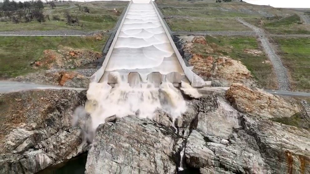
Planned release of water in California from the Orville Dam
Authorities released millions of gallons of water from the Orville Dam on Wednesday ahead of the atmospheric river.
The FOX Forecast Center said initial forecasts show this slow-moving storm has the potential to bring several days of heavy rains to the region. More widespread flooding and even heavier mountain snow are becoming increasingly likely.
