Tropical disturbance 91L in Gulf of Mexico likely to develop as flood threat grows in Texas, Louisiana
The National Hurricane Center is giving Invest 91L a high chance of developing into a tropical depression or tropical storm in the next two days.
National Hurricane Center upgrades Invest 91-L to Potential Tropical Cyclone One
FOX Weather is tracking Potential Tropical Cyclone One in the Gulf of Mexico. Meteorologist Ian Oliver has the forecast and explains how much rain we could be in for.
As of 5:00 p.m. Invest 91-L has organized and strengthened into Potential Tropical Cyclone One. Continuous coverage of Potential Tropical cyclone One has moved here.
HOUSTON – The National Hurricane Center (NHC) says a tropical disturbance it has been monitoring in the southwestern Gulf of Mexico has now officially been designated Invest 91L and has a high chance of developing into a tropical depression or tropical storm in the coming days.
An "invest" is a naming convention used by the NHC to identify areas it is investigating for possible tropical development within the next week.
But regardless of development, the flood threat is increasing along the Gulf Coast due to the copious amounts of tropical moisture expected to be pulled north into areas of Texas and Louisiana.
2024 ATLANTIC HURRICANE SEASON GUIDE

(FOX Weather)
The NHC said that satellite and surface observations indicate a broad area of low pressure located in the southwestern Gulf of Mexico that has winds between 35-40 mph in an area well to the northeast of the center.
"Environmental conditions appear conducive for additional gradual development, and a tropical depression or tropical storm is likely to form by midweek while it moves slowly westward or west-northwestward toward the western Gulf Coast," the NHC said.
The NHC is giving Invest 91L a high chance of developing in the next two days.
NEW FORECAST CONE TO BE TESTED BY NATIONAL HURRICANE CENTER DURING 2024 SEASON
Gulf Coast braces for flooding regardless of development

(FOX Weather)
NOAA’s Weather Prediction Center (WPC) expects the threat of flooding along the Gulf Coast through most of the week, with higher chances being found on Tuesday and Wednesday.
In fact, the WPC has placed areas along the Gulf Coast, including Houston, in a Level 3 out of 4 flood threat on Tuesday and Wednesday.
WHERE TROPICAL STORMS AND HURRICANES TYPICALLY OCCUR DURING EACH MONTH OF ATLANTIC HURRICANE SEASON

(FOX Weather)
"The main concern here with the flow, and it’s going to be Texas from Brownsville to Corpus Christi, perhaps to Houston, perhaps as far as Louisiana," FOX Weather Meteorologist Craig Herrera said.
Windy conditions could also add to the flood threat.
"With the wind coming in from the south or southeast, that could also mean not only a lot of rain, but also some big surf as well," Herrera continued. "And this is one that when you look, we have to question still just how far inland does it go?"
Computer forecast models show widespread rain totals of 5-8 inches along the Texas Gulf Coast from Brownsville to the Texas-Louisiana border, but locally higher amounts up to 8 or 12 inches aren’t out of the question.
Farther inland, rainfall totals of 3-5 inches are likely.
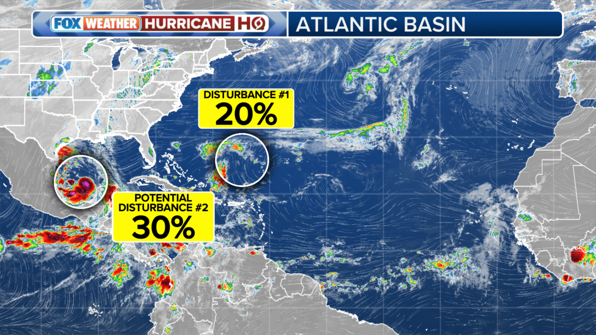
Competing with tropical disturbance in southwestern Atlantic to become ‘Alberto’
The NHC is also watching the southwestern Atlantic near the Bahamas for tropical development. This disturbance is expected to dump heavy rain along parts of the Southeast coast later this week.
If the systems in the Gulf and southwestern Atlantic were both to develop into tropical storms, the first one to attain 40-mph winds would receive the name Alberto and the second one would be named Beryl.

(FOX Weather)
On average, the first named storm of the Atlantic hurricane season forms around June 20, so we would be right on track with the average if Alberto were to develop later this week.
