Dangerous blast of arctic air to invade US during first weeks of January
The arctic outbreak will begin on Wednesday. The main push of dangerously cold air looks to move in during the January 6-14 timeframe, the FOX Forecast Center said.
Dangerous blast of frigid air to send temps plummeting across eastern half of US next week
The FOX Forecast Center is tracking a significant arctic outbreak that will send temperatures plummeting across the eastern half of the nation next week. By far the coldest air of the season so far, this blast of frigid temperatures will be widespread, extending all the way through the Deep South and into Florida and South Texas.
Winter's grip will return to half of the U.S. this week as a rush of arctic air descends, plunging temperatures from well above average to nearly 30 degrees below average for some.
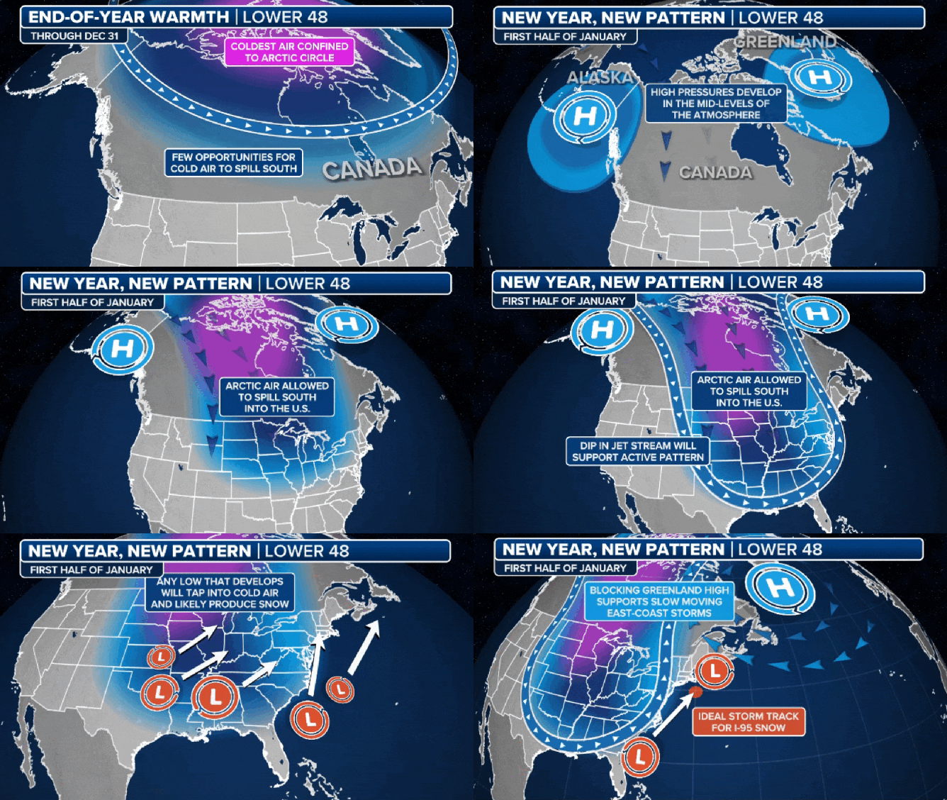
Two areas of high pressure are responsible for this pattern change, driving the bitter cold south from Canada and into the eastern half of the U.S. This setup will sink temperatures nearly everywhere east of the Rocky Mountains and increase snow chances in the Northeast and Great Lakes.

Rounds of arctic air to invade the U.S. for long-lasting cold.
(FOX Weather)
"We're talking about a big, big cool down, to say the least, especially for places up and down the East Coast as we head into really the first few weeks of January," FOX Weather Meteorologist Kendall Smith said.
The arctic outbreak will begin on Wednesday. The main push of dangerously cold air looks to move in during the January 6-14 timeframe, the FOX Forecast Center said.
The biggest changes will be in the northern Plains and eastern U.S., where high temperatures by midweek will be between 20-30 degrees below what they were on Monday.
After the first round of cold, two more rounds of arctic air will dive from Canada, setting up parts of the U.S. for a long-lasting arctic outbreak of freezing temperatures.
The chill will take hold in the Deep South by next week, plunging temperatures across Texas and the Gulf Coast states with lows in the upper 20s.
North Florida could see temperatures around freezing with overnight lows for Jacksonville and Tallahassee hovering around 30 degrees.
For the north, this change in weather pattern brings the first ingredient needed for snow. Any low-pressure system that develops and taps into this cold air is likely to produce snow.
"The next piece to this complicated puzzle is how stormy it is. Do we have a pattern that allows for several storms, possibly winter storms, to set up for the east and that includes the Mississippi River Valley? And the answer is, yeah, it does look like we could have a storm," FOX Weather Meteorologist Stephen Morgan said.
GREAT LAKES COMMUNITIES PREPARE TO BE BLASTED BY LAKE-EFFECT SNOW AS US RINGS IN 2025
The National Weather Service in Buffalo is tracking yet another prolonged lake-effect snow event beginning Wednesday, possibly through this weekend.
Western and northern New York could see anywhere from 3 inches to 3 feet of snow through Sunday.

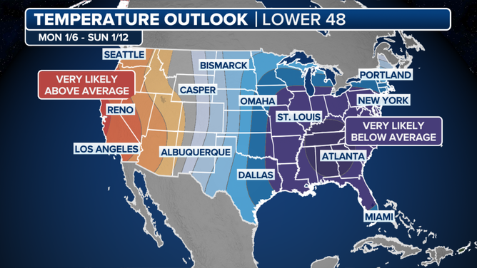
Temperature outlook for the second week of January.
(FOX Weather)


