Seattle smashes record high by 16 degrees amid historic autumn heat event
For further perspective, the historic summer heat wave of June 2021, which saw Seattle reach an all-time record high of 108 degrees, was 17 degrees above its daily record high.
Heat, dry conditions persist in Pacific Northwest through rest of the week
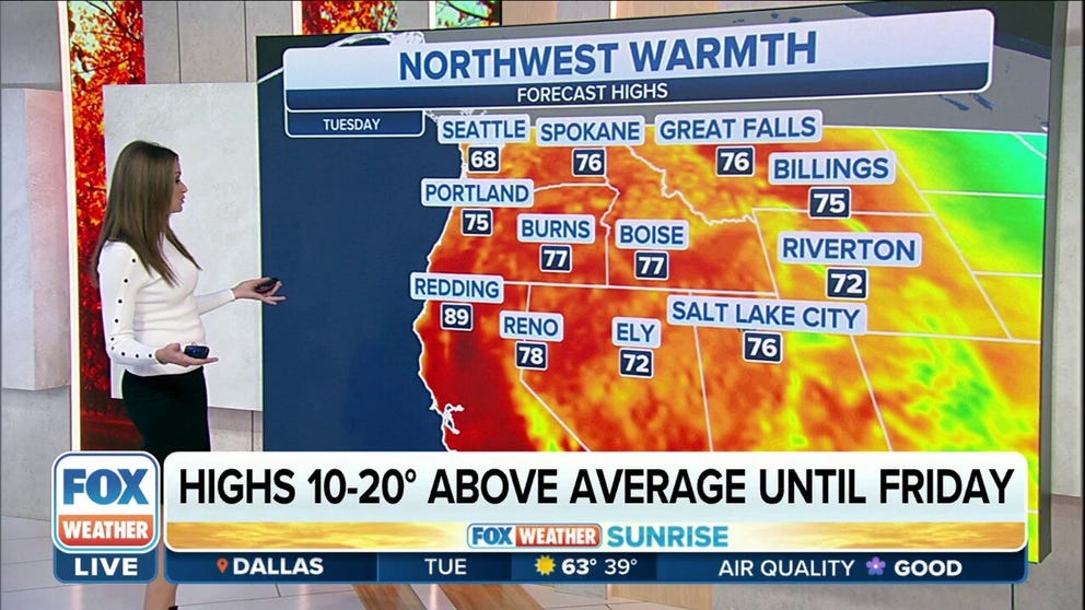
The heat will continue for most of the week. While not as hot as this past weekend, highs will remain 10-20 degrees above average through Friday with no chances for rain.
SEATTLE – Halloween is just two weeks away, but those in Seattle were sweating as if it were time to light off Fourth of July fireworks over the weekend amid a historic heat event that left the temperature record books in tatters.
A super-heated atmosphere from a strong ridge of high pressure combined Sunday with gusty offshore winds from the east that heated the air even further, baking the Puget Sound region like never before in mid-October.
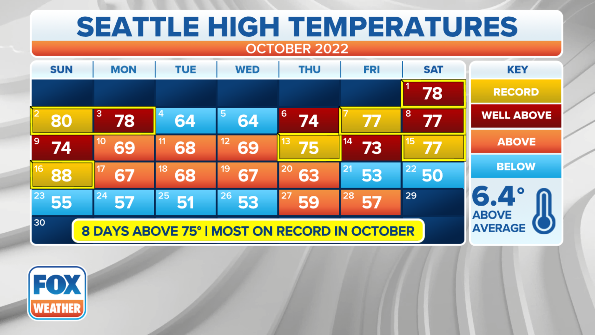
The Emerald City reached a sweltering 88 degrees on Sunday, obliterating the previous record high for Oct. 16 by an eye-popping 16 degrees. (Old record: 72 degrees set in 2018). That means in the 77 years of records at Sea-Tac Airport, no other Oct. 16 has come within 16 degrees of Sunday's high.

(FOX Weather)
The mid-October average high temperature in Seattle is 60 degrees.
For further perspective, the historic summer heat wave of June 2021, which saw Seattle reach an all-time record high of 108 degrees, was 17 degrees above its daily record high.
Some of the other records set by the unusual mid-autumn heat:
- It was Seattle's second-hottest October day on record, with only an 89-degree reading on Oct. 1, 1987, topping the chart. Of course, Sunday's heat came more than two weeks closer to winter.
- It was the latest 80- and 85-plus-degree days in Seattle. Previous records were Oct. 14 and Oct. 1, respectively.
- Sunday marked the first time Seattle had two days reach 80 degrees in the same October.
- The 88 degrees reached Sunday was hotter than any date reached in Seattle in 2011 – even in the summer.
- Eight days over 75 degrees in October extend the previous record of five.
- It's the warmest start to October by more than 3 degrees above average.
Add on top of that the unhealthy air quality as those east winds not only carried heat, but smoke from numerous wildfires burning in the Washington Cascades and eastern Washington, which made for a very smoky, unpleasantly warm day.

A smoky sunset over the Puget Sound as a Washington State ferry makes its way to Seattle.
(Sigma Sreedharan Photography)
Portland continued to bake too…
It was hot again down in Portland, Oregon – though for a change, not quite as hot as its northern neighbors. Portland reached 86 degrees Sunday, breaking its daily record of 80 degrees.

(FOX Weather)
While the Rose City didn't smash its heat records as much as Seattle, it is still rewriting the books as well. Sunday marked the 12th day in October with a high of 80 or warmer, doubling the previous record of six days, set three times prior.

(FOX Weather)
The average high in Portland through Sunday was 81.3 degrees – a full 4 degrees above its hottest start to October and about on par with what temperatures it will usually find in the first week of July.
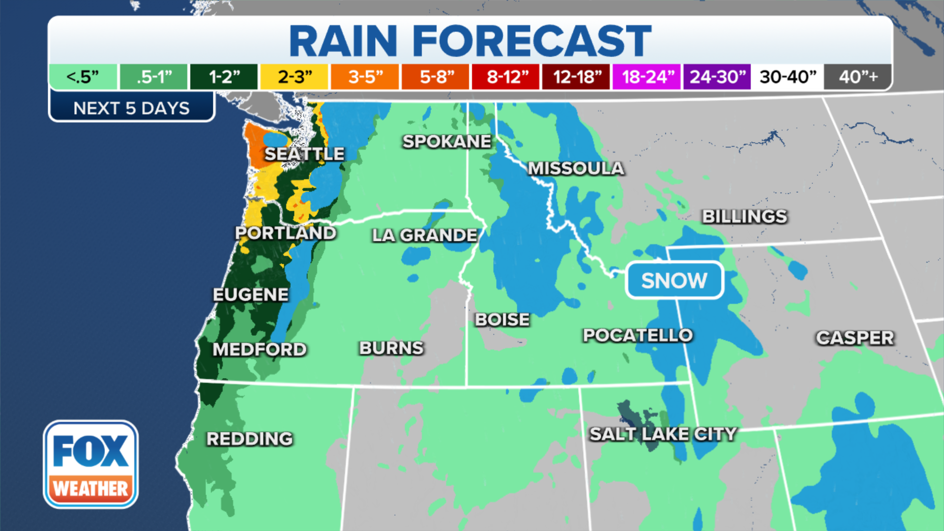
A shift to cooler ocean breezes has ended the record heat for the workweek, with the region's first significant rainfall in several months forecast for the end of the week to finally usher in autumn.

(FOX Weather)
Midwest goes straight to winter
On the other side of the coin, you've got an early winter preview in parts of the Midwest, South and East this week.
This early-season cold snap will provide the lowest temperatures since April in many areas, with more than 180 million people estimated to see temperatures of at least 10 degrees below average on Tuesday and Wednesday and 70 million under freeze alerts.

(FOX Weather)
FREEZE ALERTS ISSUES FOR MORE THAN 70 MILLION AMERICANS
Near the Great Lakes, there is even a chance of snow. The cold temperatures in combination with gusty winds over the relatively warmer Great Lakes will establish a pattern for lake-enhanced snow and rain showers from the Great Lakes to parts of the Northeast through midweek.
Cities such as Chicago, Milwaukee, Pittsburgh, Cleveland and Columbus in Ohio and Syracuse in New York will all have the potential for rain that could mix with a bit of wet snow, though little or no accumulation is expected due to warm ground temperatures and air temperatures hovering above freezing.
