Large hail, damaging winds eye Southern Plains on Sunday
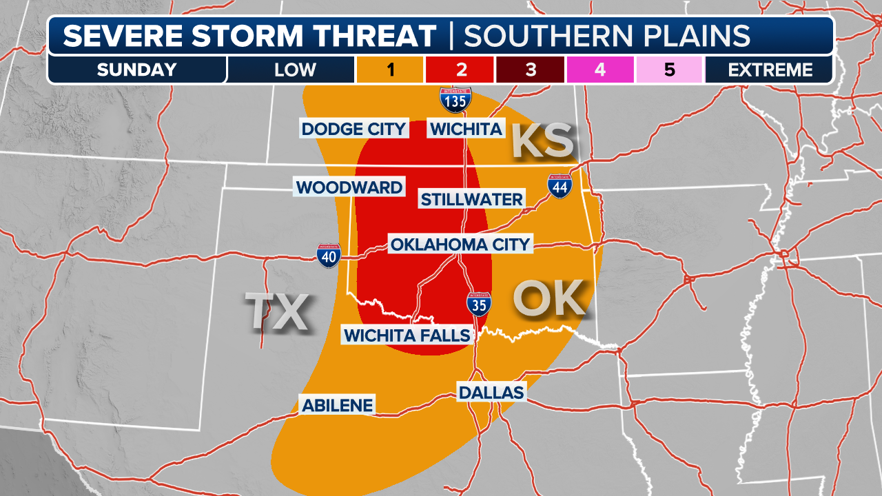
Areas from Central Texas into southern Oklahoma have the greatest threat of large hail on Sunday. NOAA's Storm Prediction Center has highlighted a hatched area for a significant hail threat in Central and Northeast Texas for hail larger than 2 inches.
Severe storm threat to unfold across Southern Plains on Sunday
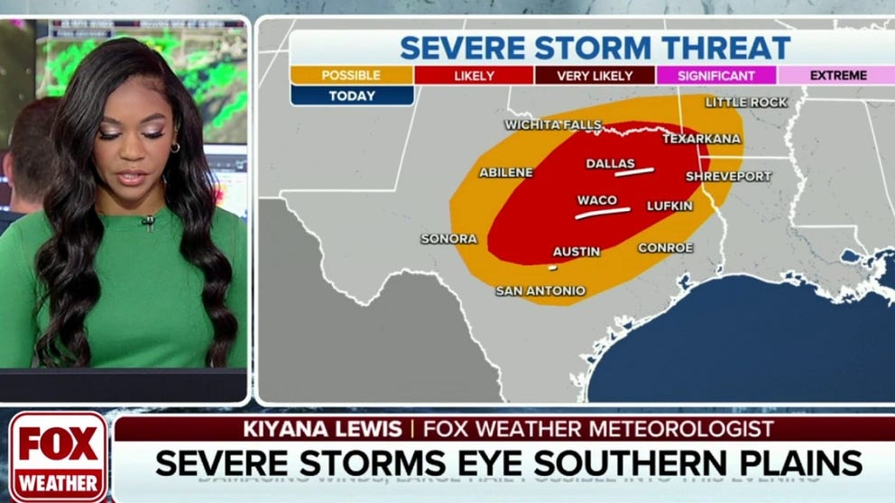
Areas in Little Rock and Dallas will face a likely severe weather threat on Sunday. Damaging winds, large hail and flash flooding are possible across the Ark-La-Tex Region.
DALLAS – Millions of Americans across the southern Plains face the threat of severe thunderstorms with damaging wind and hail through Sunday evening as a multiday severe weather threat continues.
Sunday’s round of severe weather could be a repeat of Saturday’s storms, during which areas of Oklahoma saw tea-cup-sized hail and the National Weather Service received hundreds of storm damage reports.
Thunderstorms will develop throughout Sunday and into the evening.

(FOX Weather)
NOAA's Storm Prediction Center's (SPC) severe weather forecast for Sunday placed parts of four states within a Level 2 out of 5 risk, from southern Oklahoma and the Ark-La-Tex region into Central Texas. Cities including Dallas, Austin, Fort Worth, Arlington and Plano in Texas are under the Level 2 out of 5 risk, according to the SPC.
The NWS issued Severe Thunderstorm Watches for parts of Texas through Sunday evening.
THE 5-POINT SEVERE THUNDERSTORM RISK CATEGORY SCALE EXPLAINED

(FOX Weather)
Once again, large hail and damaging wind gusts are the primary concerns.
Video shows hail raining down during thunderstorms on Saturday in Henryetta, Oklahoma. A half-dollar to golf-ball size hail threat returns for day two on Sunday.
Hail rains down in central Oklahoma
Video shows hail inundating the streets in Henryetta, Oklahoma on Saturday afternoon during a severe thunderstorm.
Areas from Central Texas into southern Oklahoma have the greatest threat of large hail on Sunday. The SPC has highlighted a hatched area for a significant hail threat in Central and Northeast Texas for hail larger than 2 inches.

(FOX Weather)
Cities with the warmest daytime temperatures are more likely to see strong to severe storms into the evening.
"When we take a look at who's going to likely see the start or initiation of this, it's going to be areas like Dallas, where we have the warm temperatures to start off during the day," FOX Weather meteorologist Kiyana Lewis said. "They actually act as a trigger point for those storms later in the day."
Meanwhile, areas from Austin to Texarkana and Shreveport, Louisiana, face a damaging-wind threat. Wind gusts between 60 and 70 mph are possible across southeast Oklahoma.

(FOX Weather)
Communities in the Plains that have already received heavy rainfall, including Oklahoma and Arkansas, are oversaturated with water, and flash flooding will be a concern on Sunday.
Rainfall had already started Sunday as the National Weather Service issued Flood Advisories for portions of southwestern Arkansas and southeastern Oklahoma through Sunday morning.
After the heavy rainfall ended Sunday morning, between 3 and 7 inches had already fallen, and flooding is forecast to continue, according to the NWS.

(FOX Weather)
With more rainfall incoming, the flooding threat will remain through Monday morning.
Heading into the workweek, more rounds of severe storms will persist across Texas and western Louisiana. The FOX Forecast Center is tracking a possible severe weather threat spanning from Fort Stockton, Texas, eastward to Lake Charles, Louisiana.

(FOX Weather)

