2 hurt from large tornadoes rolling through Nebraska as week of severe storms drags on
The Storm Prediction Center received initial reports of more than 3 dozen tornadoes on Friday from Nebraska and Kansas, leaving at least two injured and one tornado with an EF-1 rating.
Tornado touches down in Spalding, Nebraska
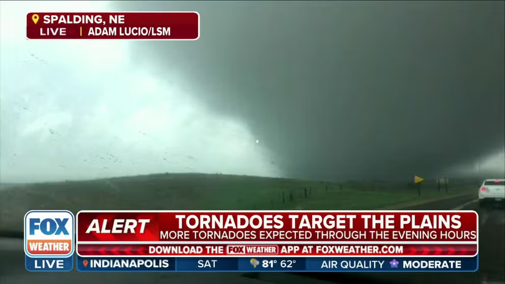
Storm Tracker Adam Lucio captures a confirmed tornado rolling through Spalding, Nebraska on Friday.
It's been more than a week with notable severe weather across the U.S., and Friday was no different, with large tornadoes ripping across Nebraska.
Storm tracker Adam Lucio captured video of a large wedge tornado moving through open fields and farmland near Spalding, Nebraska, on Friday afternoon.
Storm tracker gets up close to tornado in Spalding, NE
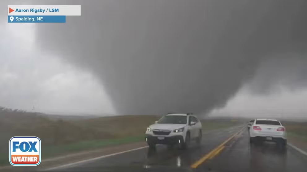
Storm tracker Aaron Rigsby gets in close range to a wedge tornado in Spalding, Nebraska on Friday. (Credit: Aaron Rigsby / LSM)
An NWS storm survey team later found the twister was on the ground for about 13 miles of rural terrain between 2:25 and 2:42 p.m., causing sporadic damage to trees, power lines and cars.
Meteorologists estimated the tornado's peak wind speeds at 105 mph, giving the twister an EF-1 rating on the Enhanced Fujita Scale.
Lucio estimated the tornado was at least a quarter-mile wide and was tracked by several storm chasers.
2 hurt as tornado damages homes near Lyon, Nebraska
Another tornado is believed to have also struck cattle lands northwest of Omaha, where storm spotters said a commercial cattle facility sustained damage and several hundred cows were on the loose in Dodge County, Nebraska.
Near Lyon, two people were injured when tornadoes caused widespread damage to homes, with one home shifted off its foundation, according to the NWS.
Another large tornado was also detected by radar and tracked by storm spotters near North Bend, Nebraska.
There were 50 Tornado Warnings issued in the Cornhusker State on Friday – the most Tornado Warnings in a single day in Nebraska since at least 1998, according to Daryl Herzmann with Iowa State University's Iowa Environmental Mesonet.
Power outages were isolated to only rural communities.
THIS IS THE LIFE CYCLE OF A TORNADO
Severe weather threat shifts to south Texas on Saturday
On Saturday, the severe threat will shift to south Texas with a secondary region along a warm front across Iowa.
A few severe storms are forecast to develop across parts of Iowa, including Des Moines, gradually diminishing in coverage southeastward toward the lower Ohio Valley.
Again, damaging wind gusts, large hail and a couple of tornadoes are possible across those areas, though the risk is less than during Friday's storms.
Communities around Des Moines, Iowa and in South Texas have the greatest likelihood of seeing severe storms.

(FOX Weather)

