Central US remains in severe weather crosshairs early this week
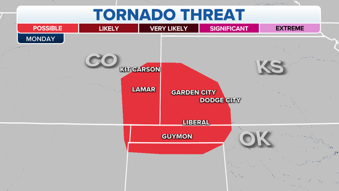
The chance for tornadoes lessens as we start the work week but the Southern Plains won't be able to shake the severe storms.
Severe weather threat extends into Monday across the Plains
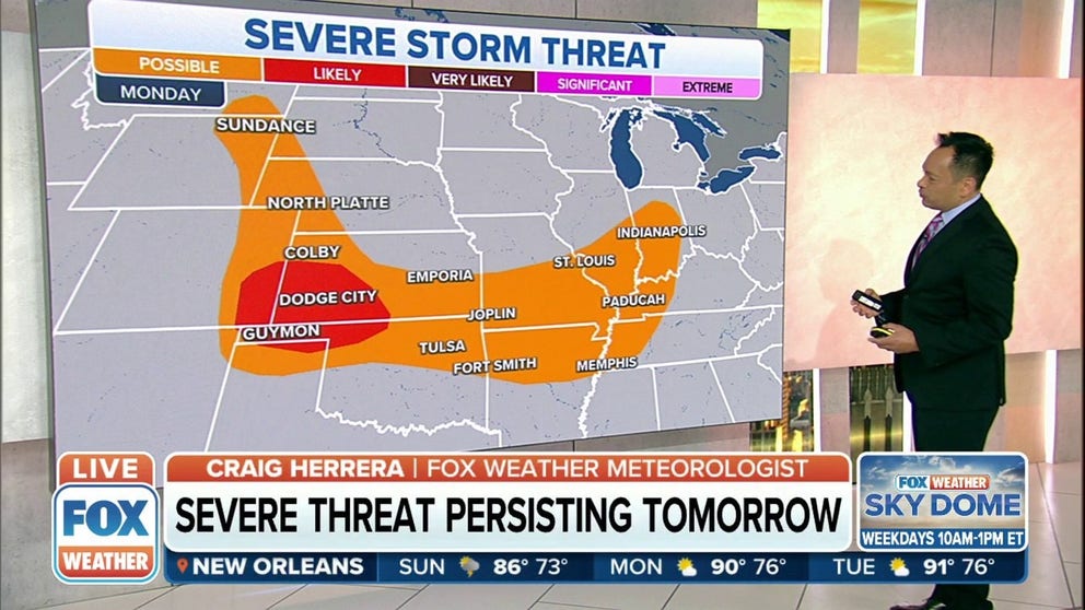
More severe weather is possible from the Rockies to the Ohio and Tennessee Valleys on Monday.
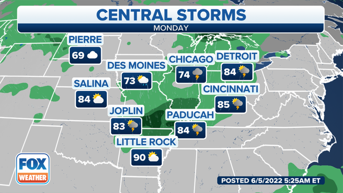
Unsettled weather is expected across the central part of the country that could produce severe weather on Monday.
The threat of severe weather extends from the Southern Plains into the Northern Plains, with some areas of the Midwest also seeing the chance for strong to severe thunderstorms as well.
(FOX Weather)
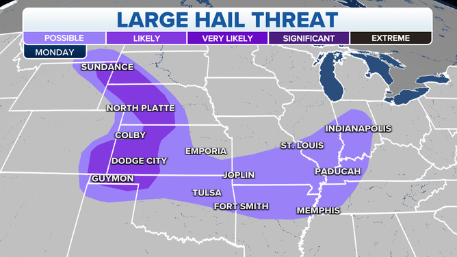
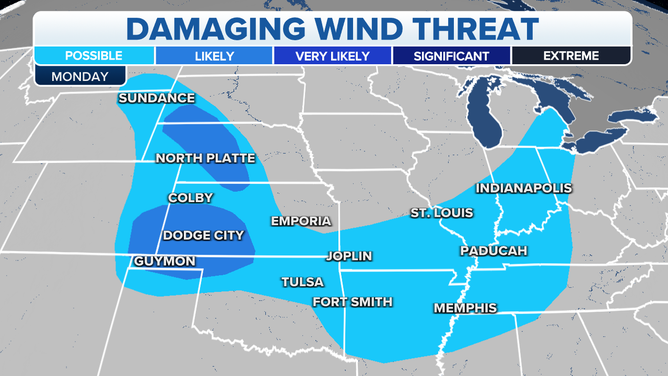
The main threats will be damaging winds and large hail, but a tornado is also possible where stronger storms develop.
THIS IS HOW MANY TORNADOES EVERY STATE RECORDS IN AN AVERAGE YEAR
Here is a day-by-day outlook of what to expect over the next few days from these rounds of storms.
HOW TO WATCH FOX WEATHER ON TV

(FOX Weather)
HERE'S WHERE TORNADOES ARE MOST LIKELY TO OCCUR IN EACH MONTH
Monday
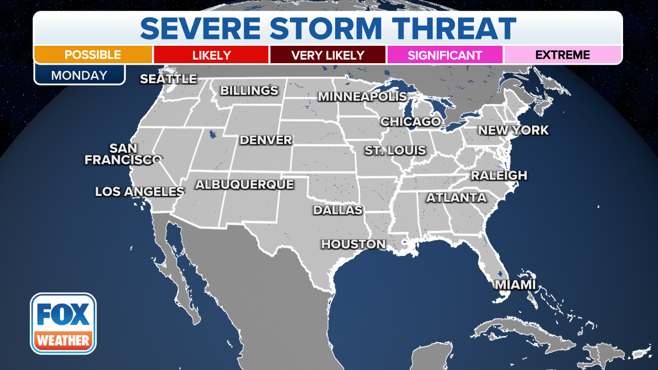
There is a slight risk of strong to severe thunderstorms on Monday from parts of the central High Plains into the Ozarks and northern Oklahoma.
(FOX Weather)
Damaging wind gusts and hail are the main hazards expected with this activity, the SPC said.
CLICK HERE TO GET THE FOX WEATHER UPDATE PODCAST
Flash flood threat
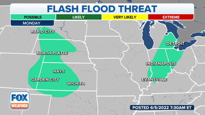
In addition to the severe storms, areas of locally heavy rain are also expected in parts of the Plains into early next week.
7 FACTS YOU SHOULD KNOW ABOUT FLASH FLOODS
Tuesday
There's still some lingering uncertainty regarding where the heaviest rainfall will set up, but confidence is increasing that some spots could pick up at least a few inches of rain. Flash flooding might become a concern in some locations.
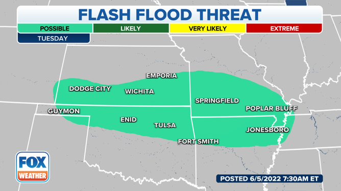
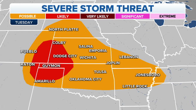
The threat of severe weather continues Tuesday adan is likely across the Southern Plains. The biggest danger will be large hail, flooding rain and powerful winds.
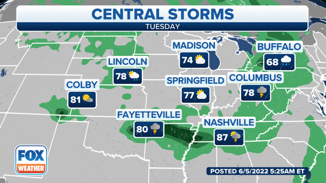
Temperatures cool across the Ohio Valley into Tuesday.
Be sure to download the FOX Weather app for the latest forecast and weather alerts for your exact location, plus the 24/7 livestream of America's Weather Team.
