Tornado Watches in Plains, Midwest cover nearly 8 million Americans
Large to giant hail, wind gusts between 60-80 mph and tornadoes are probable, including the possibility of some intense, long-track tornadoes
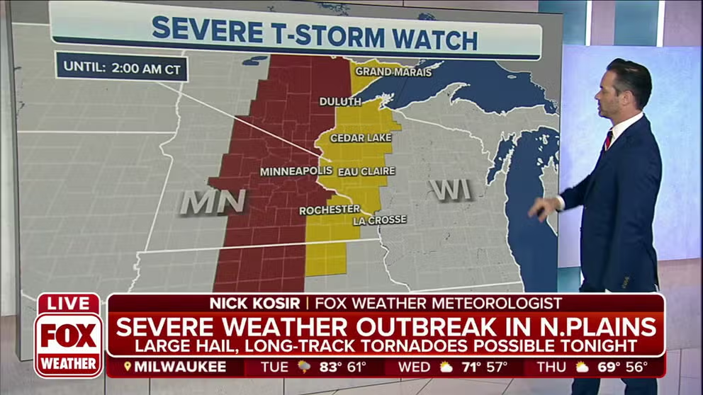
Severe Thunderstorm Watch Issued for Minnesota, Wisconsin
A new severe thunderstorm watch has been issued for Eastern Minnesota and Western Wisconsin
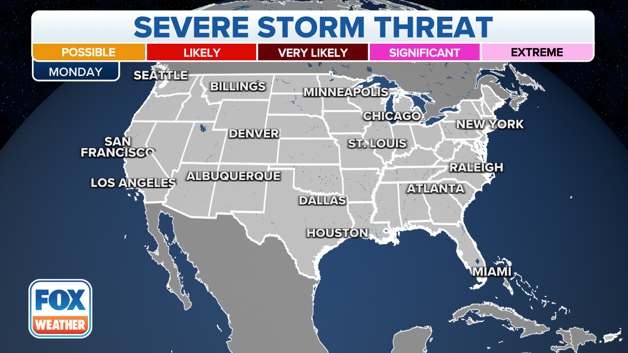
A severe weather outbreak is unfolding Monday across the Northern Plains and Upper Midwest, putting millions of Americans at risk on Memorial Day.
The Storm Prediction Center said storms that develop in the region could produce large to giant hail, wind gusts between 60-80 mph and tornadoes are probable, including the possibility of some intense, long-track tornadoes.
HOW TO WATCH FOX WEATHER ON TV
(FOX Weather)
While severe weather is possible from the Central Plains and upper Mississippi Valley north to the Northern Plains and Upper Midwest, the most significant risk will be located from the Dakotas to central and northern Minnesota.
Cities under the significant risk of severe weather on Memorial Day include Fargo and West Fargo in North Dakota, Moorhead in Minnesota and Watertown and Brookings in South Dakota.
Severe thunderstorms also appear very likely to occur in places like Sioux Falls and Aberdeen in South Dakota, Grand Forks in North Dakota and St. Cloud and Willmar in Minnesota.
Several other major cities are also expected to see severe weather. Those cities include Omaha and Lincoln in Nebraska and Minneapolis-St. Paul in Minnesota. Wichita, Kansas, is also at risk.
THE 5-POINT SEVERE THUNDERSTORM RISK CATEGORY SCALE EXPLAINED
Active alerts
The Storm Prediction Center has issued the following weather alerts:
- A Tornado Watch flagged as a "particularly dangerous situation" until 10 p.m. Central for central and southwestern Minnesota and extreme northeast South Dakota.
- A Tornado Watch until 1 a.m. Central for central and western Iowa, eastern and south-central Kansas, northwest Missouri and southeast Nebraska.
- A Severe Thunderstorm Watch until 2 a.m. Central for northeast Iowa, southeast Minnesota, western and northwestern Wisconsin and Lake Superior.
The SPC said the primary threats are tornadoes. Some could be intense and long-tracked.
Damaging winds up to 75 mph are also possible, as well as large hail that could be greater than 2.5 inches in diameter.
HERE'S WHAT THE ‘HATCHED AREA’ ON A SEVERE WEATHER MAP MEANS

(FOX Weather)
Tornadoes

(FOX Weather)

(FOX Weather)
Tornadoes are possible on Monday in areas that stretch from the Central Plains and upper Mississippi Valley all the way to the Upper Midwest and Canadian border.
However, there is a significant risk of tornadoes, including some that could be rated EF-2 or stronger, across central and northern Minnesota and eastern North and South Dakota.
Cities under that significant risk include Sioux Falls, South Dakota and Fargo and Grand Forks in North Dakota. St. Cloud and Moorhead in Minnesota are also at the most significant risk for strong tornadoes.
Hail

(FOX Weather)

(FOX Weather)
According to the SPC, large to giant hail is also expected to fall across areas in the Plains and Upper Midwest on Monday.
Cities that could see hail larger than 2 inches include Omaha, Nebraska, Sioux Falls, South Dakota, Fargo, North Dakota and Eden Prairie and St. Cloud in Minnesota.
The significant risk of large hail extends across eastern areas of the Dakotas, central and southern Minnesota, western Iowa and into parts of Nebraska, Kansas and Missouri.
WATCH VS. WARNING: HERE ARE THE DIFFERENCES BETWEEN THESE WEATHER TERMS THAT COULD SAVE YOUR LIFE
Wind

(FOX Weather)

(FOX Weather)
Strong, damaging winds also appear likely across the region, with wind gusts higher than 80 mph not out of the question.
Those winds could bring down trees and power lines and could also possibly cause structural damage to some homes and businesses.
The damaging wind threat exists in areas from the Central Plains and upper Mississippi Valley to the north across the Northern Plains and Upper Midwest.
However, there is a significant risk of strong winds across central and northern Minnesota and eastern parts of the Dakotas.
Cities under that significant risk of damaging winds include Grand Forks and Fargo, North Dakota, and Bemidji, Wadena, St. Cloud, Olivia and Marshall in Minnesota.
Sisseton, Aberdeen, Huron and Watertown, South Dakota, are also included in that threat.
EXPLAINING FLOOD ALERTS ISSUED BY NATIONAL WEATHER SERVICE
Flooding

(FOX Weather)
Flash flooding is also possible in areas where heavier rain and strong thunderstorms pop up.
The risk is the highest across eastern North Dakota and northwestern Minnesota, but flooding is also likely in South Dakota, Nebraska, Iowa, Kansas and Missouri.
Flooding could occur elsewhere across the northern Rockies, the Central and Northern Plains and the upper Mississippi Valley.
CLICK HERE TO GET THE FOX WEATHER UPDATE PODCAST
People who live in these regions should stay updated on the latest weather forecast. Download the FOX Weather app to get the forecast for your area as well as any weather alerts that are issued for your location.
Severe weather possible again on Tuesday
The same storm system that brought a particularly dangerous tornado threat to the Northern Plains will shift Tuesday, bringing a widespread storm line from Texas to Wisconsin.
By Tuesday the threat area shifts from the Texas Panhandle up through Wisconsin. At this time it appears the greatest threat for severe storms will be from the Texas Panhandle into Western Missouri
The strongest of these storms will produce large hail and 60-80 mph wind gusts. A few tornadoes will be possible as well (especially in Wisconsin and the TX Panhandle), although the threat will be lower than that on Monday.

(FOX Weather)