Wicked 90-plus-mph destructive winds expected to pummel Midwest on Thursday then shift to Northeast
Storms will erupt capable of producing hail larger than tennis balls and a few tornadoes. Wide swaths of 75-95 mph winds are also likely as they move across Kansas, Missouri, Iowa and Illinois.
Severe weather targets Northeast on Friday
The severe weather threat shifts from the Midwest to the Northeast on Friday. Meteorologist Steve Bender times out the storms.
CHICAGO – A powerful and potentially destructive storm system is expected to blast across the Midwest on Thursday, posing a significant risk of severe weather. The severe threat shifts to the Northeast for Friday.
The FOX Forecast Center said a quiet morning will lead to a very busy afternoon as a cold front begins to clash with 90-degree temperatures. Cities such as Chicago and Kansas City are in the threat area.

(FOX Weather)
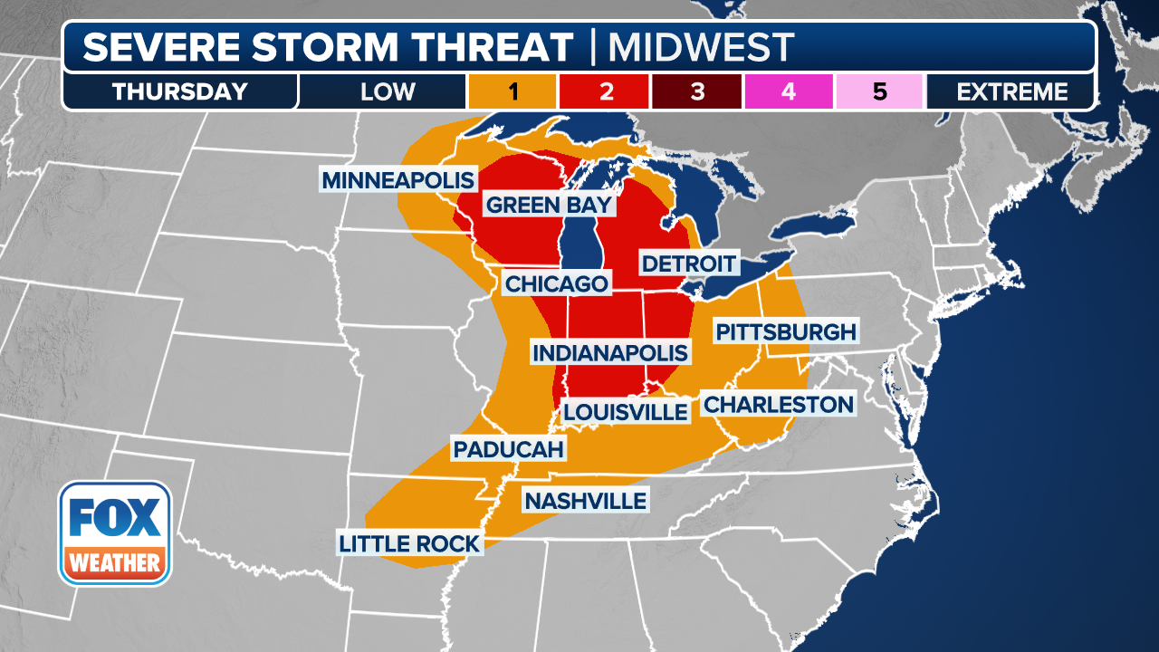
The National Weather Service's Storm Prediction Center has issued a Level 3 out of 5 on the severe storm risk scale impacting more than 3.5 million people in cities including Kansas City and Independence in Missouri and Peoria in Illinois.

(FOX Weather)
Storms will erupt during the early parts of the afternoon, with the initial storms capable of producing hail larger than tennis balls and a few tornadoes. They are then expected to congeal into lines of destructive storms capable of producing wide swaths of 75-95 mph winds as they move across Kansas, Missouri, Iowa and Illinois.
Storms will weaken after dark with the loss of daytime heating. The severe threat travels to the Northeast for Friday.
