Severe weather pounds parts of central US on Monday
The severe weather threat now shifts to the Mississippi Valley and Midwest on Tuesday, and concerns are also growing that flooding in some low-lying areas could occur.
Severe weather pounds parts of central US on Monday
A multiday severe weather threat continued across the central U.S. on Monday, pounding the region with thunderstorms that produced damaging wind gusts, large hail and reports of tornadoes.
A multiday severe weather threat continued across the central U.S. on Monday, pounding the region with thunderstorms that produced damaging wind gusts, large hail and reports of tornadoes.
There were reports of golf ball-sized hail in Texas and homes damaged by powerful wind gusts in Oklahoma. Evacuations were also ordered in parts of Missouri due to flooding.
St. Louis area evacuated following flooding as levee nears failure
An area of Iron Mountain Lake, Missouri, is being evacuated following flooding Monday afternoon. The Bismarck Fire Protection District ordered an evacuation for residents on East and West Lake Shore Drives. Shelters have opened for those affected at the Bismarck Senior Center with a command post at the Iron Mountain Lake City Hall.
The severe weather threat now shifts to the Mississippi Valley and Midwest on Tuesday, and concerns are also growing that flooding in some low-lying areas could occur.

(FOX Weather)
Several Tornado Watches and Warnings were issued Monday across the severe weather risk zone. The National Weather Service reported a 94-mph wind gust in Talala, Oklahoma, on Monday afternoon as a tornado-warned storm moved through the area.

(FOX Weather)
As of Monday evening, the National Weather Service had received at least three reports of tornadoes in parts of northeastern Oklahoma and northwestern Arkansas.
Menacing clouds loom over Oklahoma
A tornado watch is in effect for parts of eastern Oklahoma as more severe weather moves through the Central U.S. Monday evening. Ominous looking clouds were caught on camera in Lincoln County, OK, on Monday afternoon.
According to the National Weather Service, some homes were damaged about 3 miles west of Sperry, Oklahoma, on Monday afternoon in what it called "potential tornado damage."
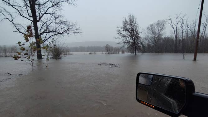
In St. Francois County, Missouri, officials issued voluntary evacuations for Iron Mountain Lake due to the possibility of a levy failing near the town. In Bismarck, Missouri, the Bismarck Fire Protection District responded to multiple water rescues Monday morning, the agency said in a Facebook post.

Floodwaters in St. Francois County, Missouri.
(Bismarck Fire Protection District)
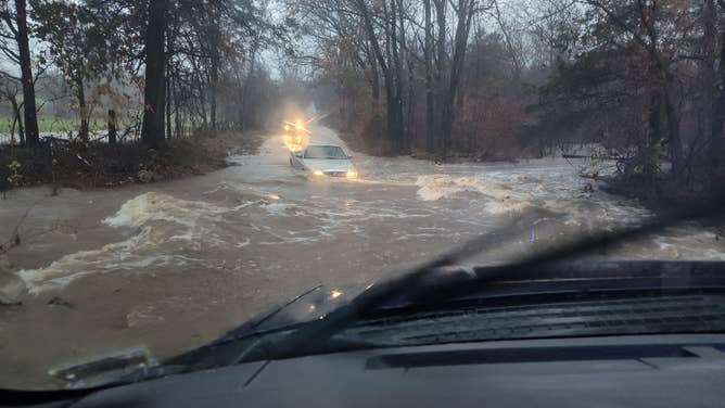
The fire protection district posted photos of the flooding. In one image, a truck is seen attempting to drive through high floodwaters.

Vehicle driving through high floodwaters in St. Francois County, Missouri.
(Bismarck Fire Protection District)


