Snow, ice to cause slick travel from Great Lakes to central Appalachians
A few inches of snow is expected in the Dakotas and northern Minnesota. Overall, snow totals should remain below 6 inches – except in the Upper Peninsula of Michigan, where over a foot of snow is possible.
Snow, ice to cause slick travel from Great Lakes to central Appalachians
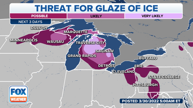
Most areas will see around 1/10" or less which will lead to dangerous road conditions. Up to 3/10" (enough for power outages) will be possible in northern Michigan and Wisconsin.
On the cold side of the same system that's bringing a severe risk to the South, the air will be cold enough to support a long-duration winter weather event in the upper Midwest through at least Thursday.

(FOX Weather)
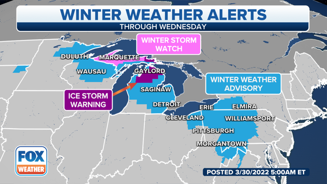
The most impactful weather will be from the ice in a zone from northern Wisconsin and much of Michigan down to the Allegheny Plateau of Pennsylvania.
Most areas will see around one-tenth of an inch or less, which will lead to dangerous road conditions. Up to three-tenths of an inch – enough for power outages – will be possible in northern Michigan and Wisconsin.

(FOX Weather)
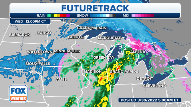
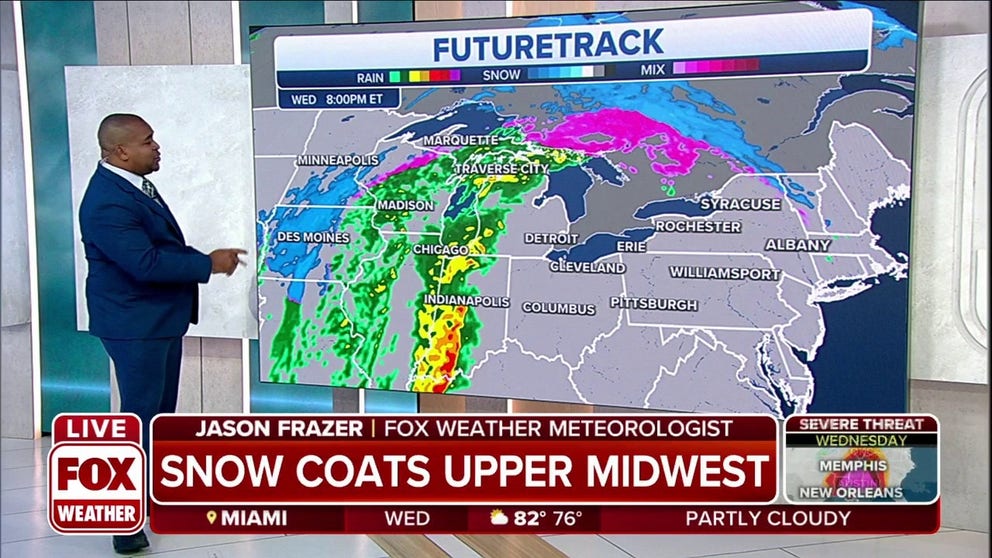
A renewed round of mostly snow will break out Wednesday into Thursday, dropping another few inches of snowfall across the region.
The National Weather Service in Duluth, Minnesota, said snow was falling across much of the Northland early Wednesday morning, with a wintry mix of precipitation just arriving from the south.
A few inches of snow is expected in the Dakotas and northern Minnesota. Overall, snow totals should remain below 6 inches – except in the Upper Peninsula of Michigan, where over a foot of snow is possible.

(FOX Weather)
The NWS in Gaylord, Michigan, said the active weather will continue through Friday. Primarily freezing rain is expected Wednesday morning before the precipitation turns over to all rain from southwest to northeast across northern Michigan during the day. Icing may also continue across parts of the eastern Upper Peninsula of Michigan into Wednesday night. The precipitation is expected to transition to snow on Thursday.
Be sure to download the FOX Weather app for the latest forecast and weather alerts for your exact location, plus our channel's 24/7 livestream – now featuring a new, all-star lineup with live programming weekdays from 6 a.m. to 10 p.m. Eastern time.
