Accumulating snow eyes Chicago, Minneapolis, Green Bay this week as fast-moving storm crosses northern US
Spring officially arrives Tuesday night, but with cold air plunging into the U.S. from Canada this week – prompting Freeze Warnings across 11 states in the South – the addition of this fast-moving storm originating from the Pacific Northwest could bring winter weather to the northern tier and make it feel like the middle of winter.
Quick-moving system brings snow to northern tier of US
The northern U.S. will see some measurable snow this week thanks to a fast-moving winter storm.
CHICAGO – A fast-moving storm system will be sweeping across the nation’s northern tier this week and could bring accumulating snow to major cities across the region, like Minneapolis, Chicago and Green Bay in Wisconsin – just in time for the start of spring.
Spring officially arrives Tuesday night, but with cold air plunging into the U.S. from Canada this week – prompting Freeze Warnings across 11 states in the South – the addition of this fast-moving storm originating from the Pacific Northwest could bring winter weather to the northern tier and make it feel like the middle of winter.
Watch: Exclusive FOX Model Futuretrack shows fast-moving storm sweeping across northern tier
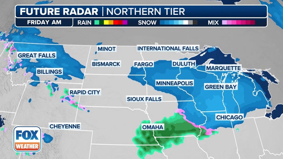
The exclusive FOX Model Futuretrack is showing a fast-moving storm sweeping across the northern tier that could bring accumulating snow to cities like Chicago, Minneapolis and Green Bay in Wisconsin later this week.
The cold temperatures are due to a large dip in the jet stream, which will allow for the disturbance to zip across the northern tier.
The FOX Forecast Center said the disturbance will be accompanied by moisture off of the Pacific Ocean as it moves from the northern Rockies to the Great Lakes and then eventually into parts of the Northeast by the end of the week.
But unlike most storm systems, the FOX Forecast Center said there won’t be a strong area of low pressure associated with this system.
Instead, the snow from the storm will be driven by the sharp difference in temperatures. Arctic air will be in place on the northern side of the system, but it will be slightly warmer to the south of it.
That change in temperatures will provide the lift needed to get the storm cranking, which will tap into moisture from the Pacific.
WHEN IS THE LAST FREEZE IN MY AREA?

(FOX Weather)
Snow is possible in portions of the northern Plains on Wednesday night as temperatures plunge to levels more typical of winter, with cities like Glasgow and Glendive in Montana dropping into the lower 20s. Farther to the east, cities in North Dakota like Minot, Bismarck and Bowman will likely drop into the upper teens to lower 20s.
DON'T LEAVE ANY OF THESE ITEMS IN YOUR CAR THIS WINTER

(FOX Weather)
The storm will continue to scoot across the region, with snow breaking out farther to the east in parts of the Upper Midwest on Thursday.
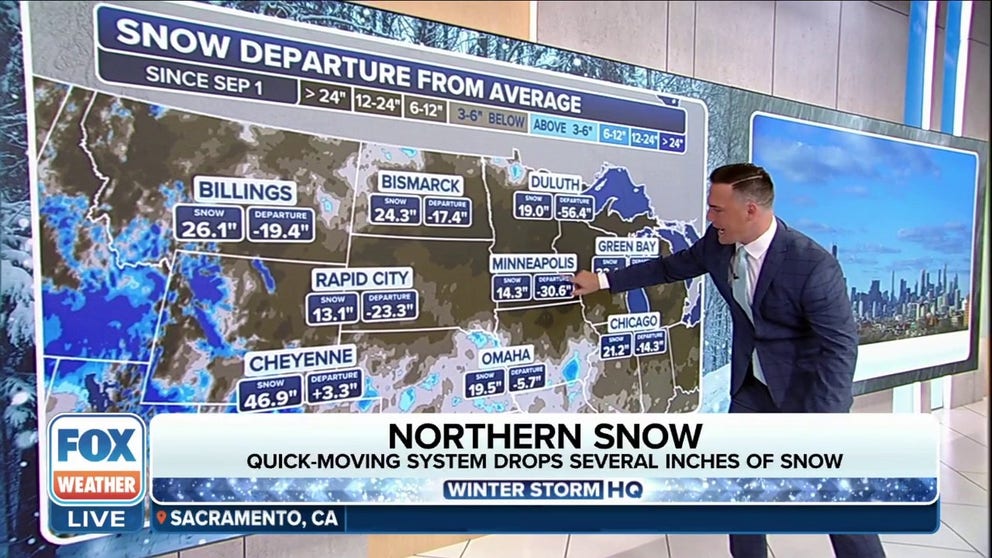
This includes the possibility of a few inches of snow in Minneapolis, which has seen its ninth-least-snowy winter on record with only 11.1 inches recorded this season.
Forecasters are still ironing out the details, but the National Weather Service said there is "increasing confidence for a few inches of accumulation despite recent warmth and thawed ground."
DRIVING ON THE ICE AND DRIVING IN THE SNOW: WEATHER DRIVING TIPS FOR DRIVING IN INCLEMENT WEATHER

(FOX Weather)
By Thursday night, snow is expected to break out across the Great Lakes, including cities like Green Bay, Milwaukee and Chicago.
The NWS office in Chicago said the potential for accumulating snow is highest for areas along and north of Interstate 88, particularly along the Wisconsin-Illinois state line.
YOU WERE JUST INVOLVED IN A WEATHER-RELATED CRASH - NOW WHAT?

(FOX Weather)
The system will then continue its journey to the east and impact portions of the Northeast on Friday.
This means there will be a chance of snow in cities like Cleveland in Ohio, Erie and State College in Pennsylvania and Buffalo and Syracuse in New York.
DOWNLOAD THE FREE FOX WEATHER APP

(FOX Weather)
The FOX Forecast Center said snow amounts are still up in the air, but generally, a few inches or more is likely for millions of people in the Midwest.

