Dangerous severe weather sweeps across South as monster winter storm spawns tornadoes
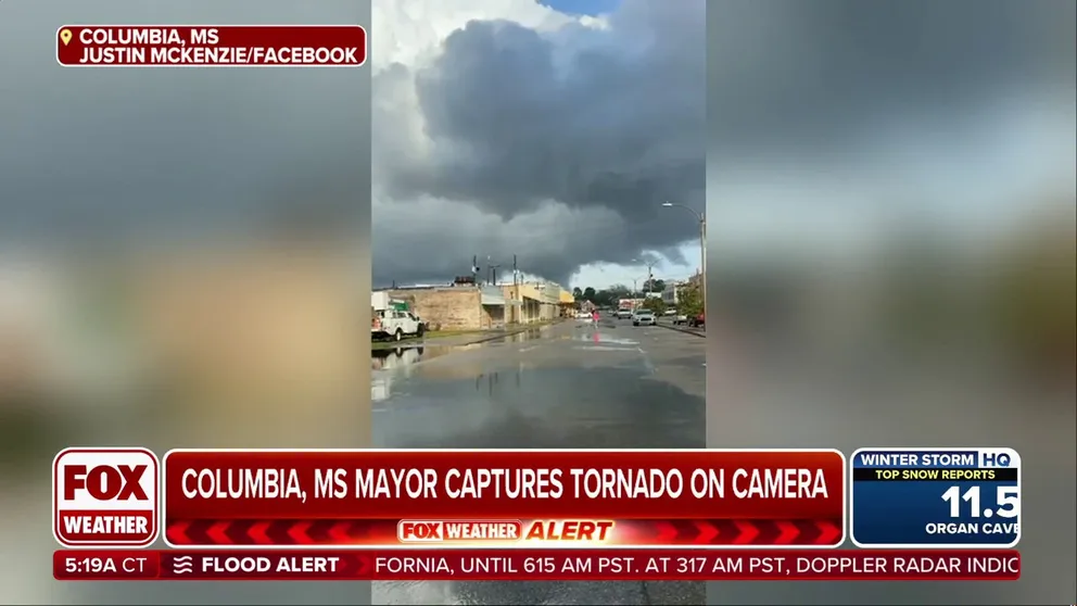
At least one tornado was spotted moving through Columbia, Mississippi, where cameras captured the funnel touching the ground.
Mayor's camera captures tornado in Columbia, Mississippi
A winter storm that blanketed parts of the Midwest with heavy snow and ice also unleashed severe weather, including at least one tornado spotted moving through Columbia, Mississippi, where cameras captured the funnel touching the ground.
COLUMBIA, MIss. – A winter storm that blanketed parts of the Midwest and Northeast with heavy snow and ice also unleashed severe weather, including tornadoes and damaging winds, across the South and Southeast on Wednesday.
The area of greatest concern covered large portions of southern Mississippi and Alabama from Hattiesburg to Montgomery, which was under a Level 3 out of 5 threat.
At least one tornado was spotted moving through Columbia, Mississippi, where cameras captured the funnel touching the ground.

Tornado captured on video rolling through Mississippi
At least one tornado was spotted moving through Columbia, Mississippi, where cameras captured the funnel touching the ground.
The local police department warned residents to seek shelter ahead of the damaging storm but has not said if there were any injuries associated with the twister.
"That's going to be what we believe to be the tornado here in Columbia. You're looking back toward between Broad Street and Church Street around East Avenue," Columbia Mayor Justin McKenzie said. "Law enforcement for now is reporting that there is some kind of debris in the tornado. Boy, that's not a huge one, but I gather it has dropped down after entering into the town."
Resident Cody Stevens said the tornado came too close for comfort as it came through the town of less than 6,000 people.
According to FindEnergy.com, less than 200 customers were without power in the Columbia area on Wednesday afternoon, with a great concentration of outages near the Mississippi River.
"We are asking for the public to stay away from the Lake View area at this time. First responders and power company need to be able to help those in need and access damage," the Marion County Sheriff's Office stated.
Residents escape Columbia, Mississippi tornado
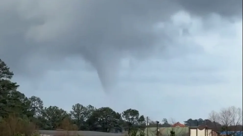
A tornado in southern Mississippi was captured on video sending debris into the air on Wednesday. (Cody Stevens)
Farther east in Thomasville, Alabama, the National Weather Service office in Mobile issued a Tornado Warning and called the event a "Particularly Dangerous Situation." Radar detected debris being lifted more than 15,000 feet in the air, which is usually a telltale sign of a powerful twister.
After the storm, damage was reported in nearby Coffeeville in the form of downed trees and utility lines.
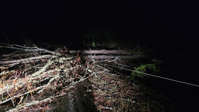
Alabama storm damage from Coffeeville. (2/12/2025)
(@mattmatta131/X)
More severe weather, heavy rain ahead
A Tornado Watch was previously in effect for parts of southern Alabama, Mississippi and Louisiana through late Wednesday evening, while Flood Watches covered a wider stretch from the Gulf Coast through the Appalachians.
Heavy rain fell Tuesday from Texas to North Carolina. Between 1 and 4 inches of rain was recorded, and minor flooding was reported in northern Alabama.
Photos from the Florence, Alabama, police department showed road closures due to flooding after multiple rounds of rain.
HOW ARE TORNADOES RATED? THE ENHANCED FUJITA SCALE EXPLAINED
![]() Image 1 of 2
Image 1 of 2Road closures due to flooding from multiple rounds of heavy rain on Tuesday. (Florence, AL Police Department)
![]() Image 2 of 2
Image 2 of 2Road closures due to flooding from multiple rounds of heavy rain on Tuesday. (Florence, AL Police Department)


Multiple inches of rain was expected to fall from portions of Louisiana through the Carolinas through early Thursday.
The greatest risk for flash flooding covered parts of the interior Southeast from Alexandria, Louisiana, to Asheville, North Carolina, the latter of which is still recovering from the damage left behind by Hurricane Helene.
The severe weather threat lessens on Thursday morning, with southern Georgia and the Florida Panhandle around Tallahassee being the areas of greatest concern.
A brief pause in the rain is expected on Friday before another potential winter storm moves into the region this weekend.