Strong severe storms target 100 million Americans from Texas to Maine in final chapter of multi-day threat
NOAA's Storm Prediction Center (SPC) has issued a Level 2 out of 5 risk of severe thunderstorms that stretches from border to border, from the Big Bend of Texas to northern Vermont.
Severe weather threat stretches 2,000 miles, from Texas to New England
After delivering tornadoes across Nebraska and Kansas and wind gusts of 90 mph in parts of the Midwest, a sprawling cold front will shift eastward through Tuesday, threatening more than 112 million people with severe weather across a 2,000-mile corridor from Texas to New England.
A sprawling cold front will shift eastward through Tuesday, threatening more than 112 million people with severe weather across a 2,000-mile corridor from Texas to New England, after unleashing tornadoes and 90 mph wind gusts across Nebraska and Kansas on Monday.
WATCH: 70 MPH WINDS BLAST ACROSS SERGEANT BLUFF, IOWA, FOLLOWING NEARBY CONFIRMED TORNADO
TORNADO TOUCHDOWN 🌪️: "Just shot some of the most insane tornado footage of my life." FOX Weather Exclusive Storm Tracker @BrandonCopicWx has had a busy evening chasing severe weather, encountering developing tornadoes along the way.#Kansas #Thunderstorm #Tornado #FOXWeather pic.twitter.com/NluU5VzbSQ
— FOX Weather (@foxweather) May 19, 2026
Monday's storms triggered a Tornado Emergency in Pawnee County, Nebraska, and 24,000 customers were still without power early Tuesday across Kansas and Missouri.
Strong wind gusts lashed parts of southern and central Michigan through Monday evening, leaving more than 35,000 customers there also in the dark Tuesday morning.
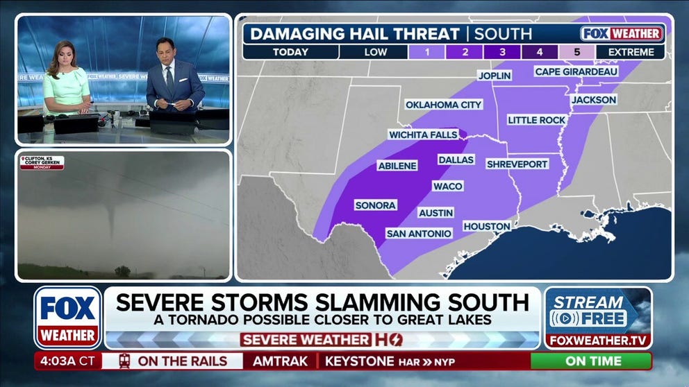
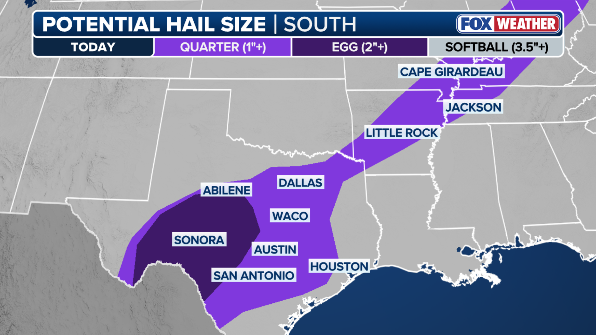
Meanwhile, Texas will remain in the threat zone Tuesday, with large hail, 2 inches in diameter, being the main hazard for the northern and central parts of the state.
(FOX Weather)
Ahead of the front, record-breaking heat is baking much of the Southeast, Mid-Atlantic and Northeast with high temperatures in the 90s. This heat will provide fuel for storm development Tuesday afternoon along the cold front as it marches eastward through the day.
RECORD HEAT TAKES AIM AT NORTHEAST, MID-ATLANTIC THROUGH MID-WEEK
Severe weather is expected to develop across the eastern Great Lakes, as well as the Ohio and Tennessee valleys.
Quarter-sized hail and damaging wind gusts are expected to be the main threat, but a few tornadoes may be embedded in the line of thunderstorms that form.

(FOX Weather)
NOAA's Storm Prediction Center (SPC) has issued a Level 2 out of 5 risk of severe thunderstorms that stretches from border to border, from the Big Bend of Texas to northern Vermont.
Storms reach the East Coast Wednesday
The cold front will arrive in the Northeast by Wednesday and break the heat wave with clusters of thunderstorms capable of strong wind gusts and large hail across the Interstate 95 corridor from Boston to Richmond, Virginia.

(FOX Weather)
This will be the final act of a marathon severe weather threat that began last Wednesday. Parts of the Central U.S., particularly Iowa and Nebraska, have consecutive days of storms that started on Friday.
Behind the severe weather, temperatures will fall back into the 60s across I-95, lasting through Memorial Day weekend.