3 killed as blizzard pummels Plains, Midwest with whiteout conditions amid 60-90+ mph gusts
As the storm moved through the Plains on Tuesday evening, winds howled through Kansas and Nebraska, where three deaths were reported due to the wintry weather.

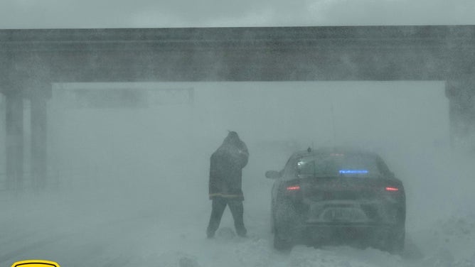
Near blizzard conditions sweep across Iowa
Iowa State Patrol Officer Paul Gardner spoke about the near blizzard conditions making travel dangerous in the Hawkeye State.
GRAND ISLAND, Neb. – At least three people were killed as a powerful winter storm created blizzard conditions across parts of the Midwest, part of a sprawling storm that brought a dangerous mix of severe weather, including tornadoes, flooding, heavy snow, blizzards and high winds.

(FOX Weather)
Officials urged people to stay at home as the winter storm blew through the Des Moines, Iowa, area Wednesday morning with blistering wind gusts. Footage posted by Iowa State Trooper Paul Gardner shows conditions on U.S. Route 20 in Webster and Calhoun counties, where he reported zero visibility with "complete whiteout conditions."

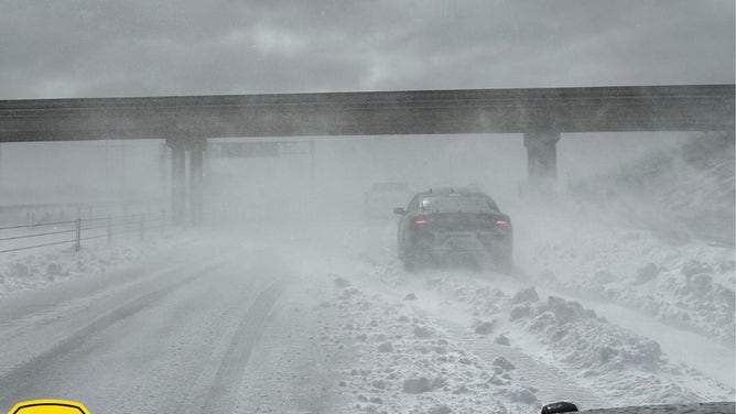
I-35 south of Ames, Iowa.
(Iowa State Patrol / FOX Weather)
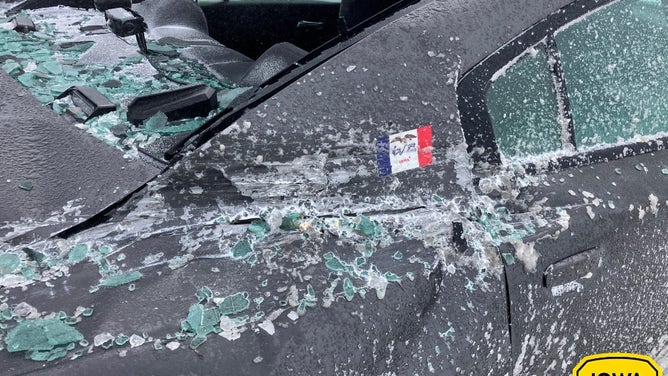
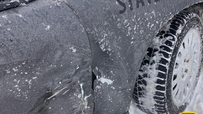
The Iowa State Patrol said vehicles were piling up, and visibility was nearly zero on Interstate 80 near Newton and other parts of the state.

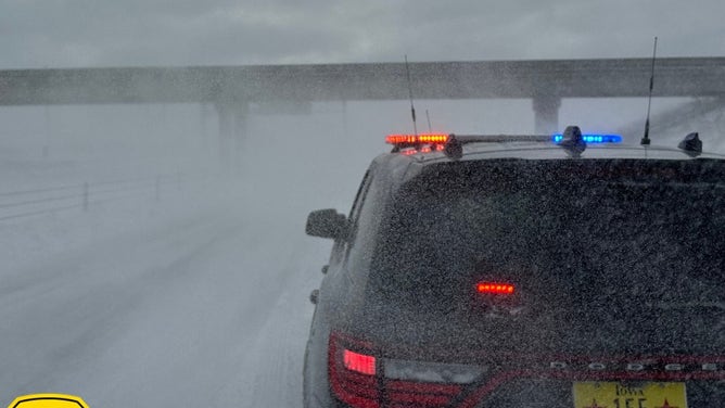
Watch: Blizzard conditions cause whiteout in central Iowa
Officials urged people to stay at home as a winter storm carrying high winds caused a
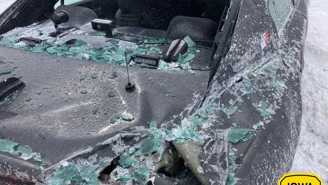
As of Wednesday night, the ISP reported 106 crashes and helped about 400 motorists.
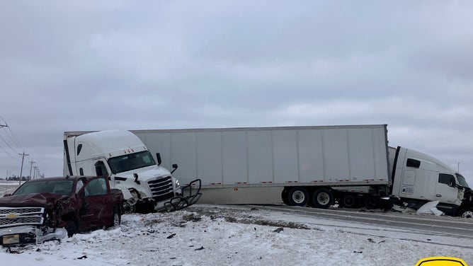
![An accident involving two semis and a truck on Hwy 69 near Alleman, Iowa.]() Image 1 of 10
Image 1 of 10An accident involving two semis and a truck on Hwy 69 near Alleman, Iowa. (Iowa State Patrol)
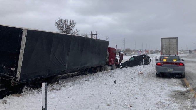
![A look at I-80 near Newton, Iowa, on Wednesday morning.]() Image 2 of 10
Image 2 of 10A look at I-80 near Newton, Iowa, on Wednesday morning. (Iowa State Patrol)
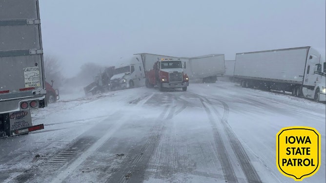
![The blizzard created hazardous conditions for drivers.]() Image 3 of 10
Image 3 of 10The blizzard created hazardous conditions for drivers. (Iowa State Police)
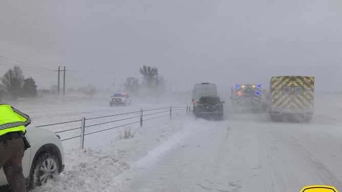
![The blizzard created hazardous conditions for drivers.]() Image 4 of 10
Image 4 of 10The blizzard created hazardous conditions for drivers. (Iowa State Police)
![The blizzard created hazardous conditions for drivers.]() Image 5 of 10
Image 5 of 10The blizzard created hazardous conditions for drivers. (Iowa State Police)
![The blizzard created hazardous conditions for drivers.]() Image 6 of 10
Image 6 of 10The blizzard created hazardous conditions for drivers. (Iowa State Police)
![The blizzard created hazardous conditions for drivers.]() Image 7 of 10
Image 7 of 10The blizzard created hazardous conditions for drivers. (Iowa State Police)
![The blizzard created hazardous conditions for drivers.]() Image 8 of 10
Image 8 of 10(Iowa State Police)
![The blizzard created hazardous conditions for drivers.]() Image 9 of 10
Image 9 of 10The blizzard created hazardous conditions for drivers. (Iowa State Police)
![The blizzard created hazardous conditions for drivers.]() Image 10 of 10
Image 10 of 10The blizzard created hazardous conditions for drivers. (Iowa State Police)
As the storm moved through the Plains on Tuesday evening, winds howled through Kansas and Nebraska, where three deaths were reported due to the wintry weather.
Two of the deaths involved a crash along a snow-covered Interstate 80 in southern Nebraska late Tuesday afternoon, according to the Nebraska State Patrol. The two were heading near Grand Island when they lost control of their SUV, crossed the median and then crashed into a semi-truck in the oncoming lanes.
The two inside the SUV were pronounced dead at the scene, while the semi-truck driver was taken to the hospital with non-life-threatening injuries, the NSP said.

Watch: Blizzard whips through eastern Nebraska
Police warned residents in eastern Nebraska against travelling on Tuesday as a blizzard whipped through the area, creating hazardous conditions. Footage from the Nebraska State Patrol shows a police car with flashing lights obscured by blowing snow.
While the crash remains under investigation, NSP said severe winter weather played a role. They added that they have responded to 28 crashes and conducted more than 300 weather-related incidents.
The third death involved a man in Omaha on Wednesday morning, Omaha Police Department confirmed to FOX Weather. But no other details were available on the cause of the man's death, pending an autopsy.
Police there also responded to five separate incidents involving people suffering from the effects of the cold weather. Three people were taken to a local hospital with stable vital signs, officials said.

Snow, wind blow through Goodland, Kansas, amid Blizzard Warning
Goodland, Kansas, is experiencing ongoing snowfall Tuesday morning. A Blizzard Warning is in effect until midnight for parts of Kansas, Colorado and Nebraska, with potential for whiteout conditions, up to 1 inch of snow and 70 mph wind gusts. Travel is strongly discouraged.
In Kansas, winds topped 93 mph in Hugoton on Tuesday. Several other reports of wind gusts over 80 mph came in across western Kansas earlier in the day Tuesday. St. Joseph, Missouri reported wind gusts topping 50 mph for nearly 10 straight hours.