

Another round of severe storms, flood threats target Northeast, Mid-Atlantic after widespread power outages
Heavier rain may impact Washington, DC, and Philadelphia into the early afternoon, while showers and downpours continue from New York City to Boston through the evening commute.
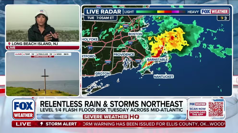
Another round of rain, severe storms target Northeast, Mid-Atlantic as flash flood threat looms
Tuesday remains soggy across the Mid-Atlantic and Northeast, with localized flash flooding and severe storms still possible after Monday’s impactful storms. FOX Weather’s Marissa Torres breaks down the latest and what to expect today:
While Monday’s severe storms hammered the I-95 corridor with widespread power outages and a historic World Cup delay, Tuesday’s focus will shift away from widespread severe weather and toward a dreary day of rain across the broader Mid-Atlantic and Northeast. However, localized flash flooding and severe storms will remain possible.
HOW HIGH PRESSURE AND LOW PRESSURE DRIVE THE WEATHER

(FOX Weather)
The official start of summer began Sunday, but the weather has been anything but seasonable.
On Monday, numerous severe thunderstorms moved through major cities along the I-95 corridor, including Washington, DC, Philadelphia, and New York City.
The storms produced damaging wind gusts, torrential rainfall, and frequent lightning, knocking out power to nearly 150,000 customers across North Carolina and Virginia.
The severe weather was also enough to delay the FIFA World Cup match between France and Iraq in Philadelphia, Pennsylvania on Monday evening. The NYNJ 2026 World Cup Fan Fest in Queens also closed for the remainder of the day.
Philadelphia Stadium was evacuated due to heavy rainfall and thunderstorms in the area three hours before the 2026 World Cup kickoff between France and Iraq. The evacuation was lifted shortly after.
A Severe Thunderstorm Warning was issued for 1.8 million Americans in the Washington, D.C. area, but has since expired.

Heavy downpours fall during powerful storms in Pennsylvania
A lot of rain fell during powerful storms in Wayne, Pennsylvania, on Monday. A low pressure system and an associated warm front tracked eastward, tapping into a deep plume of Gulf moisture.
On Tuesday, the focus will shift away from widespread severe storms and flash flooding and toward a dreary day of rain across the Mid-Atlantic and Northeast as an area of low pressure moves out of the Tennessee Valley.
As this system advances into the southern Mid-Atlantic during the afternoon, it will bring a heavier round of rainfall that could increase the risk of flash flooding.

(FOX Weather)
Consequently, a Level 2 out of 4 flash flood risk is in place for eastern Virginia and far northeastern North Carolina.
KNOW YOUR FLOOD TERMINOLOGY: WHAT FLOOD WATCHES, WARNINGS AND EMERGENCIES REALLY MEAN
Additionally, severe storms will return to portions of the region late this afternoon.
Severe storms are likely from Richmond, Virginia, south to near Fayetteville, North Carolina, with the main threat being damaging wind gusts once again.

(FOX Weather)
To the north, including Philadelphia, New York City, and Boston, cloudy skies and periods of rain will persist throughout the day.
Heavier rain may impact Washington, DC, and Philadelphia into the early afternoon, while showers and downpours continue from New York City to Boston through the evening commute.
Behind this system, drier conditions will return for a few days ahead of another round of rain just in time for the weekend.