Feet of rainfall in East Texas causes rivers to reach highest levels since Hurricane Harvey
Some 24-hour rainfall totals exceeded 7 inches in the region, with storm totals over the past few days nearing a foot. Waterwood picked up more than 10 inches of rain Wednesday, and Sebastopol wasn’t far behind with 9 inches.
Texas' Harris County says worst of flooding still yet to come
Flood Warnings continue Friday as officials and rescue crews scramble to get people out of harm's way while rivers keep rising in southeastern Texas.
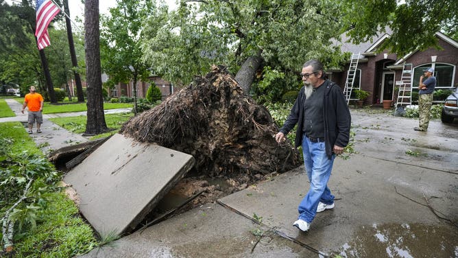
HOUSTON – Heavy showers and thunderstorms continued to pour rain into East Texas Friday, adding more water to swollen rivers that have prompted mandatory evacuations as water levels rise in some towns to levels rivaling Hurricane Harvey's devastating floods of 2017.
Officials are closely watching lakes and streams where additional rainfall on Sunday could fall at 1" to 3" per hour and soak many of the communities still waterlogged by the workweek event.
NOAA's Weather Prediction Center has placed much of the north Houston metro under a Level 3 out of 4 threat for additional flooding.

(FOX Weather)
Flood Watches remain in effect for much of southeastern Texas, including Houston, and even stretched into western Louisiana.
Flooding ‘worse than we imagined’
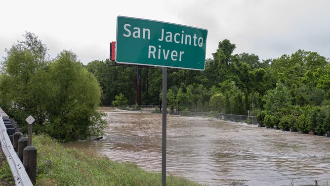
Officials remain particularly concerned about the East Fork of the San Jacinto River, which is already experiencing major flooding and forecasts have the river still to rise several more feet, not cresting until late Friday.
"We are very concerned," Meteorologist Jeff Lindner with Harris County Flood Control told FOX Weather. "Just upstream from New Caney (Texas) is Plum Grove, and we have very, very serious flooding ongoing in the Plum Grove area of Montgomery and Liberty Counties. And that water is coming very quickly down towards the northeast part of Harris County."
Texas' Harris County still dealing with extensive flooding north of Houston
Jeff Lindner with Harris County Flood Control joins FOX Weather to give an update on the worst flooding to strike the region in years.
Harris County Executive Judge Lina Hidalgo said for the east side of the East Fork of the San Jacinto River, the event is turning out "to be worse than we imagined."
On Thursday, she declared mandatory evacuations along the east side of the river, running from FM Road 1485 to Lake Houston, and Hidalgo warned flooding impacts may stretch as far as a half mile inland from the river bank.
"This is different than what happened Tuesday," Hidalgo said. "This is significantly higher water, which is going to impact mobility and your ability to take care of yourself and your family. We want you out of this area. We can’t force anyone to do anything, but this is a life-threatening situation."
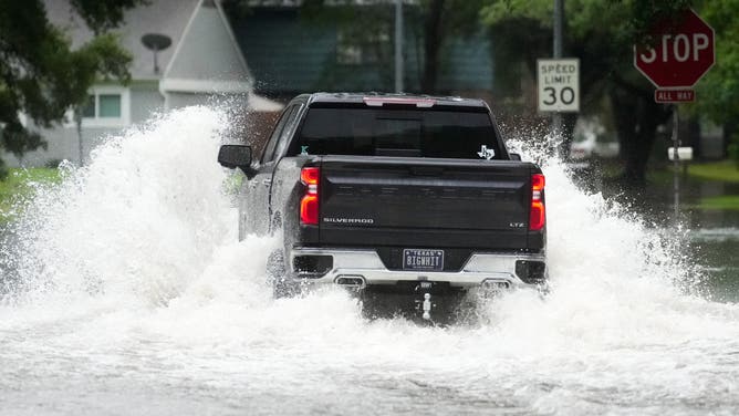
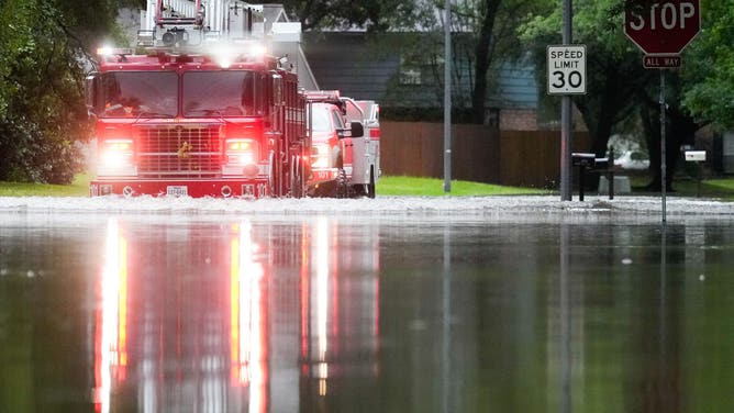
Hidalgo said the river normally flows at 45-50 feet but was up to 70 feet Tuesday as more water surged in from upriver – with floodwaters covering up to the top of stop signs. What's worse, forecasts indicate the river will rise another 8 feet starting Friday – to just 3 feet below the devastating floods of Hurricane Harvey in 2017.
Residents along the San Jacinto River and Lake Conroe under major flood threat
Days of rain have caused waterways in East Texas to swell past flood stage, triggering evacuations.
"That means elevated structures will get water … it means the water will be hitting power lines, which puts our emergency evacuation vehicles at risk because they’re not going to be able to see those power lines," Hidalgo said. "Please evacuate that area as soon as possible."
Hidalgo said farther upriver in Polk County, about 700 homes have flooded. But in Harris County so far, Hidalgo said Friday that 26 people had been rescued along with 30 pets.
But Lindner said while the East Fork area will end up a few feet shy of Harvey level flooding ,"we are going to be higher than Tropical Storm Imelda back in 2019."
On the other hand, he said the Kingwood area along the West Fork, while some of the lowest homes may get water inside "we are going to be significantly lower than Harvey — probably 7 or 8 feet lower than Harvey. So this is not Harvey flooding for the Kingwood area and to be clear, not all of Kingwood is going to flood."
FOX 26 Houston Reporter Shelby Rose said Wednesday that eight people and 23 dogs needed to be rescued from their homes in Harris County – the most populous county in Texas.
Texas towns call for voluntary evacuations as rivers overflow their banks
Heavy rain has caused rivers to overflow their banks in parts of Texas, forcing officials to ask people in neighborhoods along the Trinity River and San Jacinto River to leave their homes until water recedes.
Mandatory evacuations ordered in San Jacinto County due to flooding
High-water rescue trucks rolled into communities in San Jacinto County on Wednesday, and despite the danger and pleas from officials to evacuate, some people are refusing to leave their homes.
"I think that’s one of the biggest problems we’re going to face is the fact that some of these people do not want to abide by that evacuation order," Huffman Volunteer Fire Department Chief Tyler Shirley said. "The first rescue we had tonight was exactly that scenario. An individual that wanted to stay and realized that the water was going to rise a lot quicker than he thought. And we ended up having to go back out there after him."
Shirley called the flooding unprecedented based on how fast the waters rose.
The life-threatening situation appears to have gotten worse in the area, and that has led to officials in San Jacinto County also issuing a mandatory evacuation order for residents living in the unincorporated areas of the county, below the Lake Livingston Dam and along the Trinity River. Crews had to release extra water downstream after receiving more than 20 inches of rain over the Lake Livingston watershed since Sunday, but stressed the dam itself is not at risk and is designed to pass nearly triple the amount of water currently flowing through.
"We will continue releases until the elevation of the reservoir returns to the conservation pool of 131 feet above Mean Sea Level," officials said Friday.
Meanwhile, residents have been told to seek shelter with family, friends or at a hotel, but shelters are being opened if that isn't an option.
RELENTLESS SEVERE STORMS CONTINUE TO TORTURE AREAS FROM TEXAS TO UPPER MIDWEST ON THURSDAY
The Montgomery County Office of Homeland Security and Emergency Management issued an urgent message on Facebook on Thursday warning residents living along the West Fork of the San Jacinto River south of the Lake Conroe Dam to take immediate precautions due to a significant rise in river levels as water is released downstream.
"All residents downstream along the West Fork of the San Jacinto River should immediately begin evacuating to higher ground," officials warned.
School bus driver praised for quick thinking as bus entered floodwaters
In Crosby County, an official with the Crosby Independent School District hailed one of their school bus drivers for helping save 27 middle and high school students on a school bus after the bus ended up stopped in floodwaters.
The bus was traveling on a road that hadn't been barricaded yet due to deep waters, but the driver noticed the water was suddenly deeper up ahead, ISD officials said. The driver stopped and had the students evacuate the bus out the rear door. Another bus came to get the students off to school while the original bus driver then maneuvered the bus back out of the floodwaters to safety.
The students were offered dry clothes at school if needed.
‘A few dry days would help out’
Lindner said they are keeping a weary eye on the rainfall forecasts for the weekend, as so far they have not quite gone to plan. Rain is forecast to lighten up on Saturday, allowing the region to briefly wring out though scattered showers and thunderstorms are likely on Sunday. But the thunderstorms have been stubborn.
"You know, even (Friday) morning wasn't handled very well by some of our short range (weather forecast computer) modeling. And so, you know, the rain this morning was a little bit more than we were expecting," he said. "We're not very confident, going forward on Saturday and Sunday of how the weather's going to transpire.
"But, you know, in a lot of cases, the damage has already been done. The water is already on the ground. We are going to see serious flooding."
He did have one wish for the short-term weather forecast:
"If we could just get a few dry days, it would definitely help out," he said.
More than 25 inches of rain in some areas in the past month
While the most recent heavy rainfall is causing immediate issues, the WPC says it’s not just been a soggy few days in the region.
Many currently flooded areas of southeastern Texas have seen as much as 15-25 inches of rain over the past 30 days. Woodvillle, Texas has reported 27.05 inches of rain in the past month.
For much of the rest of the region, the past 30 days have brought 3 to 7-times their average rainfall.


