Hurricane Beryl closing in on Caribbean islands with life-threatening winds, storm surge
The latest forecast from the National Hurricane Center now shows winds reaching upwards of 130 mph near the Windward Islands.
'Extremely dangerous' Hurricane Beryl takes aim at Caribbean with life-threatening winds, storm surge
The effects of Hurricane Beryl are being felt in the Windward Islands, and forecasters say the storm is likely to remain an extremely dangerous hurricane as it moves across the region. Potentially catastrophic hurricane-force winds, a life-threatening storm surge and damaging waves are expected when the storm passes over.
As of Monday, July 1, at 7:30 a.m. ET, Hurricane Beryl was a dangerous Category 3 hurricane. Continuous coverage of Hurricane Beryl has moved here.
The situation in the Caribbean is becoming more dire, and residents are being warned to finish preparations as soon as possible ahead of Hurricane Beryl. The storm rapidly intensified and strengthened into a Category 4 hurricane and could unleash catastrophic destruction across populated island nations starting early Monday morning.
"Extremely dangerous Category 4 Beryl (is) approaching the Windward Islands," the National Hurricane Center (NHC) said Sunday evening. "Life-threatening winds and storm surge expected there early Monday morning."
Hurricane Beryl is now the second named storm of the 2024 Atlantic hurricane season and quickly strengthened from a tropical depression into a tropical storm and then a hurricane – all within 24 hours.
Not only is Hurricane Beryl intense, but it’s also made history.
Hurricane Beryl's rapid intensification happened 'sooner than we expected,' NHC says
National Hurricane Center Director Michael Brennan joined FOX Weather on Sunday to break down the latest forecast on Hurricane Beryl and what the future may hold for the monster storm as it spins closer to the Caribbean.
Hurricane Beryl intensified from a tropical depression into a major Category 3 hurricane in less than 48 hours, a feat never before achieved earlier than September.
According to Dr. Phil Klotzbach, a hurricane expert at Colorado State University, Hurricane Beryl became the first major hurricane (Category 3 or stronger) on record east of the Lesser Antilles during the month of June.
Hurricane Beryl also became the Atlantic Basin's earliest Category 4 hurricane on record. According to Klotzbach, the previous record for the earliest Category 4 hurricane on record was Hurricane Dennis, which reached Category 4 strength on July 8, 2005.
As of the latest update from the NHC, Beryl was a Category 3 hurricane with maximum sustained winds of 120 mph and a minimum central pressure of 965 millibars.
DOWNLOAD THE FREE FOX WEATHER APP

(FOX Weather)
A Hurricane Warning is in effect for Barbados, St. Lucia, St. Vincent and the Grenadine Islands, Grenada and Tobago.
A Tropical Storm Warning has been issued for Martinique and Trinidad. A Tropical Storm Watch is in effect for Dominica and the southern coasts of Haiti and Dominican Republic.
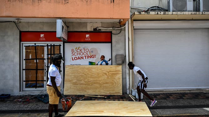
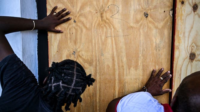
Preparations have been underway across the Caribbean as the region braces for the onslaught of Hurricane Beryl.
"Potentially catastrophic hurricane-force winds, a life-threatening storm surge, and damaging waves are expected when Beryl passes over portions of the Windward Islands with the highest risk of the core in St. Vincent and the Grenadines, and Grenada beginning early Monday morning," the NHC said.
In Barbados, Prime Minister Mia Amor Mottley took to social media Friday night to urge her constituents to prepare for the storm.
"The reality is that we are not in a position to know exactly what type of weather we are going to face, but we know we’re going to face some weather," she said. "And you and I know that when these things happen, it’s better to plan for the worst and pray for the best."
WHERE ARE THE LESSER ANTILLES, WINDWARD ISLANDS AND LEEWARD ISLANDS

(FOX Weather)
What is the forecast for Hurricane Beryl?
Hurricane-force winds (74-plus mph) extend outward up to 35 miles from the center, and tropical-storm-force winds (39-plus mph) extend outward up to 125 miles.
On Beryl's forecast trajectory, the storm's center is expected to move across the Windward Islands later Monday morning and then across the southeastern and central Caribbean later Monday through Wednesday.
Hurricane conditions are expected within the Hurricane Warning area starting early Monday morning.
"Potentially catastrophic wind damage is expected where the core of Beryl moves through portions of the Windward Islands, with the highest risk of the core in St. Vincent and the Grenadines and Grenada," the NHC said.
The latest forecast from the NHC now shows winds reaching upwards of 130 mph over the next few days.
Tropical storm conditions are expected in the Tropical Storm Warning area soon, making preparations for Hurricane Beryl difficult or dangerous.
Forecasters say that later in the week, the hurricane should be in the vicinity of Jamaica, but it could be on a weakening trend. By the end of the week, the hurricane could be near the Yucatán Peninsula of Mexico or Central America.
WHY THE EASTERN CARIBBEAN IS KNOWN AS THE 'HURRICANE GRAVEYARD'

(FOX Weather)
"It’s expected to be a powerful hurricane all the way across the Caribbean," Brennan said. "It bears watching all the way to places like Jamaica, Cuba, the Yucatan Peninsula, Cayman Islands and then potentially the Gulf of Mexico as we get into next weekend."
In addition to hurricane-force winds, torrential rain will drench the islands. Current forecast totals predict Beryl will bring 3-6 inches of rain across Barbados and the Windward Islands, producing areas of flash flooding.
The NHC has upgraded its storm surge forecast and is now predicting a "life-threatening" surge that will raise water levels by as much as 6-9 feet above normal tide levels in areas of onshore flow near where Beryl makes its closest approach to the islands.
A Hurricane Hunter aircraft investigated the hurricane on Sunday, giving the NHC a better estimate of Beryl's intensity.
BERYL TRACKER: LIVE FORECAST, TROPICAL WEATHER ALERTS, SPAGHETTI MODELS AND MORE
Will Beryl impact the US?
The closest American territories to the storm are the U.S. Virgin Islands and Puerto Rico, and neither territory is under a watch at this time.
The FOX Forecast Center expects the main impacts to remain south of the islands; however, a passing band of showers cannot be ruled out.
It is too soon to tell if the hurricane will ever threaten the continental U.S., but if it does, it will likely be in a different form.
"The odds favor high pressure holding it to the south of the U.S.," FOX Weather Hurricane Specialist Bryan Norcross said. "But if the high pressure moves out of the way too soon, there is some chance the storm could slow and possibly turn into the Gulf."

(FOX Weather)


