Potential Tropical Cyclone 1 brings tropical storm conditions to Texas on Wednesday
Potential Tropical Cyclone One is forecast to bring heavy rain and coastal flooding to much of the Texas Gulf Coast even though the center of the storm likely won't make landfall in the U.S.
Heavy rain, wind slam Texas coast as Potential Tropical Cyclone One spins across Gulf of Mexico
Tropical Storm Warnings remain in effect for portions of the Texas coastline as Potential Tropical Cyclone One continues to spin across the Gulf of Mexico on a path that will take it into Mexico.
As of Wednesday at 11 a.m. ET, Potential Tropical Cyclone One has strengthened into Tropical Storm Alberto. Continuous coverage of Tropical Storm Alberto has moved here.
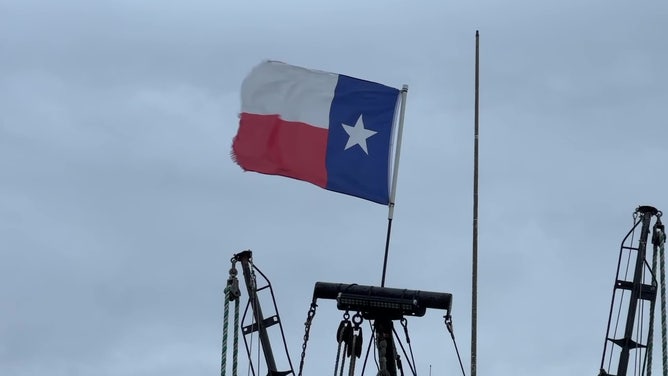
Potential Tropical Cyclone One continues to spin across the Gulf of Mexico and is expected to bring tropical storm conditions to Texas starting Wednesday, including heavy rain, flooding and high wind gusts.
A potential tropical cyclone is a designation used by the National Hurricane Center (NHC) to indicate a disturbance that is not yet a tropical cyclone but has the potential to bring that kind of weather to the U.S. within 48 hours.
Watch: Birds struggle to fly through strong winds from Potential Tropical Cyclone One in Texas
Video recorded by FOX Weather Meteorologist Craig Herrera shows birds struggling to fly through strong winds that are battering the Texas coastline from Potential Tropical Cyclone One spinning in the Gulf of Mexico on Wednesday, June 19, 2024.
The National Hurricane Center (NHC) says the system is expected to strengthen and will likely get the first name on the list for the 2024 season – Alberto.
Here’s everything you need to know about Potential Tropical Cyclone One.
Where is Potential Tropical Cyclone 1?
Potential Tropical Cyclone One is located in the western Gulf of Mexico, about 315 miles southeast of Brownsville, Texas.
WHAT’S THE DIFFERENCE BETWEEN A TROPICAL DEPRESSION, TROPICAL STORM AND HURRICANE?

(FOX Weather)
What is the forecast for Potential Tropical Cyclone 1?
Potential Tropical Cyclone One is expected to become a tropical storm on Wednesday by the time it reaches the coast of northeastern Mexico late Wednesday night or early Thursday.
A LOOK AT HOW THE HURRICANE FORECAST CONE WILL BE DIFFERENT IN 2024

(FOX Weather)
What are the impacts of Potential Tropical Cyclone 1?
A Tropical Storm Warning remains in effect for the Texas coast from San Luis Pass to the mouth of the Rio Grande. A Tropical Storm Warning has also been issued for parts of Mexico's coast from the mouth of the Rio Grande to Puerto de Altamira.
2024 ATLANTIC HURRICANE SEASON GUIDE: HERE’S WHAT TO KNOW ABOUT THIS YEAR’S STORMS

(FOX Weather)
Flood alerts have been issued along the Gulf Coast from the U.S.-Mexico border to the Mississippi-Alabama border due to the threat of heavy rain as well as the combination of storm surge and high tide.
The Flood Watches extend the length of the Texas coastline from Brownsville through Corpus Christi and into the Galveston area.
HOW TO PREPARE FOR HURRICANE SEASON

(FOX Weather)
Coastal flood alerts have also been issued and extend from the U.S.-Mexico border to the Mississippi-Alabama border.
Coastal Flood Warnings are in effect from Port Mansfield to Port Lavaca, Galveston and Sabine Pass in Texas.
Coastal Flood Advisories extend farther east and include communities along the Louisiana coast, as well as Gulfport and Biloxi in Mississippi.
7 FACTS YOU SHOULD KNOW ABOUT FLASH FLOODS

(FOX Weather)
The NHC says that the combination of storm surge and high tide will cause areas of the coastline that normally remain dry to be flooded by rising water moving inland from the shoreline.
Water could reach the following heights if the peak storm surge occurs at the time of high tide:
Sargent, Texas to Sabine Pass, Texas: 2-4 feet
Galveston Bay: 2-4 feet
Mouth of the Rio Grande River, Texas to Sargent: 1-3 feet
Sabine Pass to Vermilion/Cameron Parish Line, Louisiana: 1-3 feet
DOWNLOAD THE FREE FOX WEATHER APP

(FOX Weather)
Potential Tropical Cyclone One is expected to dump a lot of rain across portions of Texas and northern Mexico.
The NHC says rainfall totals of 5-10 inches are possible in South Texas and northeastern Mexico, with some locally higher amounts of 15 inches possible.
"This rainfall will likely produce considerable flash and urban flooding along with new and renewed river flooding," the NHC said.
In addition, mudslides are possible in the higher terrain of northeastern Mexico.

(FOX Weather)


