Two dead, many still missing after Fred barreled through North Carolina
Tropical Storm Fred caused deadly floods in western North Carolina.

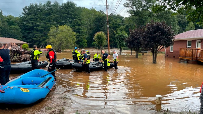
In this image provided by New Hanover County Fire Rescue, members of North Carolina’s Task Force 11, based in New Hanover County, are shown during rescue efforts in Canton, N.C, on Tuesday, Aug. 17, 2021. Authorities said that dozens of water rescues were performed after the remnants of Tropical Storm Fred dumped rain on the mountains of North Carolina. (New Hanover County Fire Rescue via AP)
(ASSOCIATED PRESS)
Tropical Depression Fred barreled through western North Carolina on Tuesday, leaving behind flooding, thousands of power outages, 2 people dead and many still missing as of today.
On Wednesday, North Carolina Governor Roy Cooper issued a state of emergency to address the damages caused by Fred.
"This state of emergency will allow our first responders to get into our affected communities quickly to save lives, restore power, remove debris and bring supplies," said Governor Cooper. "North Carolina is strong and resilient, and we’re committed to helping people and businesses recover as quickly as possible."
States of emergency have also been issued in Haywood, Jackson, McDowell, Mitchell, Rutherford, Transylvania and Yancey counties.
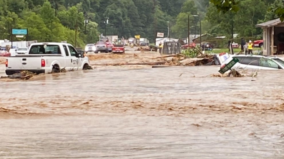
Flood damage in Haywood County, North Carolina.
NC Flood Damage (Video Credit: Meg Yarbrough via Storyful)
The hardest hit counties
States of emergency have also been issued in Haywood, Jackson, McDowell, Mitchell, Rutherford, Transylvania and Yancey counties.
In Haywood County, which lies just west of Asheville, two have been confirmed dead about 200 searchers have been dispatched to find the 20 people still missing after the floods, according to Haywood County officials.
Haywood County Sheriff Gregg Christopher says that some homes and entire mobile home parks were "completely destroyed."
On Thursday, Governor Cooper and North Carolina Senator Thom Tillis will tour flood-damaged areas in Hayward County.
Clyde and Canton Counties are under "boil water" advisories, meaning that the water in those areas has become unsafe to drink due to the floods.
The flood waters have also destroyed roads and bridges across western North Carolina.
Reminder: U.S. 276 remains accessible by residents and emergency responders only. Law enforcement will be checking ID at the intersection by Jukebox Junction. This allows emergency crews to respond to damage from #Fred 2ncwx pic.twitter.com/aYL5Az7lBh
— NCDOT Western Mts (@NCDOT_Westmtn) August 19, 2021
The future for Fred
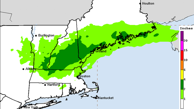
Fred is now making its way up the Northeast at about 15 mph. According to the National Hurricane Center, flash flood watches are in effect for part of New York and central New England.
According to the National Hurricane Center, Fred has maximum sustained winds near 25 mph with higher gusts and is expected to produce 1-3 inches of rain in eastern New York and New England. Isolated maximum storm totals in those areas may reach 5 inches.
Flood risk caused by Fred is expected to diminish by Friday morning.

(National Weather Service)

