Spring temperature rebound begins across South as winter tightens grip across Great Lakes, Northeast
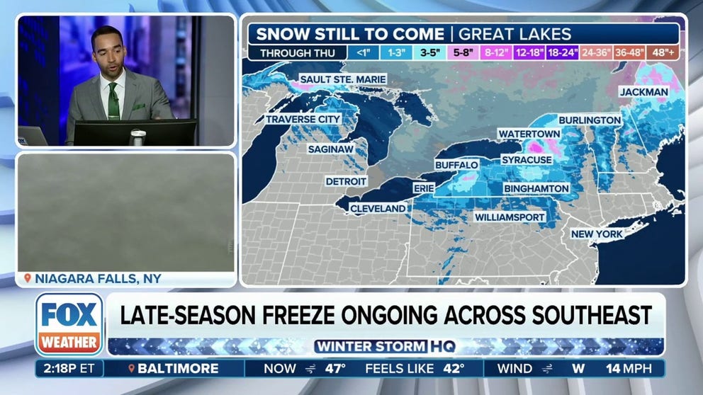
While the South gets set to welcome the warmer weather, cold air remains in place across the Great Lakes region and Northeast, which has allowed for lake-effect and lake-enhanced snow to break out across the region.
Great Lakes, Northeast continue to deal with snow as temperatures rebound in the South
Portions of the interior Northeast and Great Lakes are again dealing with lake-effect and lake-enhanced snow on Tuesday as temperatures rebound in the South were millions had been under Freeze Warnings earlier in the day.
Freeze Warnings that had been in effect for nearly 25 million people in 11 states across the South and Southeast Tuesday morning have been allowed to expire, setting the stage for a much-needed temperature warmup there as spring finally begins.
But while the South gets set to welcome the warmer weather, cold air remains in place across the Great Lakes region and Northeast, which has allowed for lake-effect and lake-enhanced snow to break out across the region.
Lake-effect snow, snow squalls continue in Northeast

(FOX Weather)
Cold temperatures have been settled across the northern tier all week, and Tuesday will be another day in which forecast high temperatures aren’t expected to get out of the 30s from cities like Marquette in Michigan to Burlington in Vermont.
And if that wasn’t enough, the region faces another day in which lake-effect snow and dangerous snow squalls could develop and lead to some potentially dangerous travel from the Great Lakes to the Northeast.
DON'T LEAVE ANY OF THESE ITEMS IN YOUR CAR THIS WINTER

(FOX Weather)
The National Weather Service said cold air flowing over the relatively warm waters of the Great Lakes will be the culprit for lake-effect snow to break out on Tuesday, and it will be further enhanced as a low-pressure system crosses from Canada to Maine over the next few days.
While most of the region won’t see too much snow accumulation, the greatest chance of seeing 6 inches or more of additional snow is across Michigan’s Upper Peninsula and northern and western areas of New York, including Tug Hill Plateau, as well as the higher elevations across New England in Vermont, New Hampshire and Maine.
