Weekend winter storm to bring severe weather to South, heavy snow to Northeast
Moderate-to-heavy snow will primarily target the Interstate 90 corridor from Des Moines, Iowa, to Chicago and eastward into New England this weekend. Meanwhile, dangerous severe storms are likely to erupt across the South and Southeast on Saturday.
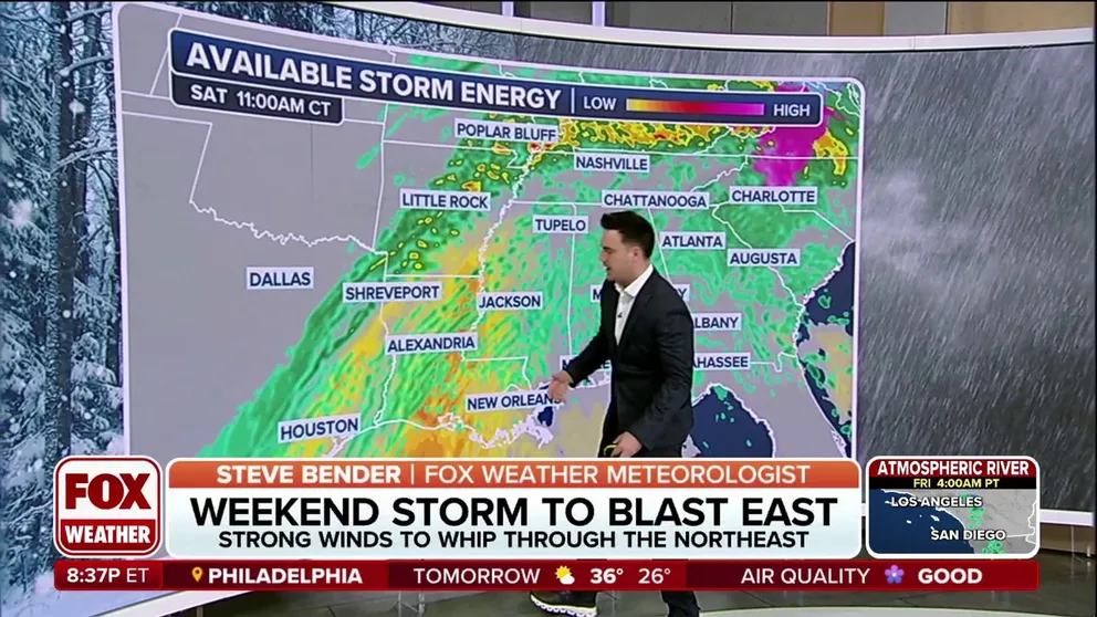
See the ingredients coming together for a weekend storm system
Severe storms, flooding, snow and ice will occur over the weekend. FOX Weather Meteorologist Steve Bender breaks down the possibilities.
Fast Facts:
- A major winter storm will pile more snow across over 25 states this weekend, creating a travel nightmare for hundreds of millions.
- The heaviest snow is expected in the interior Northeast, with strong winds blasting through the region as the storm intensifies.
- The possibility of damaging winds and tornadoes is very likely from Texas to Alabama on Saturday, reaching the I-95 corridor on Sunday.
- Heavy rain threatens flash flooding and major river flooding across the Ohio and Tennessee valleys.
The seemingly endless cycle of snow, torrential rain and disruptive weather will continue this weekend as a powerful storm system lashes the central and eastern U.S., with the added threat of a multiday severe weather outbreak.
Dangerous severe storms are likely to erupt across the South and Southeast on Saturday and into Saturday night. Damaging wind gusts, hail and tornadoes will be possible. Just how high the tornado threat will be remains in question, the FOX Forecast Center said.
The National Weather Service's Storm Prediction Center has issued a Level 3 out of 5 on the severe storm risk scale for portions of Louisiana, Arkansas, Mississippi and Alabama.

(FOX Weather)
Weekend storm could also trigger major flooding across South, Ohio Valley
In addition to the severe storms, another round of substantial rain throughout Saturday will lead to a widespread risk for flash flooding across the South and Ohio Valley.
Rainfall amounts of 3-5 inches or higher are possible, particularly across portions of Kentucky, Tennessee, southern Ohio and southern West Virginia.

(FOX Weather)
A Level 3 out of 4 risk for flash flooding is already in place, and the potential exists for numerous flash floods, some of which could be significant.
In addition, moderate to isolated major river flooding is possible this weekend across portions of central and eastern Kentucky, southwestern Virginia and northern and Middle Tennessee.
Weekend winter storm to keep piling up snow in northern US
Moderate-to-heavy snow will primarily target the Interstate 90 corridor from Des Moines, Iowa, to Chicago and eastward into New England.
A good chunk of upstate New York and New England could potentially see another significant round of snowfall, possibly up to a foot, especially north of Boston. Additionally, strong winds could create treacherous travel conditions.

(FOX Weather)
For cities along the Interstate 95 corridor, including New York City, Philadelphia and Washington, the same cold front fueling severe storms in the South could hold together as it moves north, the FOX Forecast Center said.
Some computer forecast models even suggest moderate warming could lead to scattered thunderstorms, a complete 180 degrees from the wintry conditions seen earlier in the week.

(FOX Weather)