Severe storm and flash flood threat mounts across Gulf Coast and Florida as coastal storm develops
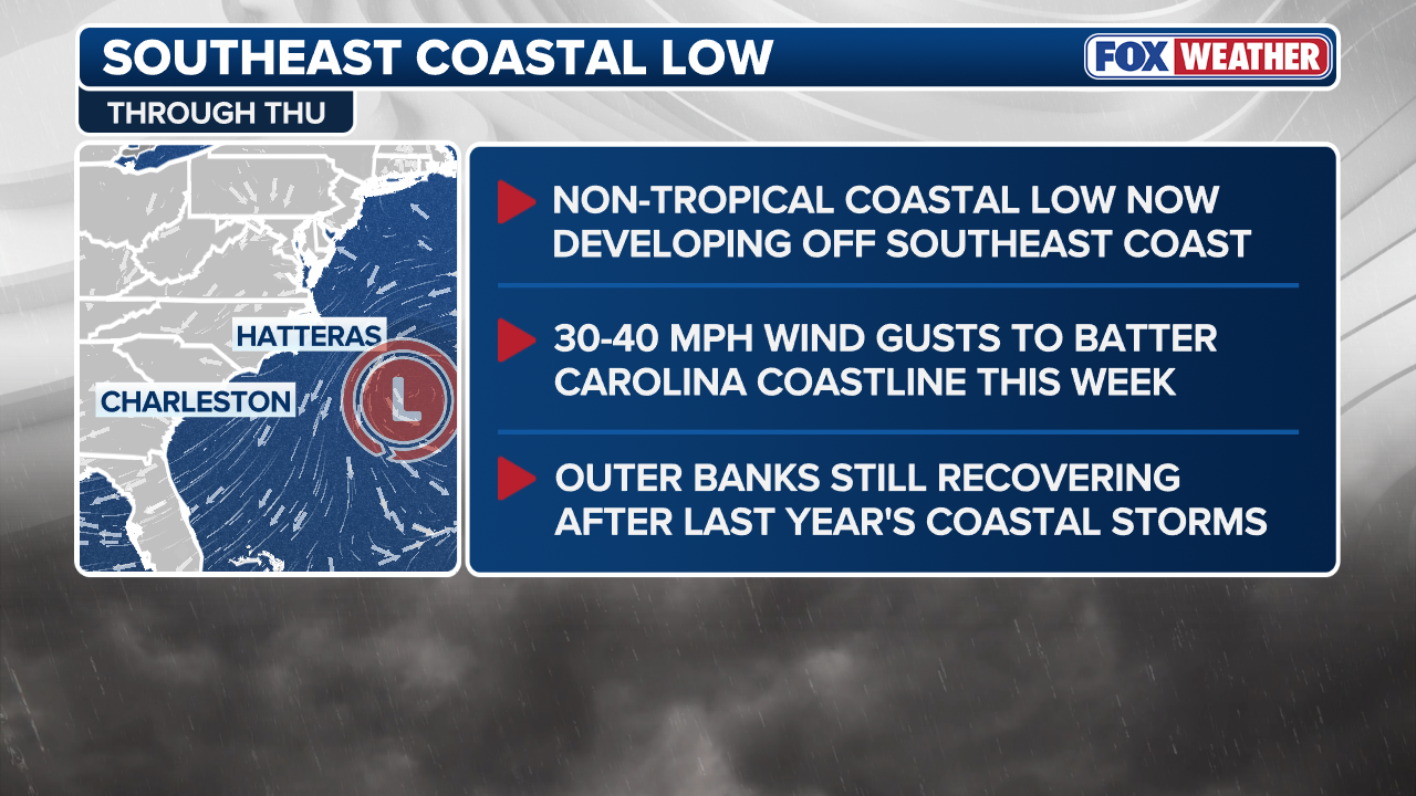
The FOX Forecast Center is monitoring a non-tropical area of low pressure that will begin to form off the Carolina coast on Tuesday.

Severe storms to redevelop over Southeast, Florida as flood threat spans parts of Gulf Coast
Millions along the Gulf Coast and across parts of the Southeast are under a flash flood threat from another round of heavy rain on Tuesday, in addition to severe storms that are forecast to redevelop over much of Florida.
Millions along the Gulf Coast and across parts of the Southeast are under a flash flood threat from another round of heavy rain on Tuesday, in addition to severe storms that are forecast to redevelop over much of Florida.
ATLANTIC HURRICANE SEASON: WHAT TO KNOW ABOUT THE 2026 FORECAST

Thunderstorm looms over Lester, Alabama Monday.
(Ethan Kerr via Storyful / FOX Weather)
This threat is part of the same system that knocked out power for hundreds of thousands of customers across Alabama on Monday.
Meanwhile, a non-tropical coastal storm is beginning to form off the Carolina coast, bringing the risk of beach erosion just as the Atlantic hurricane season begins.
![Photo shows crews working to add extra pilings to a home in Buxton, NC on March 10, 2026.]() Image 1 of 5
Image 1 of 5Photo shows crews working to add extra pilings to a home in Buxton, NC on March 10, 2026. (Jenni Koontz/Epic Shutter Photography via Storyful)
![This image from FOX Weather Correspondent Robert Ray shows large waves crashing onshore in Buxton, North Carolina, where numerous homes have fallen into the Atlantic over the past few weeks.]() Image 2 of 5
Image 2 of 5Oct. 2025: This image from FOX Weather Correspondent Robert Ray shows large waves crashing onshore in Buxton, North Carolina, where numerous homes have fallen into the Atlantic over the past few weeks. (Robert Ray)
![Debris from collapsed homes sits in a massive pile on the beach in Buxton.]() Image 3 of 5
Image 3 of 5Debris from collapsed homes sits in a massive pile on the beach in Buxton. (Katie Byrne)
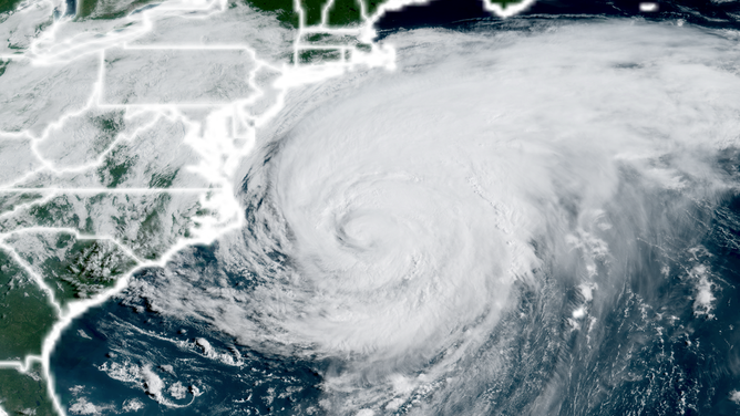
![Satellite image of Hurricane Erin on Thursday morning, Aug. 21, 2025.]() Image 4 of 5
Image 4 of 5Satellite image of Hurricane Erin on Thursday morning, Aug. 21, 2025. ( )
![BUXTON, NC - MARCH 19 : An aerial view of the recently moved house (bottom right) and a few other houses that are slated to be moved back from the approaching ocean March 19, 2026 in Buxton NC.]() Image 5 of 5
Image 5 of 5BUXTON, NC - MARCH 19 : An aerial view of the recently moved house (bottom right) and a few other houses that are slated to be moved back from the approaching ocean March 19, 2026 in Buxton NC. ((Daniel Pullen for The Washington Post via Getty Images))


Thunderstorms organized into a nearly 200-mile-long line as they swept across the Mid-South Monday afternoon. NOAA's Storm Prediction Center (SPC) received over 50 reports of downed trees due to damaging wind gusts, and more than 150,000 customers were without power at the height of the storms, according to Poweroutage.us.
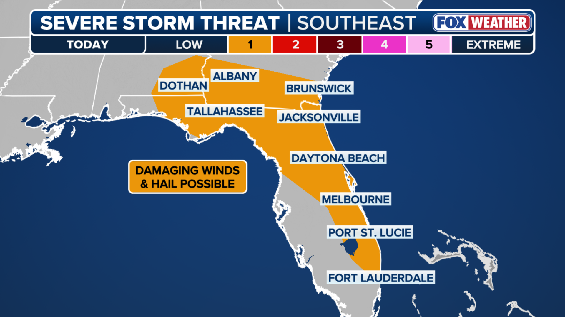
The severe storm threat will reignite Tuesday afternoon. A Level 1 out of 5 risk of severe thunderstorms covers parts of southeastern Alabama, including Dothan, as well as southern Georgia, North Florida and Florida's Atlantic Coast from Jacksonville to Fort Lauderdale.
Strong wind gusts will be the main hazard, but this latest round of rain will continue to help ease extreme drought conditions across this region.
(FOX Weather)
These severe storms are tapping into another plume of tropical moisture that has spread across the entire Southeast, producing downpours similar to those seen last week.
BRYAN NORCROSS: WELCOME TO HURRICANE SEASON 2026
Non-severe showers will also be fueled by this moisture and could produce another 1 to 2 inches of rain through Tuesday evening across parts of the Gulf Coast.
A broad Level 1 out of 4 risk of flash flooding includes East Texas and much of Louisiana, as well as the areas covered under the severe weather threat across Alabama, Georgia and Florida.

(FOX Weather)
Developing coastal storm to bring rough surf, rip currents to Carolina beaches
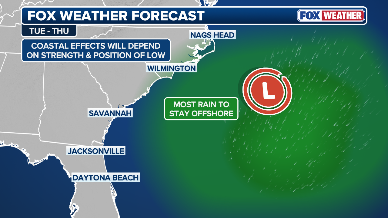
The FOX Forecast Center is also monitoring a non-tropical area of low pressure that's beginning to form off the Carolina coast, as the severe weather system moves offshore and interacts with a cold front near the East Coast.
HOW HIGH PRESSURE AND LOW PRESSURE DRIVE THE WEATHER
Currently, the FOX Forecast Center believes this system will form more than 300 miles offshore and pull away from the coast, tracking into the Atlantic — with most of the rain expected to remain out at sea.
(FOX Weather)
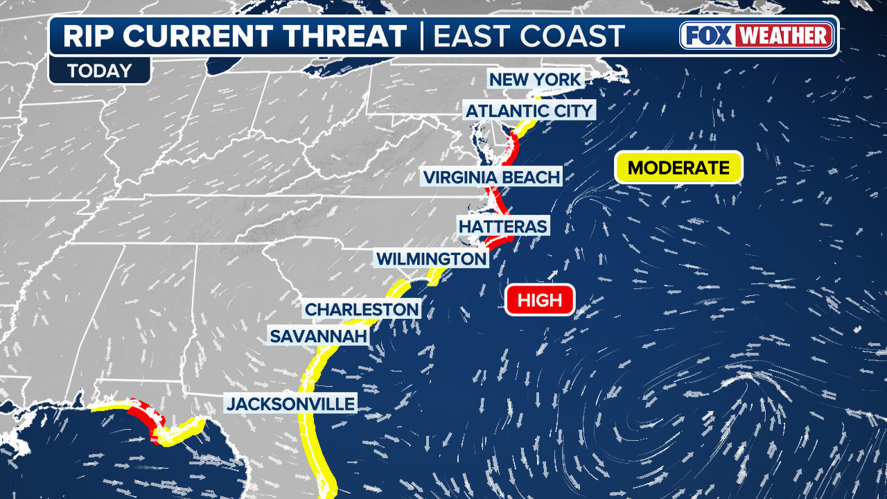
However, this track can still create rough surf, cause minor beach erosion and increase the risk of dangerous rip currents.
In fact, a moderate rip current risk spans the Eastern Seaboard from New York City to Florida Tuesday, with the National Weather Service issuing a high rip current risk along North Carolina's Outer Banks and beaches on the Delmarva.
(FOX Weather)
Those erosion impacts were evident last hurricane season, when major hurricanes Erin, Humberto and Imelda caused significant beach damage along the Carolina coast despite remaining offshore and contributed to the collapse of several homes along North Carolina's Outer Banks.
The forecast does not call for any coastal flooding from this system.
(FOX Weather)
An area of high pressure building over the Northeast is expected to shield most of the East Coast from any rain.
Stay tuned to FOX Weather as we continue to track the potential impacts over the next few days.