Yosemite National Park areas to see measurable snow on Monday
Snow levels will drop to 8,000 feet, likely bringing measurable snow to parts of the Sierra Nevada. A Winter Weather Advisory is in effect for a swath of the mountains, including those inside Yosemite National Park.
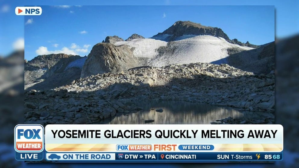
FILE - Yosemite National Park glaciers given new life after record-breaking snowfall
FILE - One of the last glaciers near Yosemite National Park was about to disappear, but after a heavy snowpack in the Sierra Nevada mountain range in 2022-23, it has been given new life. Back-to-back winter storms left 15 feet of snow on the ground, breaking a 54-year-old daily record for the amount of snow falling at one time. What does that mean for the future? FOX Weather's Max Gorden reports.
YOSEMITE NATIONAL PARK, Calif. – The calendar still says summer, but winter is coming early to parts of California’s Sierra Nevada this week, including Yosemite National Park.
A trough of low pressure diving out of the Pacific Northwest is swinging southeast through Northern and Central California on Monday, bringing a pool of cool air and moisture along for the ride.
Snow levels will drop to 8,000 feet, likely bringing measurable snow to parts of the Sierra Nevada. A Winter Weather Advisory is in effect for a swath of the mountains, including those inside Yosemite National Park.
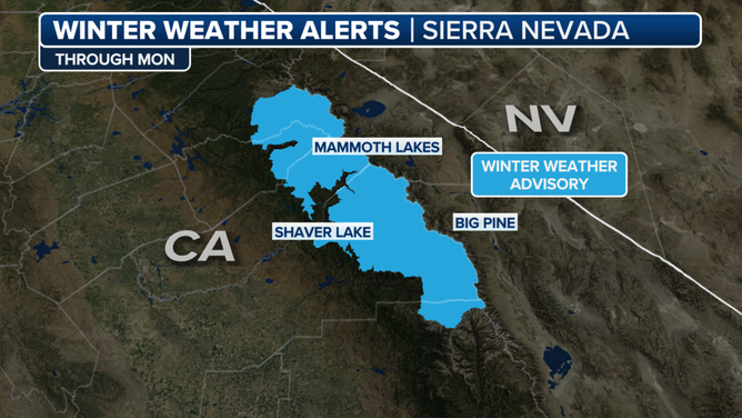
Winter Weather Advisory for the Sierra Nevada.
(FOX Weather)
Tioga Pass and Tuolumne Meadows could see up to 3 inches of snow, with even some measurable snow as low Yosemite’s Badger Pass by Monday afternoon, according to the National Weather Service in Hanford, California.
Cooler temperatures and scattered rain showers will push into the lower elevations, bringing a respite from what has been a relentlessly hot summer in the San Joaquin Valley. Highs are expected to drop below 90 degrees.
While this initial dollop of mountain snow will taper off by late Monday, another trough of low pressure may bring another blanket of mountain snow in the middle of the week.