The more you GOES: 7 things to know about NOAA's new weather satellite
Find out why meteorologists can't wait to get their hands on new GOES data
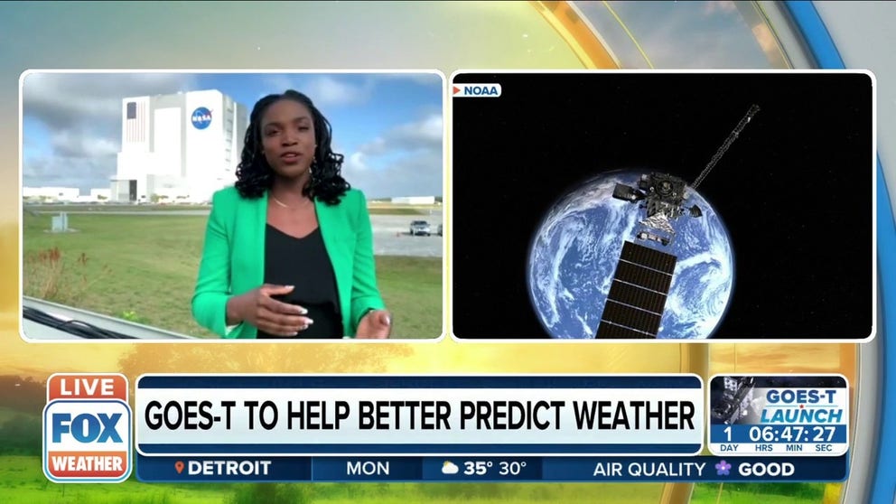
GOES-T satellite will help better predict the weather
Tewa Kpulun, Geostationary Lightning Mapper (GLM) Science Lead at Lockheed Martin, explains how the GOES-T satellite will help better predict the weather.
CAPE CANAVERAL, Fla. — Improving forecasts to help people is something every meteorologist hopes to do which is why the forecasting community is pretty excited about NOAA's new weather satellite.
NOAA and NASA's newest weather-monitoring satellite GOES-T will launch from Florida on March 1. The satellite will track hurricanes, wildfires and provide advanced warnings for tornadoes and give advanced warnings of incoming space weather caused by solar flares.
FOX Weather will have live coverage of the GOES-T launch from Florida starting Monday through the launch on Tuesday afternoon.
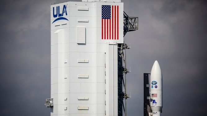
The National Oceanic and Atmospheric Administration's (NOAA) Geostationary Operational Environmental Satellites (GOES) T satellite on a United Launch Alliance Atlas V 541 rocket during the NASA rollout event in Cape Canaveral, Florida, U.S., on Monday, Feb. 28, 2022.
(Getty Images)
Here are seven key facts about the new GOES satellite that will help you truly appreciate the powerful weather imager.
GOES history
The first Geostationary Operational Environmental Satellite launched from Cape Canaveral, Florida, in 1975.
In total, there have been 17 satellites, soon to be 18, orbiting at a speed to match Earth's rotation so that they can continually keep watch on a designated region.
More than 22,000 miles away, NASA estimates the satellites have taken over 3 million images of Earth so far, provided critical data for climate forecasts and warned of solar disturbances.
There are currently three active GOES satellites, with the plan for GOES-T to join the pack in the coming days.
READ MORE: 46 years of GOES: How a history of achievements has changed weather forecasting
Lightning mapper
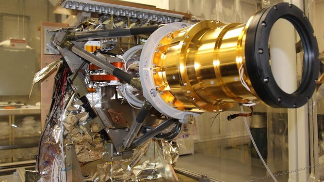
The Geostationary Lightning Mapper (GLM) Sensor Unit is shown prior to preparations for thermal vacuum testing.
( Lockheed Martin Advanced Technology Corporation)
The Geostationary Lightning Mapper, or GLM, detects momentary changes and indicates the presence of lightning. It does this using its near-infrared transient detector.
The lightning mapper measures a dedicated region within the U.S. and provides detection at an exceptional rate, providing spatial resolution and detection efficiency.
No matter the time of day, lightning can be tracked, whether in-cloud, cloud-to-cloud or cloud-to-ground.
Monitoring lightning activity helps to forecast the development of severe storms and is also vital for formation detection of tornadoes and strengthening hurricanes.
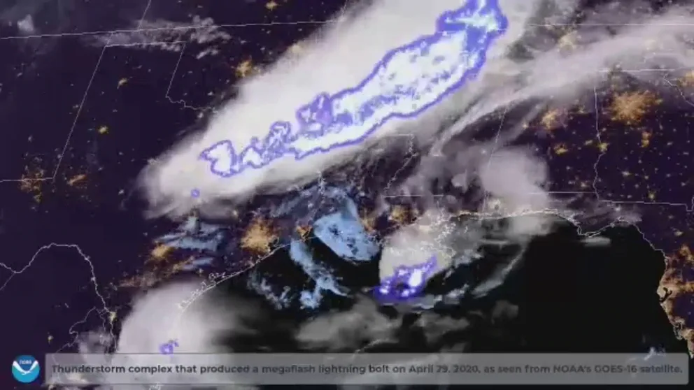
Longest lightning flash on record confirmed by meteorologists
Satellite images captured by the National Oceanic and Atmospheric Administration show a storm that brought a flash of lightning that spanned Texas, Louisiana and Mississippi on April 29, 2020. The World Meteorological Organization claims the 477.2-mile-long flash broke the previous record for longest detected ‘megaflash.’
Arleen Knaub, Deputy Manager for GOES at Lockheed Martin, says that role that GLM will play is crucial for forecasters.
"They get this science data down [from the satellite], and they're able to see trends like for the global lightning mapper. They were able to determine the formation of tornadoes, they're now able to predict more accurately the formations of tornadoes, so they'll see a great uptick in lightning strikes in a particular area and then a sharp decrease. And then they know that a tornado is going to form within the next 15 minutes, which gives us advance warning to people on the ground," Knaub says. "We actually save lives. So, it's incredibly impactful."
Tracking the electrically active individual thunderstorms is huge in forecasting and lead time for forecasters. It will also help to identify strengthening and weakening storms.
Geostationary Lightning Mapper will help GOES satellites better detect lightning strikes
The Geostationary Lightning Mapper will better help GOES satellites detect lightning strikes.
In strong storms, lightning may travel hundreds of miles before striking the ground. NOAA says that GLM can show forecasters areas far from the main line of storms where the risk of ground strikes presents a public safety hazard.
READ MORE: ‘It saves lives’: Geostationary Lightning Mapper crucial feature for GOES series
Detecting and monitoring wildfires
In 2021, six wildfires in the West caused more than a billion dollars in damages.
With GOES fixed over one area, crews will monitor those areas constantly and in real-time. The data collected will allow officials to track the spread and provide information for air quality modeling.
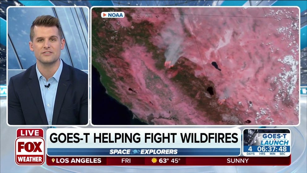
GOES-T will help fight wildfires with new detection technology
GOES-T will help fight wildfires with new detection technology.
The infrared capabilities provide information on how the fire is growing and the temperature it's burning. The satellite also shows smoke plumes and the intensity of the fire.
And with the lightning mapper aboard GOES-T, it will be able to monitor areas with lightning flashes most likely to ignite fires.
According to NOAA, lightning-initiated wildfires account for more than half of the acreage burned in the continental U.S. In many cases, fires ignited by lightning occur in less populated areas, resulting in a lag detection time.
NOAA says that emergency personnel will be able to find small and even smoldering fires before they grow, reducing forest and property loss, lowering firefighting costs, and improving air quality.
Assessing burn scars can also be used by the satellite. This information is vital for future risk assessments.
ABI: Characterizing weather by color spectrum
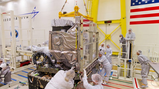
The GOES Advanced Baseline Imager (ABI) is installed onto the GOES-R spacecraft at Lockheed Martin in Littleton, Colorado, on October 13, 2014. The ABI resides on the Earth-Pointing Platform of the spacecraft, along with the Geostationary Lightning Mapper. ABI was developed and built by Exelis in Ft. Wayne, Indiana.
(Lockheed Martin)
Another GOES-T instrument called the Advanced Baseline Imager, or ABI, can take an image of the Earth every 10 minutes while simultaneously looking at regional pictures for severe storms.
L3Harris built the ABI and contributed its first GOES weather imager in the early 1990s.
"[ABI] takes pictures in 16 different colors or spectral bands, ranging from the visible blue out to thermal infrared wavelengths," said Daniel Gall, Chief Systems Engineer for the L3Harris ABI team. "That helps forecasters characterize many aspects of the atmosphere and what's going on there."
Why so many colors? These different spectrums show different features like the atmosphere and water vapor.
"That helps characterize moisture and patterns in those different parts of the atmosphere," Gall explains. "And the more colors you look at, you can pick out different features, different characteristics and do more science."
L3 Harris also provides the ground system that helps command, control and downlink data from the GOES series.
"The ground system ensures that that data gets out to NOAA forecasters … less than 30 seconds after it's collected on-orbit, down to the ground and out to users," Gall said.
The ground system handles about 3.5 terabytes of data every day from the satellites.
Space weather forecasting
NOAA and NASA's newest weather-monitoring satellite will also improve space weather forecasting, giving warnings of incoming geomagnetic storms.
While solar flares also cause beautiful phenomena like the Northern Lights, the same flares can knock out satellite communication or even create drag, causing the spacecraft to pull closer to Earth.
GOES-T has a suite of instruments to detect and provide advance warnings for space weather hazards that could disrupt communication and navigation satellites and cause power blackouts.
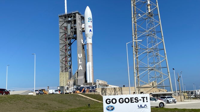
The Atlas V and GOES-T at SLS 41 at Cape Canaveral Space Force Station. (Image: Emilee Speck/FOX Weather)
(FOX Weather)
Two of the instruments point directly at the sun to measure solar rays.
The Solar Ultraviolet Imager (SUVI) telescope looks at extreme ultraviolet wavelengths. It looks for active sun areas that could emit solar flares or solar filaments that may give off a coronal mass ejection. Knowing when these solar events happen will help provide early warning on Earth.
The Extreme Ultraviolet and X-ray irradiance sensors (EXIS) detect solar flares and monitor the impacts of those flares on the upper atmosphere. The X-ray sensor will alert NOAA when flares are strong enough to cause blackouts, while the extreme ultraviolet sensor measures changes in Earth's ionosphere from large solar flares.
Two other instruments will be looking closely at the near-Earth space environment.
The Space Environment In-Situ Suite (SEISS) has four sensors that monitor energetic particles surrounding Earth. The Magnetometer monitor measures changes to the magnetosphere that could be dangerous to spacecraft or astronauts in space.
For example, NASA has to consider radiation from solar storms to determine if it will be safe for astronauts to spacewalk outside the International Space Station.
"Earth's magnetic field is important because the magnetic field protects us from the solar wind," Arleen Knaub, deputy program manager for GOES at Lockheed Martin said. "If the Earth's magnetic field is declining or changing, we want to know that because then the solar wind can strip away the Earth's atmosphere."
READ MORE: How NOAA's new GOES spacecraft will improve space weather forecasting
Why geostationary orbit?
When GOES-T reaches its final destination, it will be 22,300 miles above Earth.
It will take about 4 hours after the Atlas V launches for the satellite to reach this orbit and then several months of testing before the spacecraft is fully operational.
Dan Lindsey, NOAA GOES-R program scientist, helps explain why GOES-T will be so far away compared to the many satellites in low-Earth orbit much closer to home.
"It orbits the Earth at the same rate that the Earth spins. And the advantage of that is you're able to take an image of the Earth every five minutes, every 10 minutes or even every one minute, and then put those together in a series of images, sort of like having time-lapse photography from space," Lindsey said. "You can see things on the Earth, moves such as clouds, you can see the clouds in a hurricane spin. We can watch the wildfires progress, and it really is an absolutely critical asset for forecasters on the Earth to get that imagery."
That data is then available to NOAA within two to three minutes after the spacecraft sees the weather.
Climate data: Cloud cover
GOES-T will also collect data to better understand Earth's changing climate. Both NOAA and NASA will use this data.
One example of climate change data is collected through the ABI.
"ABI measures cloud information such as where are the clouds? How do they change throughout the day? And that's something that potentially changes with the changing climate," Lindsey said. "For example, if you have more clouds over a certain region than you had 20 30 years ago, that can have feedbacks on the Earth's climate."
What's next?
NASA will launch the next satellite for the GOES program on Tuesday from Florida.
Once in orbit, the approximately 11,500-pound spacecraft will be positioned to watch over the Western U.S., Central America and the Pacific Ocean.
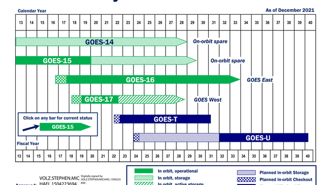
Years that the GOES satellites will be in orbit.
(NOAA)
NASA says the spacecraft will continue improving forecasting capabilities and provide real-time warnings of disturbances on Earth and in space.
It'll gain the designation of GOES-18 while scientists back on Earth continue the assembly of its predecessor.
NOAA is aiming to launch GOES-U by mid-2024, with the hope that the new additions keep a watchful eye over the skies through 2040.
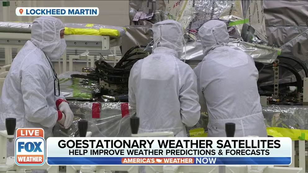
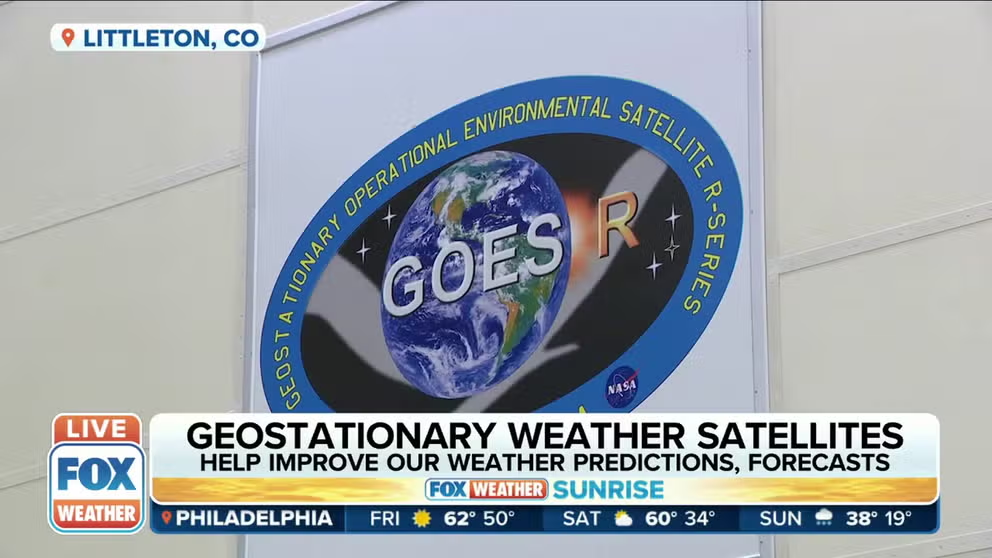
GOES Series helping Improve Weather Forecasts
FOX Weather goes inside the Lockheed Martin clean room in Colorado.