7 things to know about floodplains
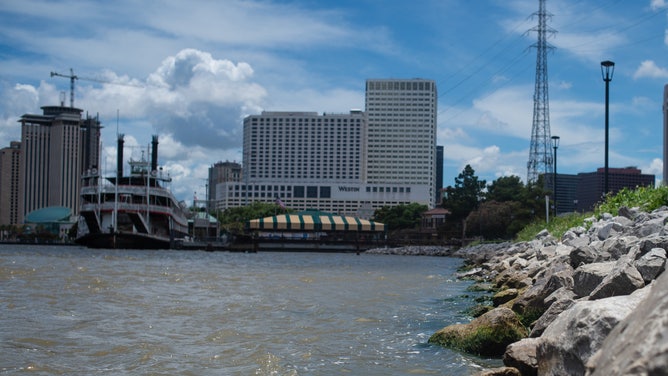
Floodwaters from the Mississippi River splash against the Levees of Downtown New Orleans. (Photo by Matthew Hatcher/SOPA Images/LightRocket via Getty Images)
(Getty Images)
Nearly 90 million people around the world live in floodplains and might not even know it. In fact, NASA satellite images show the number of people living in flood-prone areas is increasing.
With dams and levees, communities have built up around floodplains, including some of the nation's most historic cities.
Read on to learn seven things about floodplains, how people can live around these low-lying areas, and the importance of flood management.
What is a floodplain?
Let's start with the basics.
A floodplain is typically a low-lying area near a river or body of water. In the rainy season, severe weather, or heavy snowmelt, the water will often spill over into these areas.
The video below by The Nature Conservancy explains how floodplains work and what happens when communities build up around those areas.
The benefits of natural floodplains
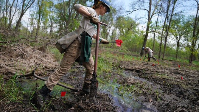
Conservation Corps volunteers planted hundreds of young trees Wednesday, May 22, 2019, in a Mississippi floodplain on national refuge land in southeast Minnesota. More frequent, severe flooding due to climate change affects critical bird habitats in the floodplain forests around the Mississippi River. (Photo by Anthony Souffle/Star Tribune via Getty Images)
(Getty Images)
Most associations are immediately alarming when you hear the word "flood," but natural floodplains benefit wildlife around rivers and provide biological flood control. The ecosystems around rivers need small floods to thrive.
According to the American Rivers nonprofit, "giving rivers room to move is our best protection against floods and is a great way to help keep rivers healthy."
Floodplains also help restore groundwater aquifers and provide nutrients for habitats along rivers. According to FEMA, these areas often contain wetlands which directly affect the quality of the local environment.
[RELATED: What does the term '100-year flood' actually mean?]
Flood management vs. floodplains
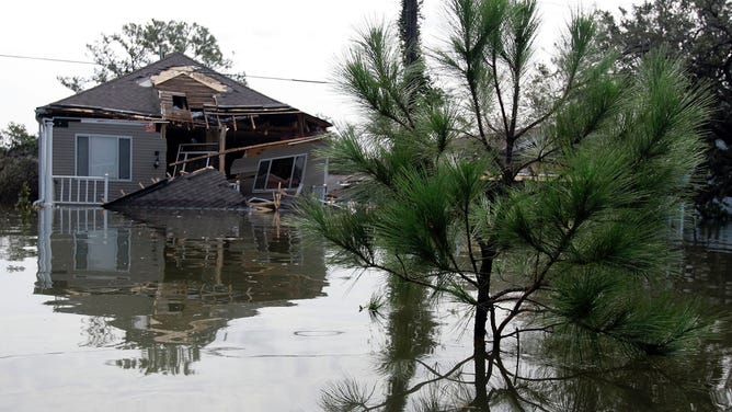
A home with only its second story visible sits destroyed by Hurricane Katrina on August 30, 2005, in New Orleans, Louisiana. Devastation was widespread throughout the city, with water 12 feet high in some areas. (Photo by Chris Graythen/Getty Images)
(Getty Images)
Dams and levees can be used to prevent floodplains from filling up with overflow by redirecting water into a dam instead of allowing the river to expand outward along low-lying areas. These structures are why communities can build around a natural floodplain, but sometimes nature has other plans.
Storm surge from Hurricane Katrina in 2005 caused the levees and floodwalls to fall, causing devasting flooding in 80 percent of New Orleans and along the Gulf Coast. The American Red Cross estimates more than 300,000 family homes were destroyed and hundreds of thousands of people were displaced.
According to FEMA's review of building plans after Katrina, storm surge exceeded the mapped base flood elevations in many coastal areas.
An example of successful floodplain management
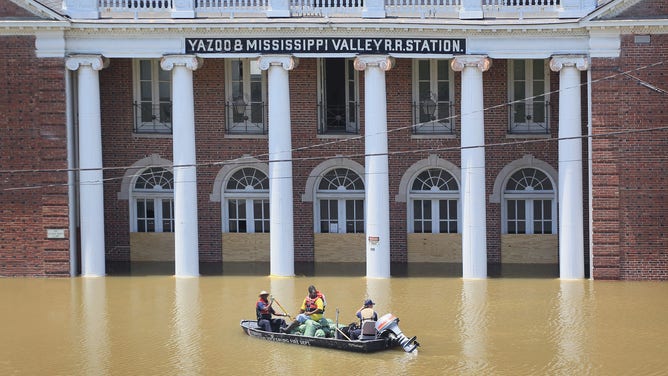
City workers transport a load of sandbags to be used in re-enforcing a levee gate past the Yazoo & Mississippi Valley Railroad Station May 11, 2011 in Vicksburg, Mississippi. The Mississippi River at Vicksburg was expected to crest at a record 58.5 feet. (Photo by Scott Olson/Getty Images)
(Getty Images)
Human-made structures combined with flood management can prevent disastrous flooding in communities built near floodplains.
An example of successful floodplain management was the Mississippi River flood in 2011 when the lower river experienced the most significant floodwaters ever recorded. Because of previous devastating floods in 1927, the U.S. Army Corps of Engineers developed the Mississippi Rivers and Tributaries Project, combining river and floodplain management and new levee placement and dam operations.
The 2011 flood put the MR&T project to the test, and the system managed the flood without a single levee breach or death. However, damage to homes and property throughout the region was still widespread.
"The dramatically different outcomes of the floods of 1927 and 2011 emphasize the effectiveness of both system-scale approaches to river management and the value of hydrologically connected floodplains, as use of the floodways was essential to reducing flood risk for riverside cities," according to a study by The Nature Conservancy.
Research shows more people are living near floodplains
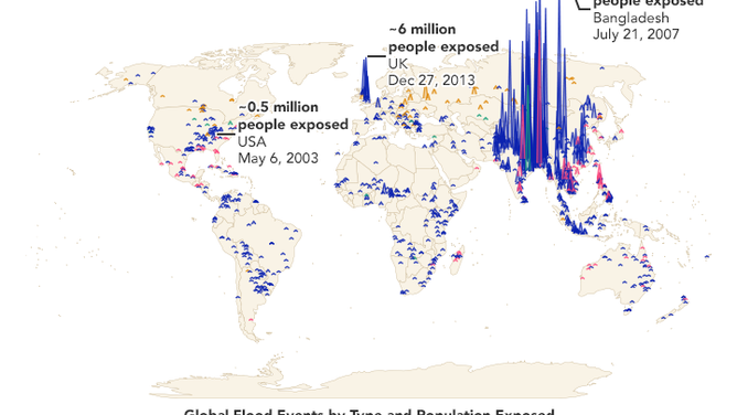
A map using NASA satellite data shows the number of people exposed to flooding is increasing.
(NASA/Benjamin Cooley/ Cloud to Street)
A study funded in part by NASA and Google Earth Outreach looked at satellite data of flood events over 20 years and found that the number of people living in flood-prone areas is growing.
According to the study, 24 percent of the world's population now lives in areas exposed to floods, increasing by 4 percent over the past two decades.
The study also found that areas with increased exposure to floods are concentrated in middle-to-low-income countries in Asia and Sub-Saharan Africa.
Meanwhile, in the U.S., 25 percent of North Carolina's population is exposed to flooding. Researchers attribute this increase to flooding caused by hurricanes Florence and Michael.
Researchers used data from the study to create the Global Flood Database.
How to know if you are living near a flood-prone area
The Federal Emergency Management Agency has a map to help determine if an area is more likely to flood. The map is used by the National Flood Insurance Program and shows areas that are expected to be covered with water when 11 inches of rain falls in 24 hours. This downfall, known as the 100-year storm, is unlikely to happen, with only a 1% chance of occurring within a year.
Enter your address at FEMA.org to find out your flood risk.
[MORE: Explaining flood alerts issued by National Weather Service]
What living near a floodplain means for you
Most homeowners insurance doesn't cover flood damage. According to FEMA, homes with a low-to-moderate risk are five times more likely to be damaged by a flood than a fire. After you determine your risk, you should contact your insurance company to add flood insurance.
FEMA's National Flood Insurance Program policy is one of the more affordable options.