How much snow will an inch of rain produce?
You look out at the freshly fallen snowfall -- maybe it's 6 inches -- and you wonder: How much rain would that have been had it been above freezing? Here's how to find out:

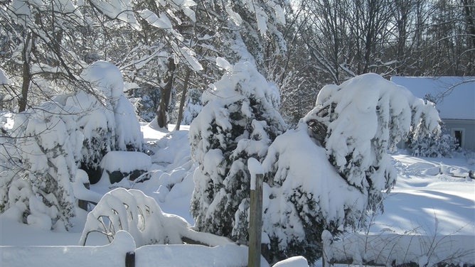
Heavy snow falls in Fairfax, Virginia on Feb. 7. 2010.
(Dr. Neal Kaske / NOAA)
You look out at the freshly fallen snowfall -- maybe it's 6 inches -- and you wonder: How much rain would that have been had it been above freezing?
In the past, the rule of thumb was relatively simple -- an inch of rainfall translated to about 10 inches of snow. Better and more recent research has now adjusted that rule of thumb to about a foot of snow to 1 inch of rain.
So that 6 inches that just fell, if it were a pretty typical snowfall, would have been about a half-inch of rain.
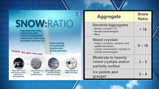
But not all snowstorms are created equal, as the temperatures at which the snow falls are a significant factor in determining how much snow will be generated from, say, an inch of rainfall. The colder the storm, the more snow you can expect to fall out of the same amount of available moisture compared to warmer, more fringe snow events.

(NOAA)
For example, as temperatures near the surface drop into the 20s, you might get a 15-to-1 snow-to-rain ratio with a 20-1 ratio as temperatures drop to near 20.
But as the air gets colder, it holds less moisture, so to get an inch equivalent of rainfall on temperatures well below freezing could make some eye-popping snow totals.
On the other hand, if temperatures go to or just above freezing, snow ratios could drop down to 5-to-1.
Thus, some parts of the country that get colder snow (like the upper Midwest) typically have larger snow-to-rain ratios than where snow is more marginal, like the Pacific coast and Tennessee Valley.
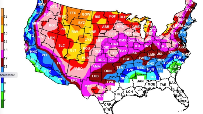
Marty Baxter, a professor of meteorology at Central Michigan University, produced a handy, interactive map that shows on average how much snow you could expect for an inch of rain.

Estimated snowfall-to-rain ratios across the U.S.
(Marty Baxter, Central Michigan University)
The average ratio around Minnesota is 13 or 14-to-1, with an average ratio of up to 15 or 16-to-1 in the Lake Effect snow areas of western New York and the Rockies.
On the other hand, snow ratios are down in the nine or 10-to-1 range in the Pacific Northwest and spots like Nashville and Raleigh, where any snowfall usually occurs right on the cusp of freezing.
The amount of ice inside a snow-producing cloud and how much wind accompanies the storms can also affect snow totals.