LIVE: Tracking first nor'easter of the season in Northeast
The first nor'easter of the season is expected to bring heavy rain, flooding and strong winds across the Northeast
Coverage for this event has ended.
Syracuse, NY saw a record-breaking 2.31" of rain Tuesday knocking off the previous 1943 record of 1.51". Their monthly October average is 3.24".
With 2.44" of rain, Binghamton broke their 1978 record of .77"
Cayuga Lake in Ithaca, NY is under a Flood Warning and is currently at the moderate flood level. Lake waters are forecast to rise to major flood level Thursday.
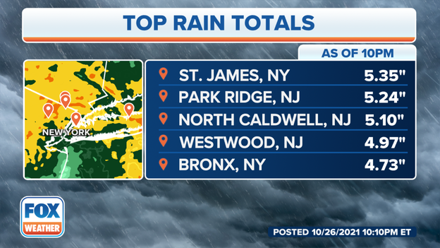
St. James, NY on Long Island just reported 5.35" of rain and Park Ridge, NJ had 5.24"
Heavy rain continues to travel north. Emergency managers in Tomkins County, NY in the Finger Lakes area report home and road flooding while crews are busy in Sullivan County with multiple water rescues. Do not drive through a flooded roadway.
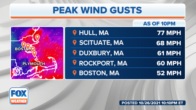
The nor'easter continues to pound Massachusetts with Boston reporting a 52 mph wind gust. Hull's top wind gust was 77 mph.
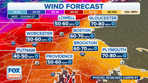
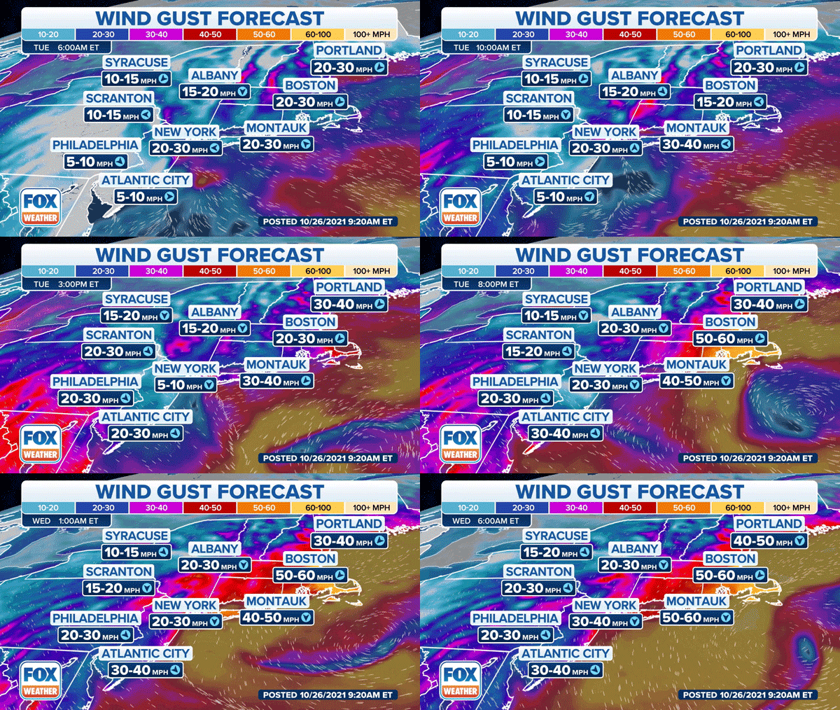
A reporting station in Scituate, MA clocked a 68 mph wind gust while Hull reported a 77 mph. Strong and gusty winds will continue to push north into the North Shore, New Hampshire, and Maine. Boston currently has 24 mph sustained winds and is bracing for forecasted 60 to 70 mph gusts into the early morning.
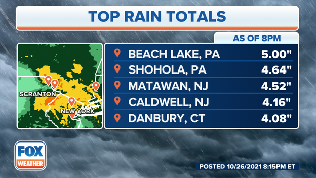
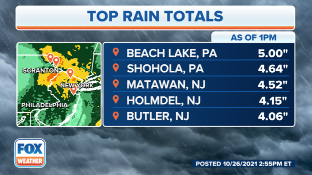
Heavy rains are tapering off through the Southern Delaware River Valley and the New York Tri-State area but flash flooding is still possible after the nor'easter dropped 5" of rain in Beach Lake, PA. Matawan, NJ had 4.25" since the start of the storm.
The Southern Tier of New York is under a Flash Flood Warning. Seneca County has declared a State of Emergency as underpasses and some urban area streets are underwater.
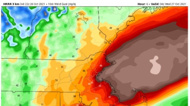
One of FOX Weather's forecast models shows tropical storm force winds across Cape Cod, Scituate, Boston and Gloucester around 10 PM EDT. The light tan area shows winds nearing 60 miles per hour.
The National Weather Service just recorded a 64 mph wind gust in Hull.
Strong winds already blew a tree into powerlines in Chatham taking out neighborhood power and blocking roads.
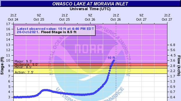
A Flash Flood Emergency has been issued for Moravia, NY and Locke, NY. NWS meteorologists said record flooding is expected on the Owasco Intlet. The inlet is expected to crest around 11 feet. Residents in low-lying areas are encouraged to seek higher ground.
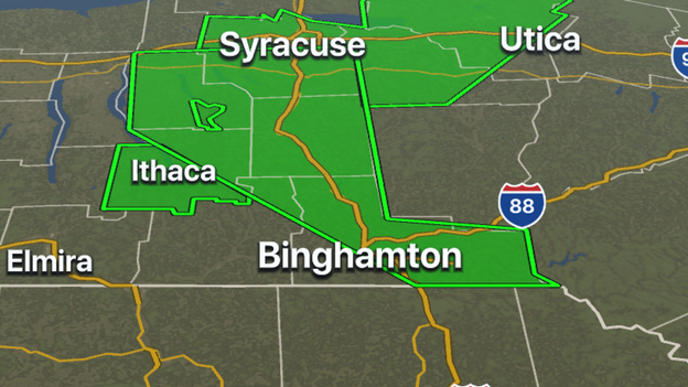
The National Weather Service in Buffalo is warning of heavy rainS and issued flood warnings for Cayuga, Ontario and Wayne counties until 11 p.m. Meteorologists say nearly 2 inches of rain has already fallen and more is on the way.
Several inches of rain have already fallen in parts of New Jersey, New York and Connecticut and it will continue for many areas. The FOX 3D Weather Radar is still lighting up with plenty of rain to go.
The NWS issued flood warnings for the Passaic River above Singac and at Little Falls in New Jersey.
At 3:45 p.m. the river was above 6 feet and the river's flood stage is 8.5 feet.
The river is expected to rise above flood stage late Wednesday morning and continue rising Thursday morning. Above 9 feet, area bridges will close.
The NWS has issued a flood warning for the Susquehanna River for Delaware and Chenango counties in New York.
Moderate flooding is expected from late Tuesday to early Friday morning, according to the NWS.
The flood stage for the river is 15 feet. At 3:30 p.m. Tuesday the stage was 11.2 feet.
With the nor'easter bringing heavy rainfall across the northeast it's a good time to stay off the roads but if you are driving, read below why you should not use cruise control in heavy rain.
The National Weather Service issued a flood warning for areas in central New York and northeast Pennsylvania.
Delaware County, Otsego County, Sullivan County in New York and Pike County and Wayne County in northeastern Pennsylvania are under flood warnings until 6:30 p.m. ET.
For flood warnings, you need to keep a close eye on water levels in your area and move to higher ground if those levels start to increase.
The Sullivan County Democrat reports at least two calls for water rescues have been made Tuesday to emergency services. The video above shows high water levels on Callicoon Creek.
Video from New York City shows a flooded street in Brooklyn.
Several inches of rain can be expected in the area as the season's first nor'easter moves through.
Video posted to twitter on Tuesday show cars driving over flooded roads in Piscataway, New Jersey.
The National Weather Service has issued a Flash Flood Warning valid until 3:45 p.m. Eastern time for western Delaware, southwestern Otsego and southwestern Sullivan counties in New York and Pike and Wayne counties in Pennsylvania.
Flooded roads have been reported by local law enforcement in several locations across the area, especially along Callicoon Creek, according to the NWS.
Between 2.5 and 3 inches of rain has already fallen, and moderate to heavy rain will continue into this afternoon, the NWS said.
The National Weather Service reported a vehicle was in the river near Kenoza Lake in Sullivan County, New York.
Roads in the area have been closed because of the flooding.
The National Weather Service has issued a Flood Warning valid until 4:15 p.m. Eastern time for Northampton, Monroe and eastern Carbon counties in northeastern Pennsylvania.
Doppler radar indicated periods of moderate to heavy rain across the area. Between 2 and 4 inches of rain have fallen so far, with an additional inch or two possible though the day, according to the NWS.
Flooding is ongoing or expected to begin shortly in the warned area, the NWS said.
The National Weather Service has issued a Flood Warning valid until 6:15 p.m. Eastern time for Greene and Ulster counties in east-central New York.
Doppler radar has indicated heavy rain over this area. Flooding of small streams, low-lying areas and poor-drainage locations is expected to begin shortly in the warned area, according to the NWS.
Between 2 and 3 inches of rain has already fallen, and an additional 1 to 2 inches is expected in the area, the NWS said.
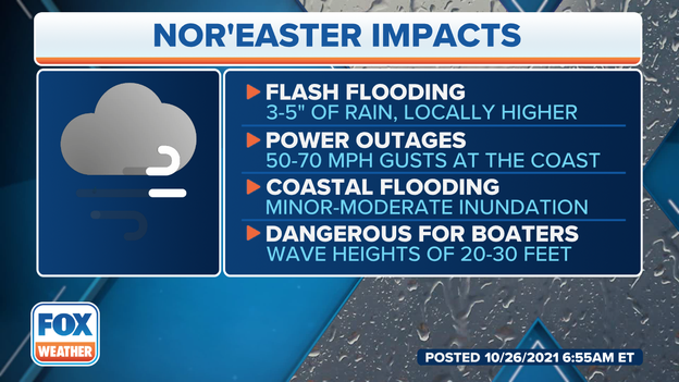
Wind gusts of up to 70 mph could create dangerous driving conditions and widespread power outages by the time the region’s first nor’easter of the season winds down Wednesday.
The National Weather Service has issued a Flash Flood Warning valid until 2:45 p.m. Eastern time for Delaware and Sullivan counties in New York's Catskill Mountains.
Flooded roads in several locations were starting to be reported across the area by local law enforcement, according to the NWS.
Between 2.5 and 3 inches of rain has already fallen, and the NWS says moderate to heavy rain will continue into this afternoon.
Some areas of New Jersey have already seen several inches of rain from this nor'easter, and more could fall before the storm winds down.
The National Weather Service has issued a Flash Flood Warning valid until 1:15 p.m. Eastern time for Delaware and Otsego counties in New York's Southern Tier.
Radar is estimating 1.5 to 2.5 inches of rain has already fallen, and moderate to heavy rainfall is expected to continue in this area into early afternoon.
Flash flooding is ongoing or likely to begin shortly, the NWS said.
Mount Kisco, New York, in Westchester County, received 4.46 inches of rain as of about 11 a.m. Tuesday morning.
Numerous other locations in northeastern New Jersey and the lower Hudson Valley have also picked up more than 4 inches of rain so far.
Click here for a complete list of rainfall totals in the New York City tri-state area.
Strong wind, heavy rain and flooding are expected as a potentially powerful nor’easter makes its way across the Northeast Tuesday into Wednesday.
Fox Weather Multimedia Journalist Katie Byrne is reporting from the Nassau County Office of Emergency Management as the area prepares for the season’s first nor’easter.
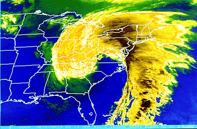
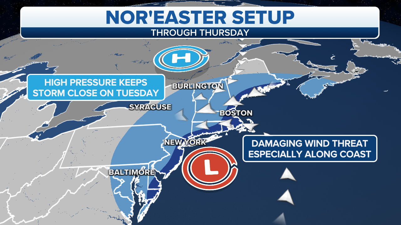
A nor’easter is a strong low-pressure system that impacts the East Coast of the United States, particularly the Northeast, but that’s not what makes it a nor’easter.
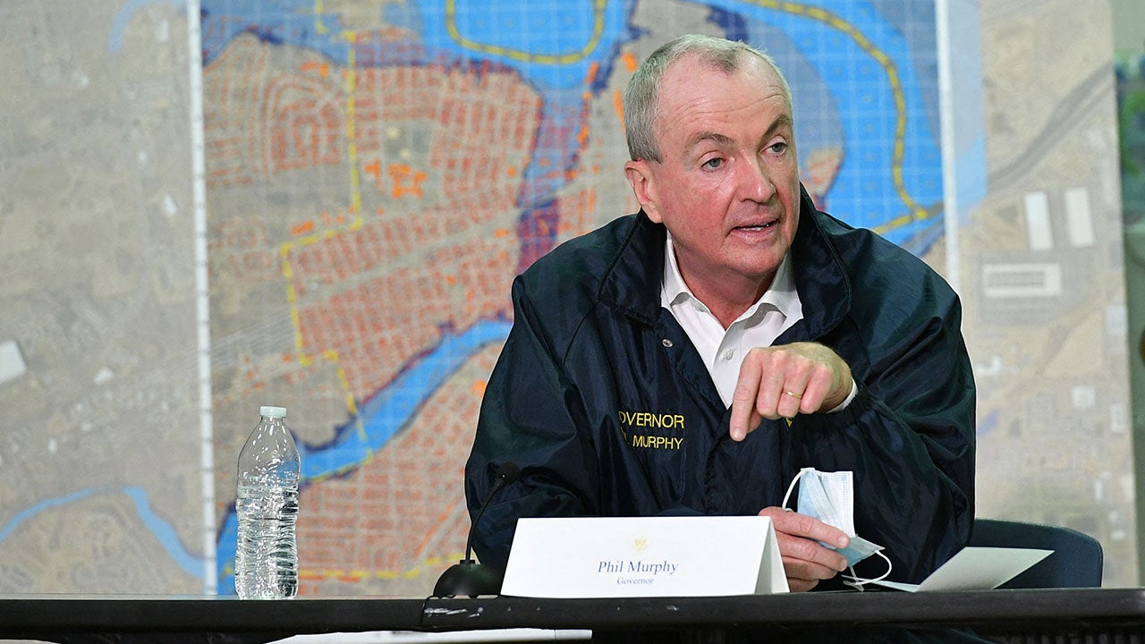
New Jersey Gov. Phil Murphy and New York Gov. Kathy Hochul have declared a state of emergency in their states as a nor’easter moves into the area.
Knowing the differences between all the flood-related alerts that are issued by the National Weather Service can help keep you safe in the event waters start to rise.
New Jersey Gov. Phil Murphy is joined by other officials to provide updates on the region’s first nor’easter of the season.
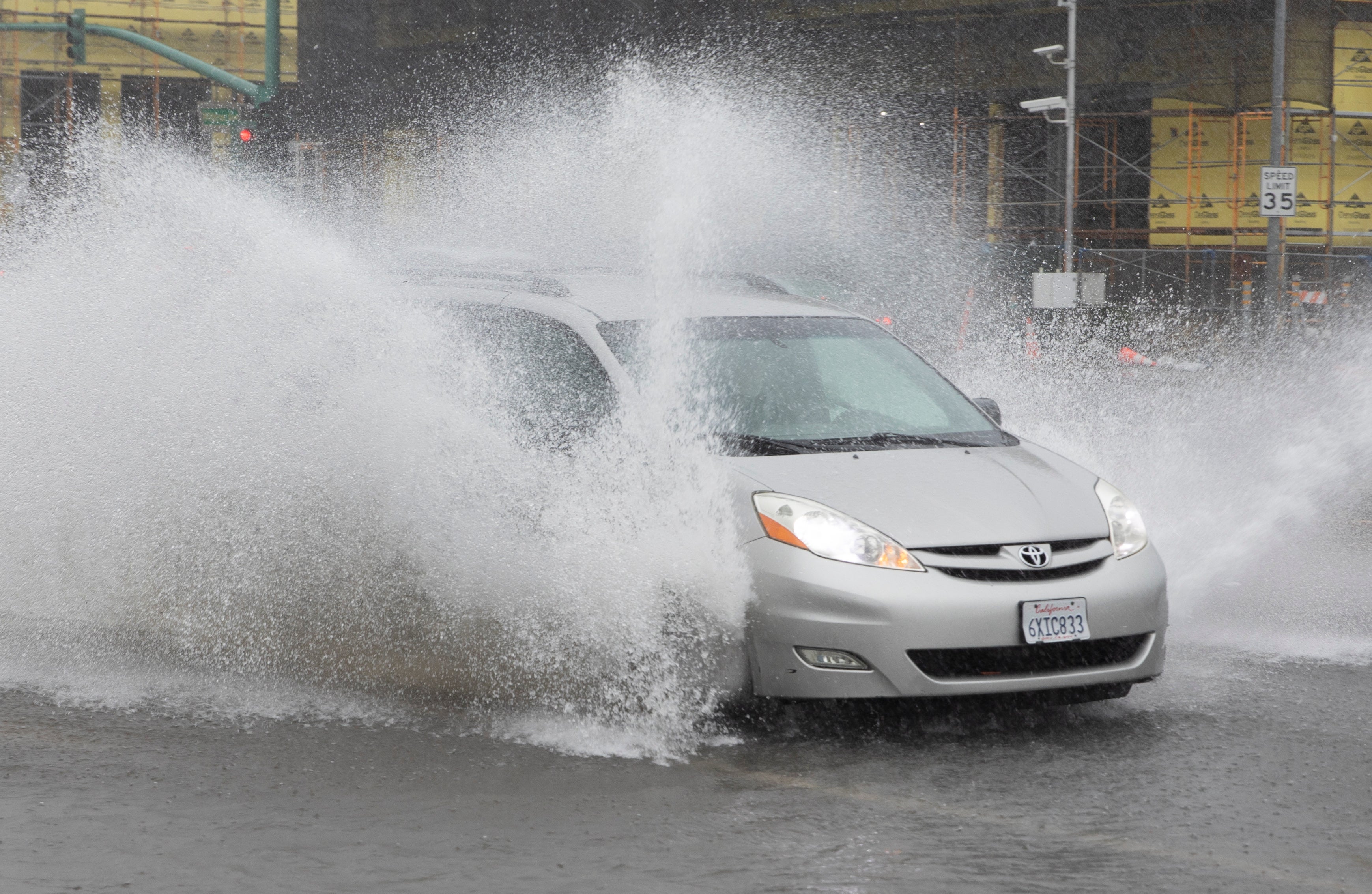
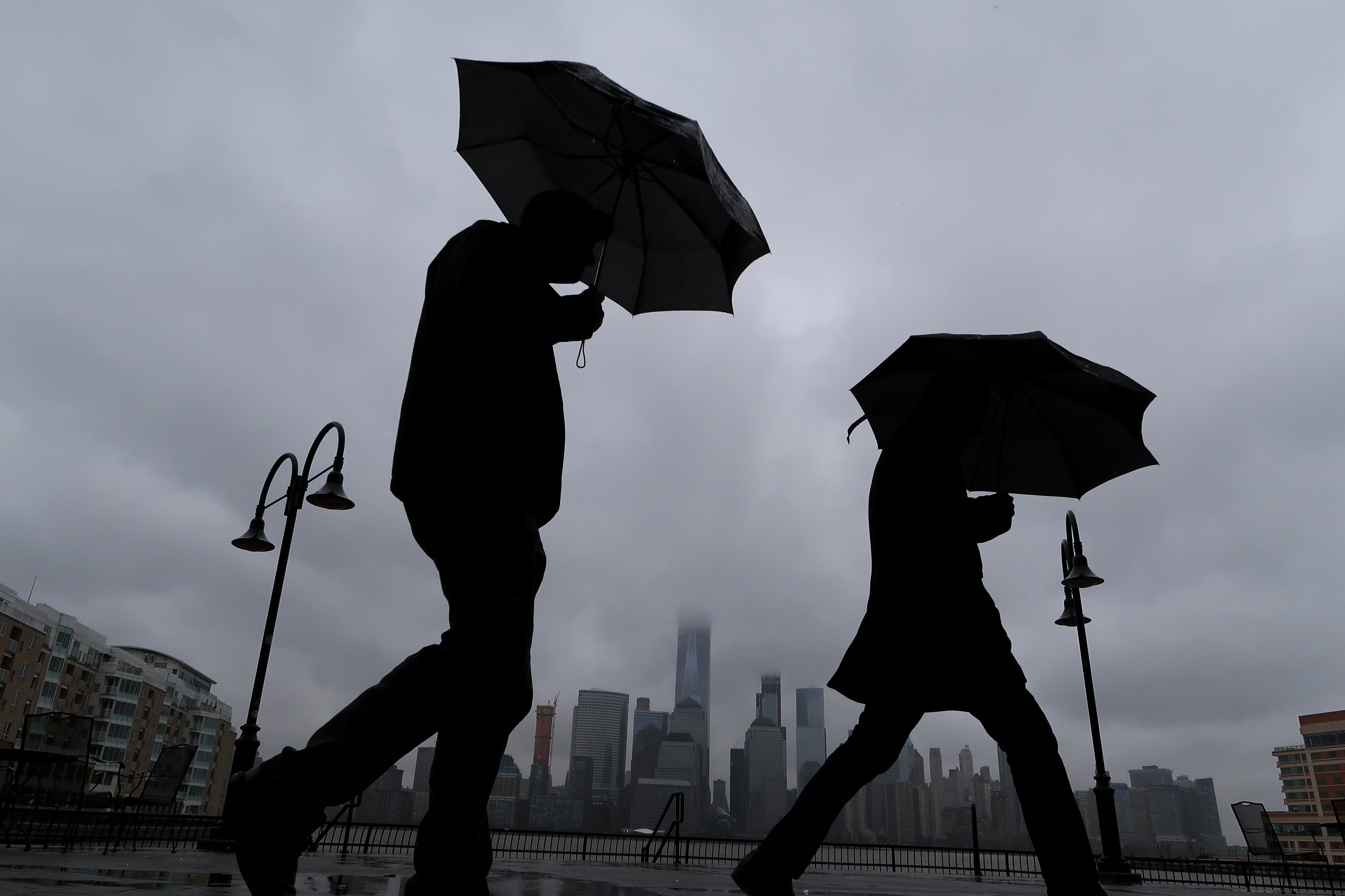
Heavy rain, damaging winds and flooding are expected across the Northeast Tuesday as the region gets hit with the first nor'easter of the season.
Water covers roads in Forest Hills, Queens in New York City. Flooding is a concern as the area gets hit with the first nor'easter of the season.
The region's first nor'easter of the season will bring high winds, heavy rain and flooding to areas from New Jersey to New England on Tuesday.
Live Coverage begins here
