Arctic ice hits 12th lowest minimum extent on record
15 lowest minimum extents have come in the last 15 years, scientists say
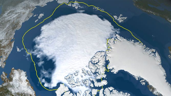
A still image visualizing Arctic sea ice on Sept. 16, 2021, when the ice appeared to reach its yearly minimum extent. On this date, the extent of the ice was 4.72 million square miles (1.82 million square kilometers).
(NASA's Scientific Visualization Studio)
The extent of ice in the Arctic hit its 12th lowest level on record during the spring and summer of 2021.
According to scientists at NASA and the National Snow and Ice Data Center, the Arctic sea ice shrank to 1.82 million square miles on Sept. 16. That’s a bit more than the size of India.
This continues a trend of significant declines in ice extent since satellites began measuring consistently in 1978. The past 15 years have seen the 15 lowest ice extents, according to scientists.
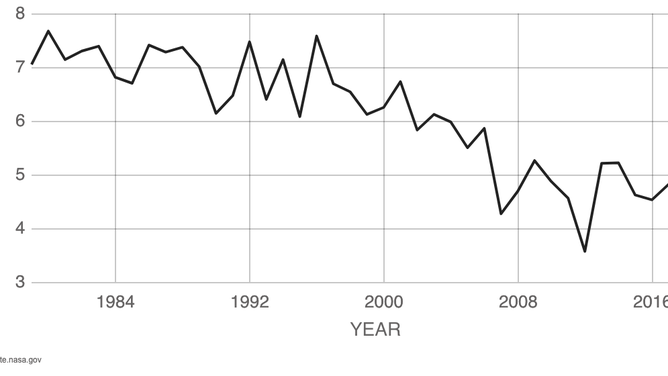
The average minimum extent of Arctic sea ice in September from 1979 to 2020.
(NSIDC/NASA)
NASA released this video on YouTube showing the Arctic ice melting during the summer.