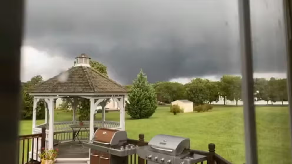
Follow the path of destruction from the EF-3 tornado that struck Mullica Hill, N.J.
The National Weather Service storm survey team from their Mt. Holly office has since presented its timeline and description of the damage the tornado wrought along its 12.6-mile path.
Tornadoes hit New Jersey and Maryland as storms from Ida sweep through
Tornadoes touch down in Maryland and New Jersey in the wake of Hurricane Ida sweeping through the Northeast.
MULLICA HILL, N.J. -- On Sept. 1, a strong tornado ripped through southern New Jersey, causing severe damage along the Mullica Hill area. Two people were injured and the twister likely caused millions in storm damage.
The National Weather Service storm survey team from their Mt. Holly office has since presented its timeline and description of the damage the tornado wrought along its 12.6-mile path.
Touchdown in Harrisonville, NJ.
The tornado touched down at 6:10 p.m. at EF-0 strength at 60 mph near Harrisonville, NJ doing mostly damage to trees and limbs before strengthening and moving northeast.
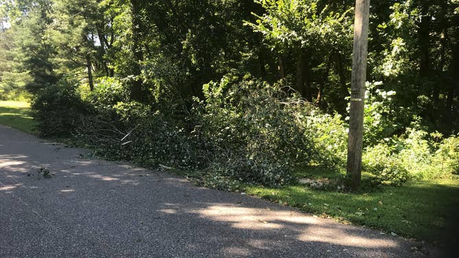
Damage from Mullica Hill, NJ tornado in Harrisonville on Sept. 1, 2021
(National Weather Service)
EF-1 strength as it heads into Cedar Grove
As it moved to the northeast, it crossed into the Cedar Grove area as an EF-1 tornado, producing more significant damage to trees with many trees uprooted, according to the storm survey team.
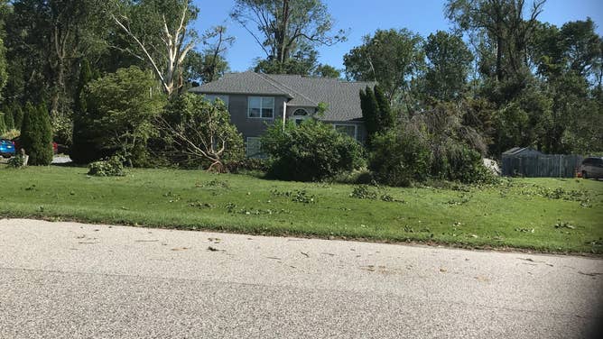
Tornado damage from the Cedar Grove area of Mullica Hill, NJ on Sept. 1, 2021
Tornado gets stronger as it goes into Willow Oaks neighborhood
The tornado moved into the Willow Oaks subdivision strengthening further to EF-2-level wind, producing significant damage to trees, as well as serious structural damage to a number of homes, surveyors said.
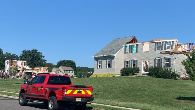
Tornado damage in Willow Oaks subdivision from Mullica Hill, NJ tornado on Sept. 1, 2021
The NWS said several homes had exterior walls completely collapsed, a number of homes lost roofs and upper story walls, and one home had only a few interior walls remaining.
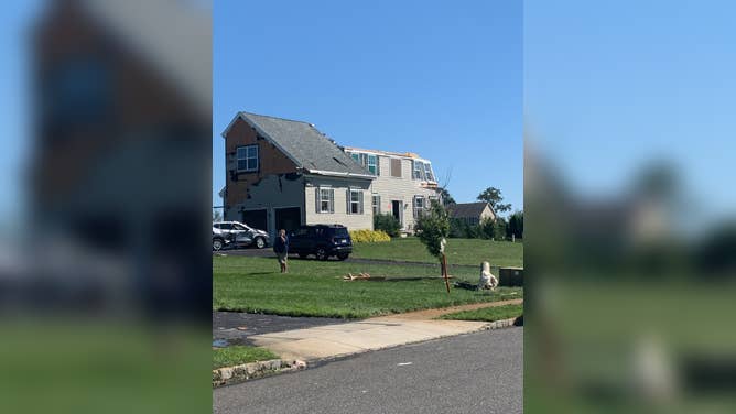
Tornado damage in Willow Oaks subdivision from Mullica Hill, NJ tornado on Sept. 1, 2021
"Vehicles were tossed around and moved, and damage from flying debris was observed in several spots," storm surveyors wrote.
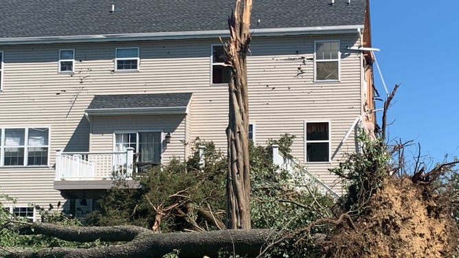
Tornado damage in Willow Oaks subdivision from Mullica Hill, NJ tornado on Sept. 1, 2021
More damage in Bridgeton Pike
The tornado continued to move to the northeast to the Bridgeton Pike area, where multiple trees had trunks snapped and most of the barns and storage buildings at a large commercial farm were completely destroyed, according to the NWS.
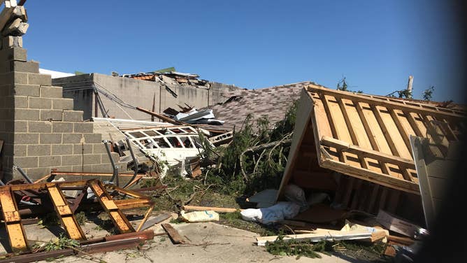
Damage from Bridgerton Pike area of Mullica Hill, NJ from tornado on Sept. 1, 2021
This is the spot along its path that the tornado reached its maximum width, which surveyors estimated to be around 400 yards wide (four football fields!)
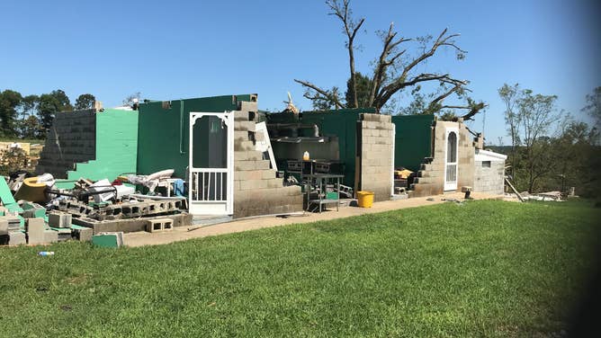
Damage from Bridgerton Pike area of Mullica Hill, NJ from tornado on Sept. 1, 2021
Salvatore Drive: Where the tornado goes into its full wrath
Next, the tornado then continued northeast through the woods with multiple trees snapped before entering the subdivision at Salvatore Drive, the Weather Service said.
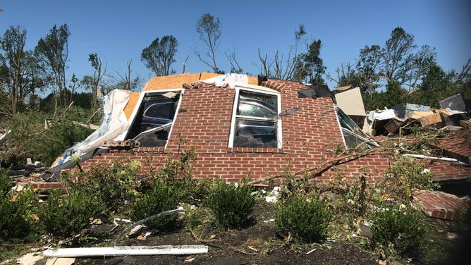
Extensive damage along Salvatore Drive near Mullica Hill, NJ.
(National Weather Service)
"Here the tornado's most significant damage was observed with one home completely destroyed with no interior or exterior walls standing," the NWS storm survey team wrote.
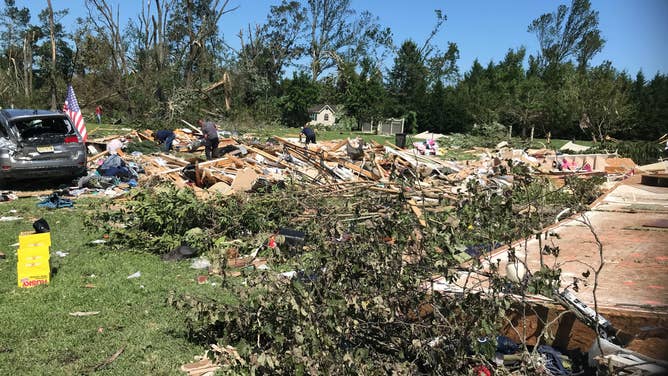
Extensive damage along Salvatore Drive near Mullica Hill, NJ.
(National Weather Service)
"Other homes in the subdivision had exterior walls collapsed along with garage collapses and vehicles being tossed around by the tornadic winds."
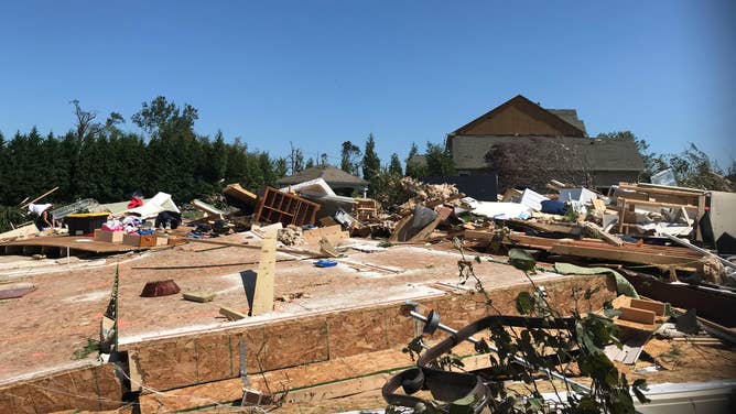
Extensive damage along Salvatore Drive near Mullica Hill, NJ.
(National Weather Service)
Judging by the extensive damage at this spot, surveyors estimated the center of the tornado was bringing winds consistent with EF-3 damage, while noting tree damage was a little less severe on the fringe of the tornado path, giving winds estimated at EF-2 strength on the edge of the circulation.
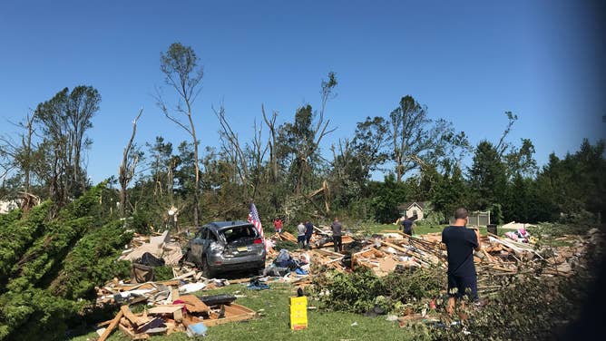
Extensive damage along Salvatore Drive near Mullica Hill, NJ.
(National Weather Service)
This was the section of the tornado's path where the twister was given its official EF-3 designation, with a peak wind estimated at 150 mph.
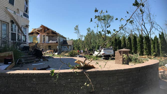
Extensive damage along Salvatore Drive near Mullica Hill, NJ.
(National Weather Service)
Dairy Farm Damaged
The tornado's next target as it tracked to the northeast was a large commercial dairy farm, where the storm survey team says extensive damage occurred.
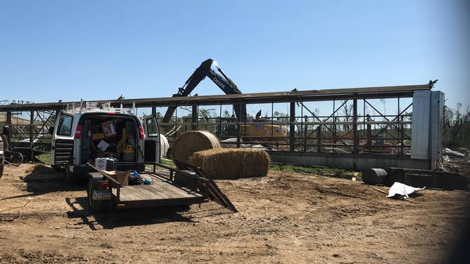
Commercial dairy farm suffers heavy damage from Mullica Hill tornado.
(National Weather Service)
Barns were destroyed and two large grain silos were toppled, according to the NWS.
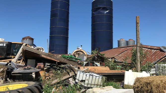
Commercial dairy farm suffers heavy damage from Mullica Hill tornado.
(National Weather Service)
Several trees stripped bare
The tornado then crossed Jefferson Road and crossed Eachus Road snapping multiple trees.
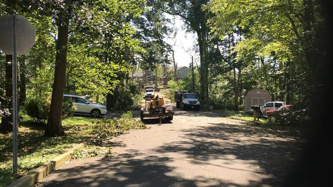
Tree damage near Jefferson Road from nearby tornado.
(National Weather Service)
Thereafter, the tornado moved into the Breakneck Road area -- still at EF-2 strength -- "producing complete deforestation with nearly 100 percent of the trees in a thickly wooded area snapped," storm surveyors wrote.
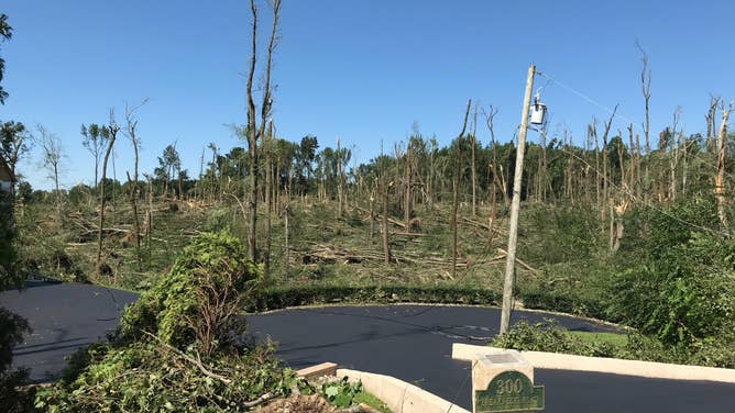
Trees were stripped bare in the Breakneck Road area from an EF-3 tornado in Mullica Hill, NJ.
Commercial greenhouse destroyed
The tornado path crossed Main Street, just south of Chestnut Branch Park in Mantua Township, snapping and uprooting a number of trees before reaching the Delaware Valley Florist Commercial greenhouse, mostly destroying the structure, surveyors wrote.
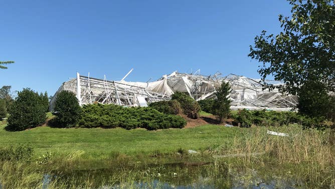
Delaware Valley Florist greenhouse destroyed by tornado near Mullica Hill, NJ
(National Weather Service)
The tornado damage path then continued to the northeast, reaching Wenonah, where it wreaked havoc snapping and uprooting a number of trees, while a few homes lost roofs and one structure collapsed, according to NWS.
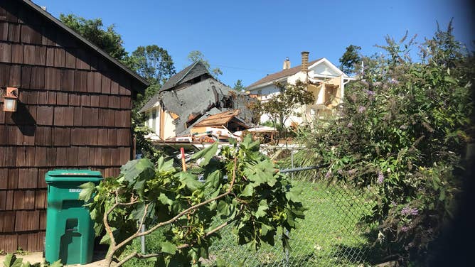
Damage in the Wenonah neighborhood from a tornado.
(National Weather Service)
In eastern portions of Woodbury Heights, surveyors said they found several trees were snapped along a path from Chesnut Avenue to the intersection of Walnut Avenue and Tanyard Road.
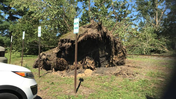
Damage in the Wenonah neighborhood from a tornado.
(National Weather Service)
And along a path on Glenwood Court, two homes lost a significant amount of siding on one side and a fence was blown over.
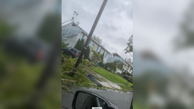
Tornado damage in Glenwood Court near Mullica Hill, NJ.
The tornado began to weaken as it approached Deptford, still managing to cause some tree damage.
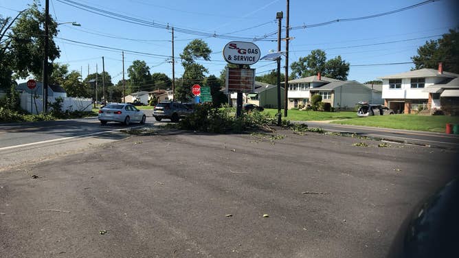
Tree damage near Deptford, NJ from a tornado on Sept. 1, 2021.
From there, a full 30 minutes after it had touched down 12 miles earlier, the tornado finally dissipated – and just in time. If it had stayed on its current path, it was moments from striking the Deptford Mall complex:
Well that was a close call. Just doing some research on the Mullica Hill, NJ tornado from Sept. 1 and this is part of the @NWS_MountHolly storm survey. That EF-3 tornado was heading for Deptford Mall but dissipated moments before :O (red line tornado path) #njwx pic.twitter.com/07XXtRB1bk
— Scott Sistek (@ScottSeattleWx) September 7, 2021
Despite the damage, luckily no one was killed. The tornado was one of several to touch down in southern New Jersey as the remnants of Hurricane Ida brought stormy weather to the Mid-Atlantic states.
The National Weather Service office in Mt. Holly issued 16 tornado warnings that day, including their first ever Tornado Emergency – the most extreme warning in their arsenal – for the Mullica Hill tornado.
We print our warnings issued automatically for verification purposes. Between all new warnings and warning updates, it has added up to 3.5 pounds of paper over the last 24 hours! It has been incredibly busy, even on the midnight shift. Severe flooding continues across the area. pic.twitter.com/ofjoaTgDQJ
— NWS Mount Holly (@NWS_MountHolly) September 2, 2021
The tornado outbreak was just the latest in a very stormy year for the Philadelphia and southern New Jersey area. Their National Weather Service office has issued 4,106 storm reports since Jan. 1 – more than double a vast majority of other National Weather Service offices around the nation.
This is wild. @NWS_MountHolly has over double the storm reports of almost every other NWS office since the start of 2021. They've been absolutely pummeled this year! pic.twitter.com/FNjVWd2xFR
— Geoff Bansen (@WeatherGeoff) September 7, 2021
