Damage reported as severe storms roll through Mississippi State campus
At 1:45 p.m., a Tornado Warning was issued for the west side of Starkville's Oktibbeha County, and students and staff began heading to a safe place.
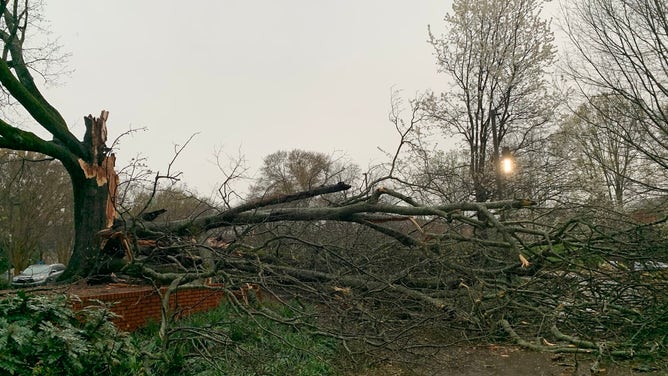
Wind damage at Mississippi State University.
(Ryan Larmeu)
STARKVILLE, Miss. -- Severe storms rolled across much of Mississippi Tuesday, including the campus of Mississippi State University.
Amid predictions of possible tornadoes, Mississippi State made the decision early Tuesday morning to dismiss classes at 12:30 p.m. so students could shelter in place for the storms. University officials stated that their priority was to get all students inside a building so they weren’t walking around outside as the storms arrived.
At 1:45 p.m., a Tornado Warning was issued for the west side of Starkville's Oktibbeha County, and students and staff began heading to a safe place.
![]() Image 1 of 5
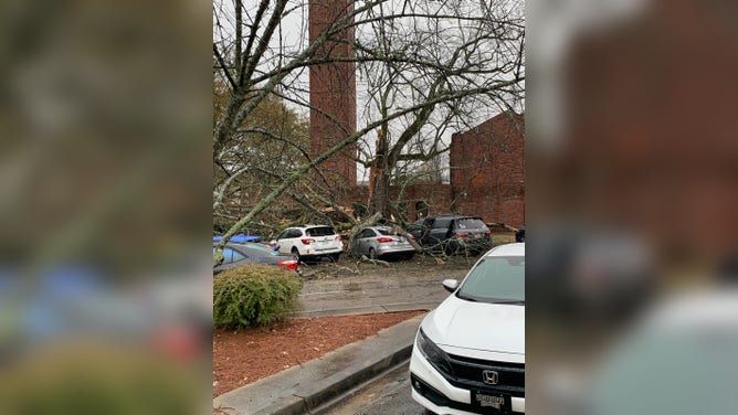
Image 1 of 5Wind damage at Mississippi State University. (Owen Basselman)
![]() Image 2 of 5
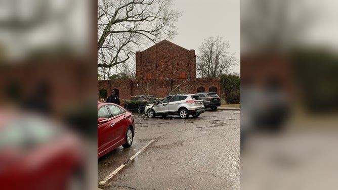
Image 2 of 5Wind damage at Mississippi State University. (Ryan Larmeu)
![]() Image 3 of 5
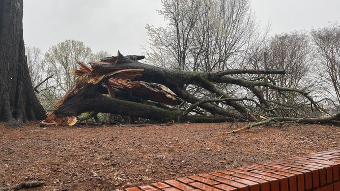
Image 3 of 5Wind damage at Mississippi State University. (Owen Basselman)
![]() Image 4 of 5
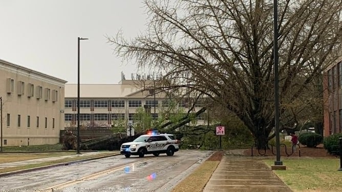
Image 4 of 5Wind damage at Mississippi State University. (Owen Basselman)
![]() Image 5 of 5
Image 5 of 5Wind damage at Mississippi State University. (Ryan Larmeu)
About 45 minutes later, the rotation in the storms had decreased, allowing the National Weather Service to switch to a Severe Thunderstorm Warning instead, but the line of storms began to "bow out", which raised the concern of strong straight-line, non-tornadic wind gusts up to 60 mph.
The storm barreled into campus at 2:50 p.m., and students were riding out the storm in their dorms or safe buildings on campus.
Several minutes passed as the storm unleashed its wrath on the area. As the storm began to wind down, students and staff began to come out of their safe places and venture outside.
There, they found trees and debris littered the campus, blocking roadways and sidewalks, and lying on cars.
No injuries were reported.
On Wednesday, officials at the NWS office in Jackson, Mississippi, said they were planning to survey the damage after an image captured on the Junction Cam on campus showed what appeared to be a funnel cloud in the area at the time the damage happened.
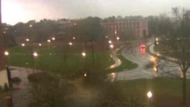
A dark cloud is seen lowered over the Mississippi State University campus in Starkville, Mississippi, on March 22, 2022.
(MSU)
Officials said they believe the damage is still related to straight-line winds, but the survey team will make the final determination. A report is expected by Wednesday night.