Severe thunderstorms, including tornadoes, threaten Florida on Tuesday as heavy rain targets Southeast coast
The risk for severe storms will shift toward the eastern Florida Peninsula on Tuesday afternoon
Severe thunderstorms, including tornadoes, threaten Florida on Tuesday
Severe thunderstorms, including tornadoes, threaten Florida on Tuesday as heavy rain targets the Southeast coast.
A low-pressure system from the Gulf of Mexico is forecast to track across the Florida Peninsula on Tuesday, bringing the threat of severe thunderstorms, including a few tornadoes, while heavy rain may also trigger flash flooding along the Southeast coast.
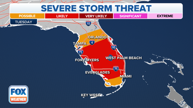
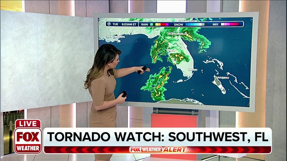
The Tornado Watch that was previously in effect for southwestern Florida was allowed to expire at 10 a.m. Eastern. However, the risk for severe storms will shift toward the eastern Florida Peninsula on Tuesday afternoon.
In addition to the threat of a few tornadoes, the storms in Florida could produce damaging wind gusts on Tuesday.

Severe storm threat on Tuesday, Dec. 21, 2021.
(FOX Weather)
This Gulf of Mexico low has been ingesting plenty of moisture from the Gulf waters and will also spread a quick round of moderate to heavy rain across North Florida on Tuesday. The heavy rain could trigger areas of flash flooding.
SPACEX PREPARES FOR TRIFECTA OF COAST-TO-COAST LAUNCHES TO END THE YEAR
By Tuesday evening, the low-pressure system will exit into the Atlantic Ocean, but some of the heavier rainfall could still brush parts of the Southeast coast Tuesday night into Wednesday morning as the low turns northeastward and tracks along the Gulf Stream.
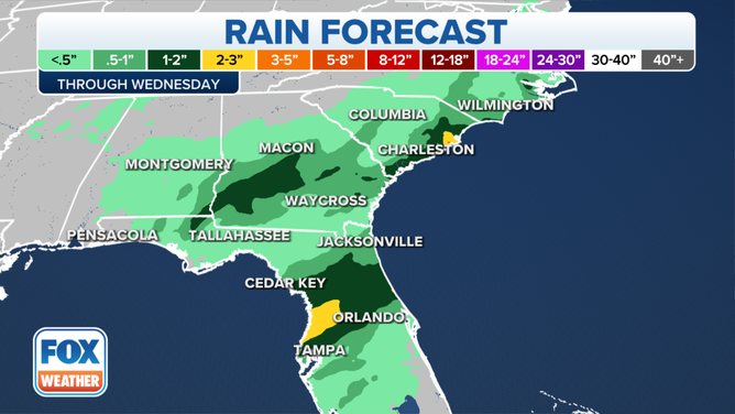
More than an inch of rain is forecast across parts of North Florida, South Georgia and far southern South Carolina before the low-pressure system moves away from the southeastern U.S. on Wednesday. Locally higher amounts up to 2 or 3 inches are not ruled out in some areas.

Rain forecast through midweek.
(FOX Weather)
Tuesday's rain might put a damper on vacation plans at some of the popular Florida theme parks.
AAA said the theme parks are expected to be busy during the holiday season and rank as one of the top destinations for travelers.
Before you get stuck in the rain, make sure to download the FOX Weather app so you can track the storms using our mobile 3D radar to help you avoid the downpours.
