Tornado Watch issued in Florida as severe storm threat shifts to Southeast from Florida to Carolinas Thursday
Damaging wind gusts and a few tornadoes are the main threats
Severe storm threat shifts to Southeast from Carolinas to FL on Thursday
Severe storm threat shifts to Southeast from Carolinas to Florida on Thursday.
The threat of severe thunderstorms will shift to the Southeast from Florida to the Carolinas on Thursday.
Multiple tornadoes were confirmed along the Gulf Coast on Wednesday, one of which caused significant damage near Lake Charles, Louisiana. The National Weather Service received nine total reports of tornadoes between southeastern Texas and southwestern Mississippi.
CREWS SURVEYING TORNADO DAMAGE ACROSS GULF COAST
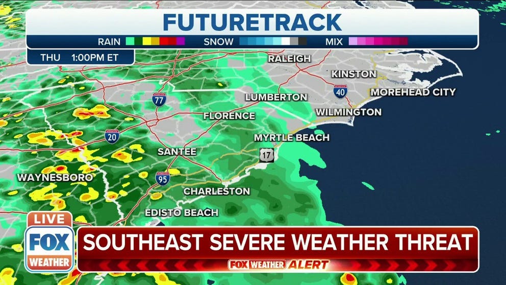
The same weather system that spawned Wednesday's severe weather is now arriving in the Southeast, and the next round of severe storms will fire up Thursday afternoon into Thursday night.
NOAA's Storm Prediction Center has issued a Tornado Watch valid until 5 p.m. Eastern time for parts of North and Central Florida. This watch includes Jacksonville, Daytona Beach, Tampa and Fort Myers.
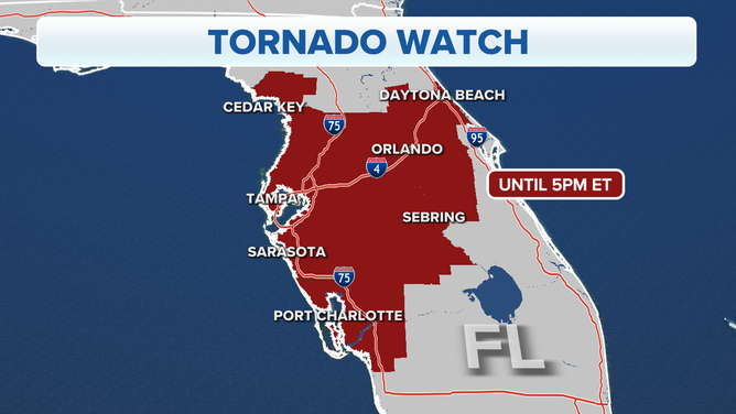
A tornado watch has been issued for parts of central and northern Florida until 5 p.m.
(FOX Weather)
Some severe thunderstorm and tornado warnings have been issued across the state Thursday. You can follow live updates on these developments on the FOX Weather Wire throughout the day.
North and Central Florida and southern Georgia have the greatest risk of severe thunderstorms Thursday afternoon and evening. Damaging wind gusts and a few tornadoes are the main threats with these storms.
LAKE CHARLES MAN'S HOME DAMAGED BY HURRICANES, NOW HAS TO CLEAN UP FROM A TORNADO
Thursday night, additional severe storms are possible farther north into the eastern Carolinas.
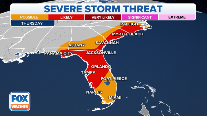
Severe storm threat Thursday, Oct. 28, 2021.
(FOX Weather)
Isolated severe thunderstorms remain possible into Friday morning over northeastern North Carolina and far southeastern Virginia. Damaging wind gusts and an isolated tornado are the main threats.
HOMES DAMAGED, CARS CRUSHED AFTER TORNADOES STRIKE TEXAS, LOUISIANA
This weather system will then drift into the mid-Atlantic Friday afternoon, spreading areas of heavy rain across the region through Friday night.
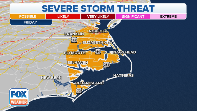
Severe storm threat Friday, Oct. 29, 2021.
(FOX Weather)