Tropical development not expected, but Southeast coast still has our attention
Regardless of development, heavy rain will be the main impact

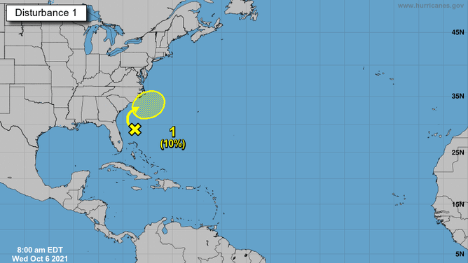
The five-day Tropical Weather Outlook from the National Hurricane Center issued Wednesday, Oct. 6, 2021.
(FOX Weather)
While there are no active storms in the Atlantic on Wednesday, an area of disturbed weather off the east coast of Florida is being monitored for possible tropical development.
A large area of disorganized showers and thunderstorms was about 200 miles east of Florida on Wednesday morning. This activity is forecast to slowly drift northward in the direction of the Southeast and mid-Atlantic coasts over the next few days.
However, the National Hurricane Center said strong upper-level winds will likely hinder this system's chance of developing into a tropical depression or tropical storm, placing the odds at just 10% in the next five days.
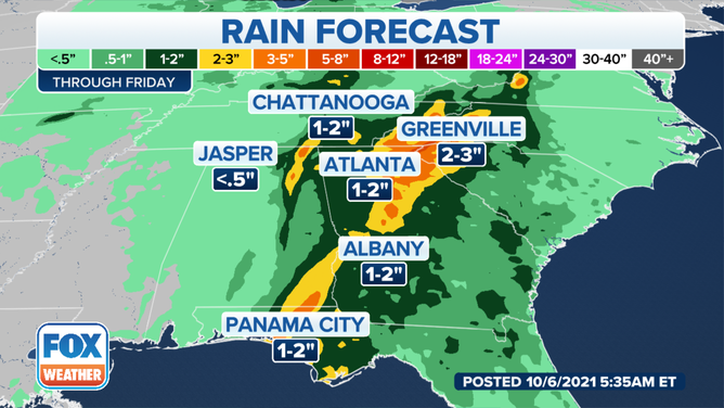
Regardless of development, this system will interact with a slow-moving cold front and upper-level low over the Southeast by this weekend, acting to enhance the heavy rainfall that's been plaguing the region all week.

Rainfall forecast through Friday, Oct. 8, 2021.
(FOX Weather)