Winter storm to blanket the N. Plains and Midwest in snow
A foot of snow forecasted for the Northern Plains and Midwest.
Another storm to bring heavy snow, ice to Northern Plains, Upper Midwest
Winter weather alerts are in effect across the Northern Plains and Upper Midwest as a second storm system will move in and bring heavy snow and some ice.
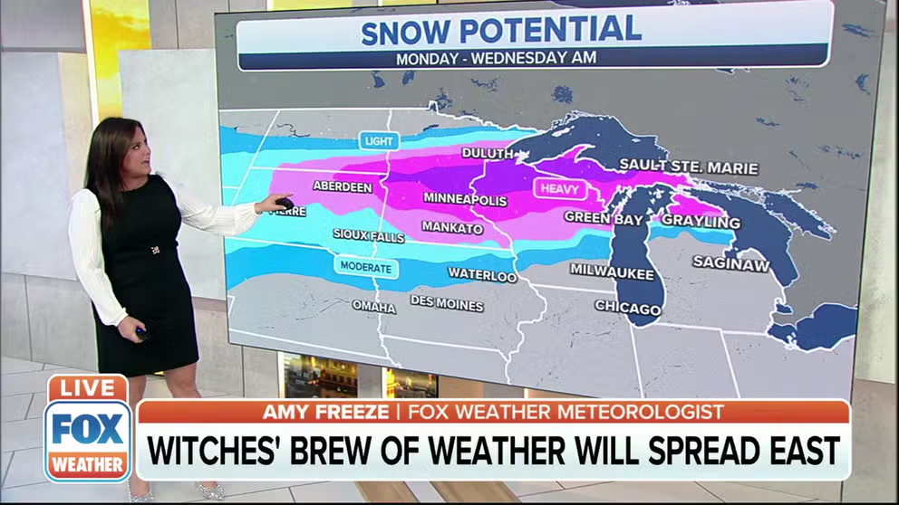
Get ready for another foot of snow. Winter Storm Warnings are up for a stretch from central Montana, across the Dakotas, to central Minnesota and northern Wisconsin. Over a foot of snow could snarl commutes Monday and Tuesday.
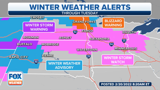
Winter weather alerts in effect through Tuesday.
(FOX Weather)
The storm starts late Sunday and brings heavy snow Monday before tapering off Tuesday when it moves east.
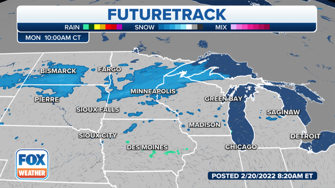
Futuretrack on Monday morning.
As the storm system heads to the east, the threat for a glaze of ice extends from the Central Plains through the Great Lakes and into parts of the Northeast and northern New England.
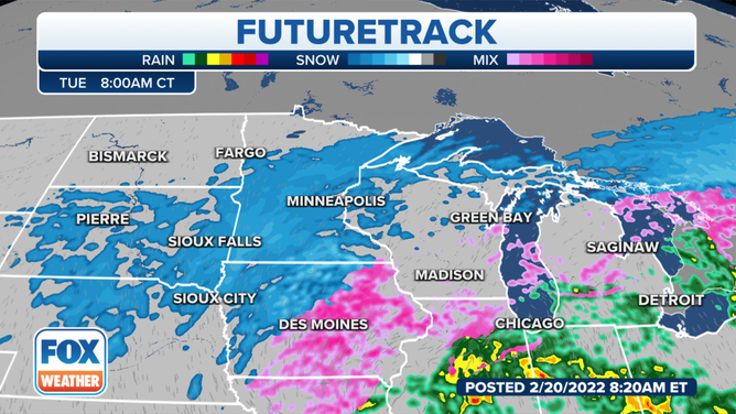
The Futuretrack on Tuesday morning
Areas of southern Wisconsin and central Michigan have the highest chance for icing.
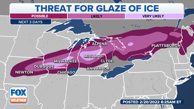
The threat for a glaze of ice over the next three days.
(FOX Weather)
Northeast winds will blow Monday 20-25 mph making for tough travel between the ice and the blowing snow.
Concerns are also growing for the threat of disruptive ice from northeastern Iowa, across southern Wisconsin and central and northern Michigan by the time the system moves out.
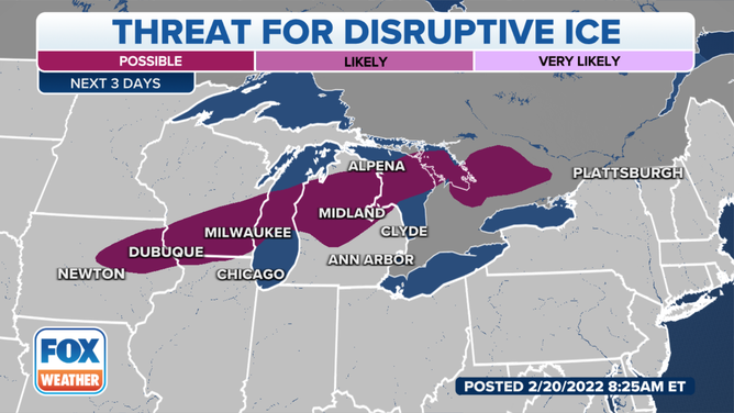
The threat for disruptive ice over the next three days.
(FOX Weather)
There will be the threat of power outages if ice collects on power lines.
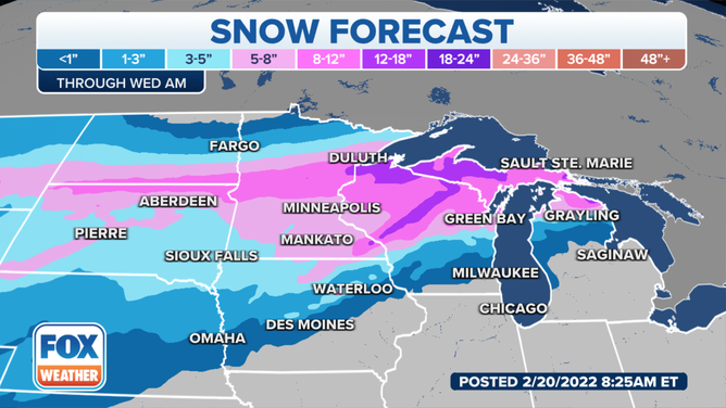
The snow forecast through Wednesday morning.
(FOX Weather)
Southern to central Minnesota is expected to receive 5-8 inches of snow, but locally higher amounts are expected a bit further to the north.